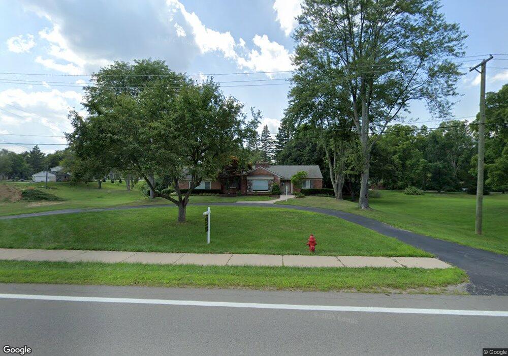
6150 Franklin Rd Unit Bldg-Unit Bloomfield Hills, MI 48301
Estimated Value: $567,000 - $696,000
3
Beds
3
Baths
2,024
Sq Ft
$323/Sq Ft
Est. Value
About This Home
This home is located at 6150 Franklin Rd Unit Bldg-Unit, Bloomfield Hills, MI 48301 and is currently estimated at $653,378, approximately $322 per square foot. 6150 Franklin Rd Unit Bldg-Unit is a home located in Oakland County with nearby schools including Conant Elementary School, South Hills Middle School, and Bloomfield Hills High School.
Ownership History
Date
Name
Owned For
Owner Type
Purchase Details
Closed on
Apr 21, 2023
Sold by
Molle Josephine
Bought by
Molle Josephine
Current Estimated Value
Purchase Details
Closed on
Oct 4, 2019
Sold by
Molle Anthony and Molle Josephine
Bought by
Molle Anthony and Molle Josephine
Purchase Details
Closed on
Jun 23, 2016
Sold by
Al Najjar Mufid B and Al Najjar Suhayla S
Bought by
Molle Josephine and Molle Anthony
Purchase Details
Closed on
Jan 4, 2000
Sold by
Titus Gregory R
Bought by
Al-Najjar Mufid B
Create a Home Valuation Report for This Property
The Home Valuation Report is an in-depth analysis detailing your home's value as well as a comparison with similar homes in the area
Home Values in the Area
Average Home Value in this Area
Purchase History
| Date | Buyer | Sale Price | Title Company |
|---|---|---|---|
| Molle Josephine | $625,000 | None Listed On Document | |
| Molle Anthony | -- | None Available | |
| Molle Anthony | -- | None Available | |
| Molle Anthony | -- | None Available | |
| Molle Josephine | $302,000 | None Available | |
| Al-Najjar Mufid B | $290,000 | -- |
Source: Public Records
Tax History Compared to Growth
Tax History
| Year | Tax Paid | Tax Assessment Tax Assessment Total Assessment is a certain percentage of the fair market value that is determined by local assessors to be the total taxable value of land and additions on the property. | Land | Improvement |
|---|---|---|---|---|
| 2024 | $5,012 | $269,290 | $0 | $0 |
| 2023 | $3,346 | $242,360 | $0 | $0 |
| 2022 | $8,408 | $200,100 | $0 | $0 |
| 2021 | $8,192 | $177,540 | $0 | $0 |
| 2020 | $3,952 | $169,750 | $0 | $0 |
| 2019 | $7,685 | $162,780 | $0 | $0 |
| 2018 | $7,534 | $159,760 | $0 | $0 |
| 2017 | $7,417 | $151,000 | $0 | $0 |
| 2016 | $6,003 | $168,030 | $0 | $0 |
| 2015 | -- | $153,220 | $0 | $0 |
| 2014 | -- | $118,750 | $0 | $0 |
| 2011 | -- | $116,240 | $0 | $0 |
Source: Public Records
Map
Nearby Homes
- 6041 Eastmoor Rd
- 4456 W Maple Rd
- 6701 Franklin Rd
- 4603 Hedgewood Dr
- 4597 Broughton Dr
- 5897 Sutters Ln
- 4665 W Maple Rd
- 6720 Castle Dr
- 5611 Priory Ln
- 6750 Wing Lake Rd
- 4776 Walnut Lake Rd
- 6572 Spruce Dr
- 4200 Surrey Cross
- 5605 Woodwind Dr
- 6940 Castle Dr
- 6420 Apple Grove Ln Unit 10
- 1651 Hoit Tower Dr
- 750 Trailwood Path Unit B
- 450 Billingsgate Ct Unit C
- 1760 Trailwood Path
- 6150 Franklin Rd
- 4541 Ottawa Ln
- 6190 Franklin Rd
- 4514 Lakeview Ct
- 0000 Ottawa Ln
- 4418 Ottawa Ln
- 6125 Dakota Cir
- 6140 Dakota Cir
- 6060 Franklin Rd
- 6139 Dakota Cir
- 4544 Ottawa Ln
- 6091 Franklin Rd
- 4540 Lakeview Ct
- 4561 Ottawa Ln
- 4490 Chippewa Ct
- 6153 Dakota Cir
- 6065 Franklin Rd
- 4509 Lakeview Ct
- 6160 Dakota Cir
- 4511 Lakeview Ct