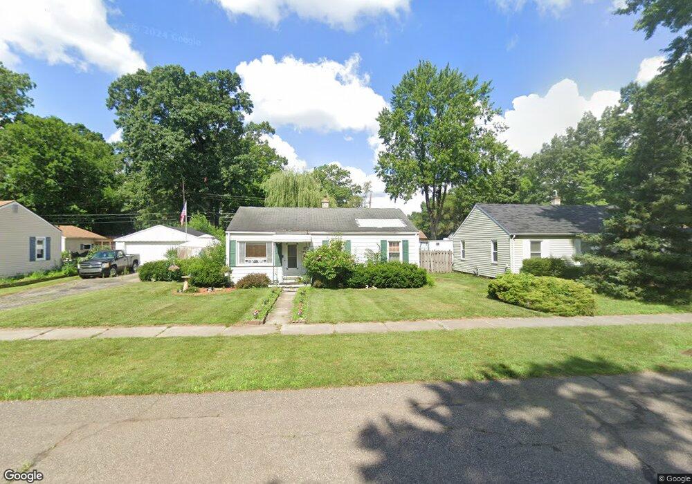
6151 Herbert St Westland, MI 48185
Estimated Value: $172,000 - $213,000
3
Beds
1
Bath
900
Sq Ft
$207/Sq Ft
Est. Value
About This Home
This home is located at 6151 Herbert St, Westland, MI 48185 and is currently estimated at $186,079, approximately $206 per square foot. 6151 Herbert St is a home located in Wayne County with nearby schools including P.D. Graham Elementary School, Marshall Upper Elementary School, and Adlai Stevenson Middle School.
Ownership History
Date
Name
Owned For
Owner Type
Purchase Details
Closed on
Nov 5, 2015
Sold by
Birman Edward
Bought by
Birman Mary Lou
Current Estimated Value
Purchase Details
Closed on
Jun 30, 2010
Sold by
Corkery Mike and Corkery Margareth V
Bought by
Birman Mary Lou
Purchase Details
Closed on
Apr 12, 2007
Sold by
Yops Alfred R
Bought by
Jpmorgan Chase Bank and First Franklin Mortgage Loan Trust 2005-
Purchase Details
Closed on
Sep 17, 2004
Sold by
Thorp Scott and Thorp Lindsay
Bought by
Yops Alfred R
Purchase Details
Closed on
Nov 8, 2001
Sold by
Taig Leonard L
Bought by
Thorp Lindsay
Create a Home Valuation Report for This Property
The Home Valuation Report is an in-depth analysis detailing your home's value as well as a comparison with similar homes in the area
Home Values in the Area
Average Home Value in this Area
Purchase History
| Date | Buyer | Sale Price | Title Company |
|---|---|---|---|
| Birman Mary Lou | -- | Attorney | |
| Birman Mary Lou | $59,000 | Embassy Title Agency | |
| Jpmorgan Chase Bank | $106,250 | None Available | |
| Yops Alfred R | $127,000 | Multiple | |
| Thorp Lindsay | $108,250 | -- |
Source: Public Records
Tax History Compared to Growth
Tax History
| Year | Tax Paid | Tax Assessment Tax Assessment Total Assessment is a certain percentage of the fair market value that is determined by local assessors to be the total taxable value of land and additions on the property. | Land | Improvement |
|---|---|---|---|---|
| 2025 | $1,067 | $72,600 | $0 | $0 |
| 2024 | $1,067 | $72,400 | $0 | $0 |
| 2023 | $1,748 | $64,500 | $0 | $0 |
| 2022 | $1,479 | $57,700 | $0 | $0 |
| 2021 | $1,184 | $53,500 | $0 | $0 |
| 2020 | $1,490 | $46,700 | $0 | $0 |
| 2019 | $1,687 | $42,900 | $0 | $0 |
| 2018 | $838 | $36,800 | $0 | $0 |
| 2017 | $445 | $34,700 | $0 | $0 |
| 2016 | $1,592 | $19,500 | $0 | $0 |
| 2015 | $2,943 | $30,140 | $0 | $0 |
| 2013 | $3,005 | $31,040 | $0 | $0 |
| 2012 | $1,460 | $33,250 | $0 | $0 |
Source: Public Records
Map
Nearby Homes
- 37186 Amhurst Dr Unit 5
- 6026 Wilmer St
- 6145 N Dowling St
- 6541 Pembrook Dr
- 0 Dowling Ave
- 6013 N Newburgh Rd
- 5889 N Globe St
- 5834 Morley St
- 5692 N Globe St
- 35863 Hunter Ave Unit 34
- 35754 Castlewood Ct
- 38066 Sherwood St
- 38201 Carolon Blvd Unit 17B
- 38030 Greenwood St
- 38247 Carolon Blvd Unit 12C
- 35833 Ford Rd
- 35737 Hunter Ave
- 2260 N Hix Rd Unit 1C
- 6546 Quail Run Cir
- 38343 Carolon Blvd
- 6177 Herbert St
- 6123 Herbert St
- 6117 Herbert St
- 6168 Wilmer St
- 6148 Wilmer St
- 6182 Herbert St
- 6162 Herbert St
- 6122 Wilmer St
- 6097 Herbert St
- 6136 Herbert St
- 6124 Herbert St
- 6148 Herbert St
- 37065 Amhurst Dr
- 37113 Amhurst Dr Unit 39
- 37077 Amhurst Dr
- 37089 Amhurst Dr
- 37089 Amhurst Dr Unit 41
- 37041 Amhurst Dr Unit 44
- 37029 Amhurst Dr
- 37029 Amhurst Dr Unit 45