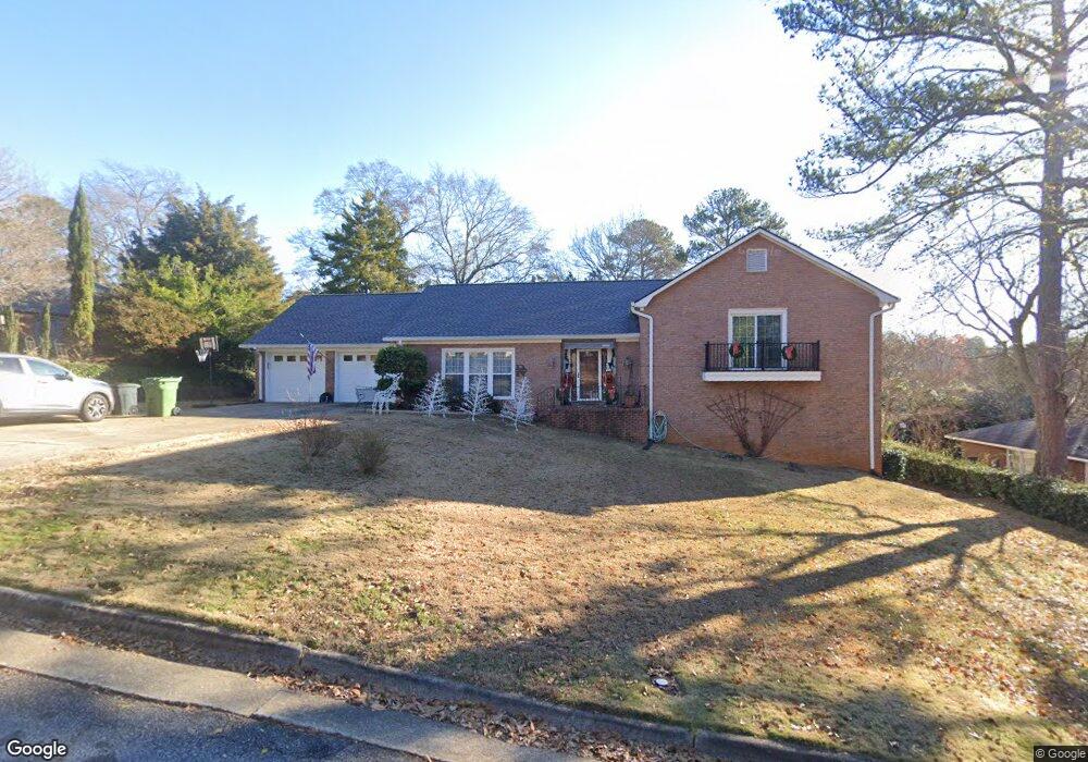
6152 Cape Cod Ct Columbus, GA 31904
North Columbus NeighborhoodEstimated Value: $357,000 - $387,000
4
Beds
4
Baths
2,668
Sq Ft
$139/Sq Ft
Est. Value
About This Home
This home is located at 6152 Cape Cod Ct, Columbus, GA 31904 and is currently estimated at $371,801, approximately $139 per square foot. 6152 Cape Cod Ct is a home located in Muscogee County with nearby schools including River Road Elementary School, Double Churches Middle School, and Northside High School.
Ownership History
Date
Name
Owned For
Owner Type
Purchase Details
Closed on
Jun 30, 2010
Sold by
Roach Gary
Bought by
Roach Gary and Roach Anita
Current Estimated Value
Create a Home Valuation Report for This Property
The Home Valuation Report is an in-depth analysis detailing your home's value as well as a comparison with similar homes in the area
Home Values in the Area
Average Home Value in this Area
Purchase History
| Date | Buyer | Sale Price | Title Company |
|---|---|---|---|
| Roach Gary | -- | None Available |
Source: Public Records
Tax History
| Year | Tax Paid | Tax Assessment Tax Assessment Total Assessment is a certain percentage of the fair market value that is determined by local assessors to be the total taxable value of land and additions on the property. | Land | Improvement |
|---|---|---|---|---|
| 2025 | $1,537 | $110,628 | $22,004 | $88,624 |
| 2024 | $1,537 | $110,628 | $22,004 | $88,624 |
| 2023 | $1,179 | $110,628 | $22,004 | $88,624 |
| 2022 | $1,941 | $89,740 | $22,004 | $67,736 |
| 2021 | $1,934 | $91,904 | $22,004 | $69,900 |
| 2020 | $1,935 | $91,904 | $22,004 | $69,900 |
| 2019 | $1,943 | $91,904 | $22,004 | $69,900 |
| 2018 | $1,943 | $91,904 | $22,004 | $69,900 |
| 2017 | $1,951 | $91,904 | $22,004 | $69,900 |
| 2016 | $1,959 | $96,312 | $9,474 | $86,838 |
| 2015 | $1,964 | $96,312 | $9,474 | $86,838 |
| 2014 | $1,968 | $97,215 | $9,474 | $87,741 |
| 2013 | -- | $97,215 | $9,474 | $87,741 |
Source: Public Records
Map
Nearby Homes
- 6333 Cape Cod Dr
- 6390 Cape Cod Dr
- 6101 River Rd Unit 14
- 6101 River Rd Unit 13
- 6101 River Rd Unit 2
- 16 Kylemore Ct
- 6400 Green Island Dr Unit 42
- 6400 Green Island Dr Unit 11
- 6400 Green Island Dr Unit 43
- 7281 Mobley Walk Dr
- 5616 Morris Ave
- 222 Cascade Rd
- 254 Cascade Rd
- 5602 Morris Ave
- 5472 Roaring Branch Rd
- 831 53rd St
- 5431 Roaring Branch Rd
- 1325 Autumnridge Dr
- 258 Cascade Rd
- 6801 River Rd Unit 406
- 6162 Cape Cod Ct
- 6144 Cape Cod Ct
- 6119 Bristol Blvd
- 6111 Bristol Blvd
- 6153 Cape Cod Ct
- 6127 Bristol Blvd
- 6145 Cape Cod Ct
- 6116 Cape Cod Ct
- 6170 Cape Cod Ct
- 6161 Cape Cod Ct
- 6101 Bristol Blvd
- 6137 Bristol Blvd
- 6137 Cape Cod Ct
- 6100 Brookstone Blvd
- 6169 Cape Cod Ct
- 6173 Cape Cod Ct
- 6044 Brookstone Blvd
- 6149 Bristol Blvd
- 6114 Bristol Blvd
- 6129 Cape Cod Ct
Your Personal Tour Guide
Ask me questions while you tour the home.