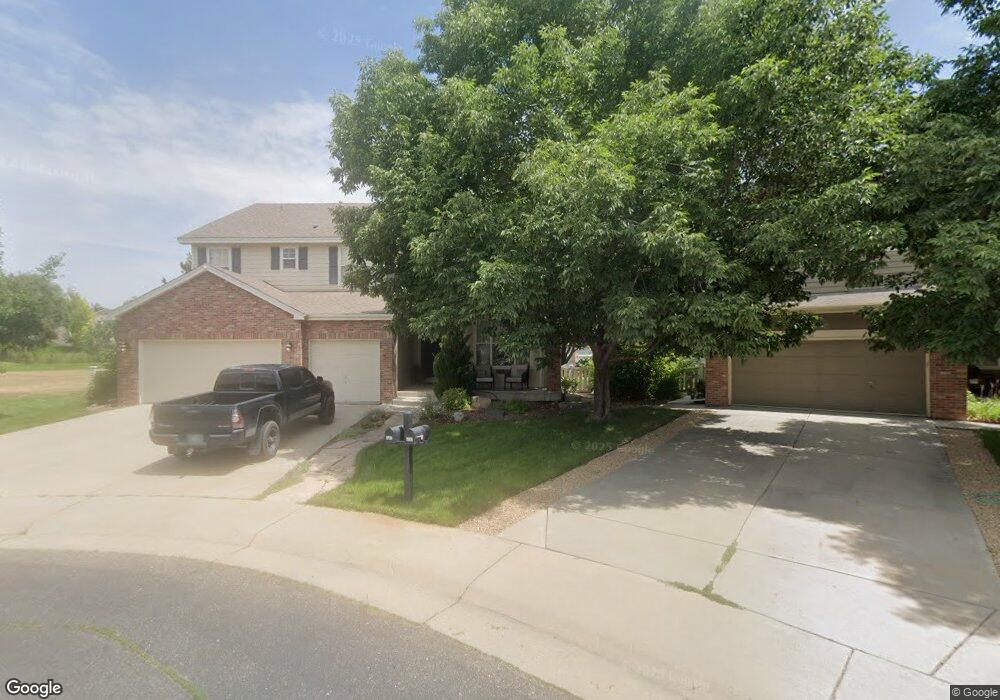
6152 Devinney Way Arvada, CO 80004
Ralston Valley NeighborhoodEstimated Value: $936,017 - $1,004,000
4
Beds
5
Baths
2,910
Sq Ft
$338/Sq Ft
Est. Value
About This Home
This home is located at 6152 Devinney Way, Arvada, CO 80004 and is currently estimated at $983,754, approximately $338 per square foot. 6152 Devinney Way is a home located in Jefferson County with nearby schools including Fremont Elementary School, Drake Junior High School, and Arvada West High School.
Ownership History
Date
Name
Owned For
Owner Type
Purchase Details
Closed on
Mar 12, 2022
Sold by
Smith Patrick G
Bought by
Smith Cheryl A
Current Estimated Value
Home Financials for this Owner
Home Financials are based on the most recent Mortgage that was taken out on this home.
Original Mortgage
$530,000
Outstanding Balance
$494,799
Interest Rate
3.85%
Mortgage Type
New Conventional
Estimated Equity
$488,955
Purchase Details
Closed on
Jul 23, 1999
Sold by
Smith Patrick G
Bought by
Smith Patrick G and Smith Cheryl A
Home Financials for this Owner
Home Financials are based on the most recent Mortgage that was taken out on this home.
Original Mortgage
$257,100
Interest Rate
7.63%
Create a Home Valuation Report for This Property
The Home Valuation Report is an in-depth analysis detailing your home's value as well as a comparison with similar homes in the area
Home Values in the Area
Average Home Value in this Area
Purchase History
| Date | Buyer | Sale Price | Title Company |
|---|---|---|---|
| Smith Cheryl A | -- | None Listed On Document | |
| Smith Patrick G | -- | Land Title | |
| Smith Patrick G | $321,384 | Land Title |
Source: Public Records
Mortgage History
| Date | Status | Borrower | Loan Amount |
|---|---|---|---|
| Open | Smith Cheryl A | $530,000 | |
| Previous Owner | Smith Patrick G | $257,100 |
Source: Public Records
Tax History
| Year | Tax Paid | Tax Assessment Tax Assessment Total Assessment is a certain percentage of the fair market value that is determined by local assessors to be the total taxable value of land and additions on the property. | Land | Improvement |
|---|---|---|---|---|
| 2024 | $5,634 | $58,082 | $24,168 | $33,914 |
| 2023 | $5,634 | $58,082 | $24,168 | $33,914 |
| 2022 | $4,560 | $46,566 | $17,934 | $28,632 |
| 2021 | $4,636 | $47,906 | $18,450 | $29,456 |
| 2020 | $4,323 | $44,803 | $17,502 | $27,301 |
| 2019 | $4,265 | $44,803 | $17,502 | $27,301 |
| 2018 | $4,122 | $42,097 | $12,827 | $29,270 |
| 2017 | $3,773 | $42,097 | $12,827 | $29,270 |
| 2016 | $3,841 | $40,362 | $9,358 | $31,004 |
| 2015 | $3,742 | $40,362 | $9,358 | $31,004 |
| 2014 | $3,742 | $36,958 | $9,456 | $27,502 |
Source: Public Records
Map
Nearby Homes
- 6060 Deframe Ct
- 6329 Braun Cir
- 6363 Cole Ln
- 6369 Cole Ln
- 6262 Braun Cir
- 13812 W 64th Place
- 12321 W 58th Dr
- 13750 W 65th Ave
- 13400 W 65th Ave
- 13155 W 63rd Place
- 5276 Flora Way
- 5316 Flora Way
- 6409 Zang St Unit A
- 5726 Fig Ct
- 13030 W 58th Ave
- 12924 W 64th Dr Unit B
- 5683 Fig Way
- 6128 Xenon St
- 14880 W 58th Ave
- 12670 W 66th Place
- 6142 Devinney Way
- 13799 W 61st Ln
- 6132 Devinney Way
- 13789 W 61st Ln
- 6228 Devinney Cir
- 6122 Devinney Way
- 13768 W 61st Ln
- 6226 Devinney Cir
- 13779 W 61st Ln
- 13769 W 61st Ln
- 6234 Devinney Cir
- 13758 W 61st Ln
- 13759 W 61st Ln
- 6112 Devinney Way
- 6224 Devinney Cir
- 13749 W 61st Ln
- 6117 Coors Way
- 6107 Coors Way
- 6127 Coors Way
- 6236 Devinney Cir