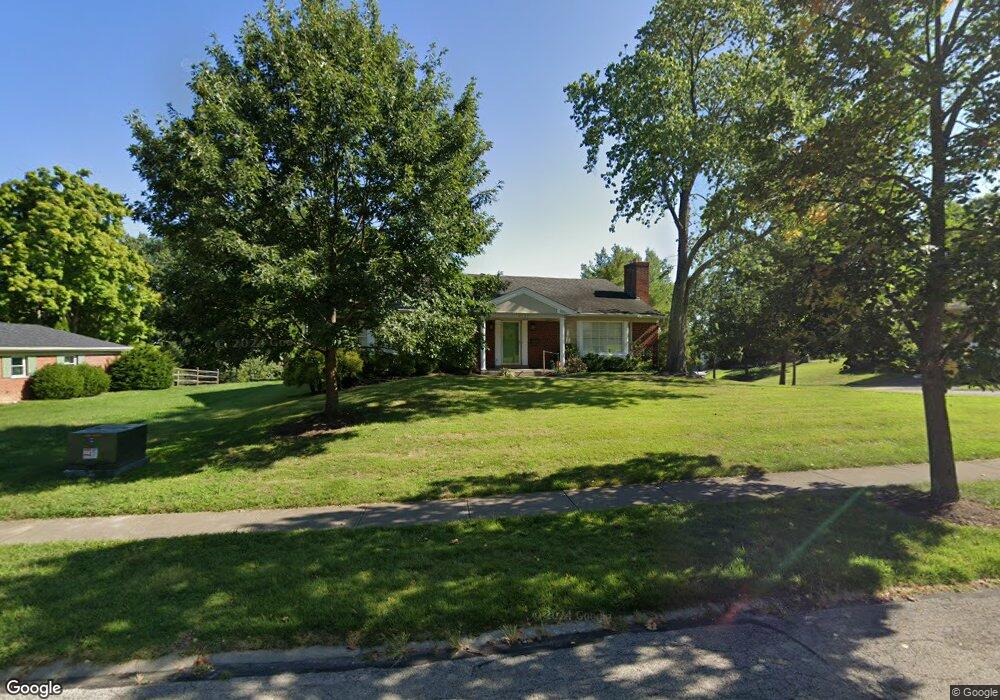
6152 Wasigo Dr Cincinnati, OH 45230
Mount Washington NeighborhoodEstimated Value: $346,000 - $443,000
3
Beds
3
Baths
1,947
Sq Ft
$196/Sq Ft
Est. Value
About This Home
This home is located at 6152 Wasigo Dr, Cincinnati, OH 45230 and is currently estimated at $381,192, approximately $195 per square foot. 6152 Wasigo Dr is a home located in Hamilton County with nearby schools including Mt. Washington Elementary School, Clark Montessori High School, and Shroder High School.
Ownership History
Date
Name
Owned For
Owner Type
Purchase Details
Closed on
May 30, 2025
Sold by
Uhl Emily K and Uhl Timothy E
Bought by
Kellenberger Jack and Deda Argisa
Current Estimated Value
Home Financials for this Owner
Home Financials are based on the most recent Mortgage that was taken out on this home.
Original Mortgage
$246,000
Outstanding Balance
$239,959
Interest Rate
5.94%
Mortgage Type
New Conventional
Estimated Equity
$141,233
Purchase Details
Closed on
Oct 27, 2009
Sold by
Schroer Robert J and Schroer Lynette M
Bought by
Katz Cynthia C and Uhl Emily K
Purchase Details
Closed on
Sep 1, 2005
Sold by
Thurner William A and Thurner Marilyn T
Bought by
Hatfield Family Llc
Create a Home Valuation Report for This Property
The Home Valuation Report is an in-depth analysis detailing your home's value as well as a comparison with similar homes in the area
Home Values in the Area
Average Home Value in this Area
Purchase History
| Date | Buyer | Sale Price | Title Company |
|---|---|---|---|
| Kellenberger Jack | $399,000 | None Listed On Document | |
| Kellenberger Jack | $399,000 | None Listed On Document | |
| Katz Cynthia C | $185,000 | Attorney | |
| Hatfield Family Llc | -- | None Available |
Source: Public Records
Mortgage History
| Date | Status | Borrower | Loan Amount |
|---|---|---|---|
| Open | Kellenberger Jack | $246,000 | |
| Closed | Kellenberger Jack | $246,000 |
Source: Public Records
Tax History
| Year | Tax Paid | Tax Assessment Tax Assessment Total Assessment is a certain percentage of the fair market value that is determined by local assessors to be the total taxable value of land and additions on the property. | Land | Improvement |
|---|---|---|---|---|
| 2025 | $5,361 | $86,122 | $12,429 | $73,693 |
| 2024 | $5,199 | $86,122 | $12,429 | $73,693 |
| 2023 | $5,316 | $86,122 | $12,429 | $73,693 |
| 2022 | $4,470 | $64,803 | $10,122 | $54,681 |
| 2021 | $4,285 | $64,803 | $10,122 | $54,681 |
| 2020 | $4,410 | $64,803 | $10,122 | $54,681 |
| 2019 | $4,230 | $56,844 | $8,880 | $47,964 |
| 2018 | $4,236 | $56,844 | $8,880 | $47,964 |
| 2017 | $4,023 | $56,844 | $8,880 | $47,964 |
| 2016 | $4,641 | $64,751 | $8,880 | $55,871 |
| 2015 | $4,187 | $64,751 | $8,880 | $55,871 |
| 2014 | $4,217 | $64,751 | $8,880 | $55,871 |
| 2013 | $4,288 | $64,751 | $8,880 | $55,871 |
Source: Public Records
Map
Nearby Homes
- 2605 Bonnie Dr
- 5459 Hanover Cir
- 6253 Sturdy Ave
- 2121 Sutton Ave
- 2127 Oxford Ave Unit 10
- 2111 Sutton Ave
- 6050 Bagdad Dr
- 6519 Copperleaf Ln
- 2412 Findlater Ct
- 6542 Rainbow Ln
- 1944 Rockland Ave
- 5965 Wayside Ave
- 2140 Trailwood Dr
- 1741 Mears Ave
- 6123 Cambridge Ave
- 6362 Stirrup Rd
- 2669 Newtown Rd
- 1508 Beth Ln
- 1190 Linden Hill Ln
- 6604 Ambar Ave
- 6140 Wasigo Dr
- 6164 Wasigo Dr
- 2455 Kewanee Ln
- 2462 Wenatchee Ln
- 2468 Wenatchee Ln
- 2456 Kewanee Ln
- 6170 Wasigo Dr
- 6147 Wasigo Dr
- 6153 Wasigo Dr
- 6141 Wasigo Dr
- 2463 Kewanee Ln
- 6159 Wasigo Dr
- 2474 Wenatchee Ln
- 6135 Wasigo Dr
- 2464 Kewanee Ln
- 6176 Wasigo Dr
- 6165 Wasigo Dr
- 2463 Wenatchee Ln
- 2469 Kewanee Ln
- 6127 Wasigo Dr
Your Personal Tour Guide
Ask me questions while you tour the home.