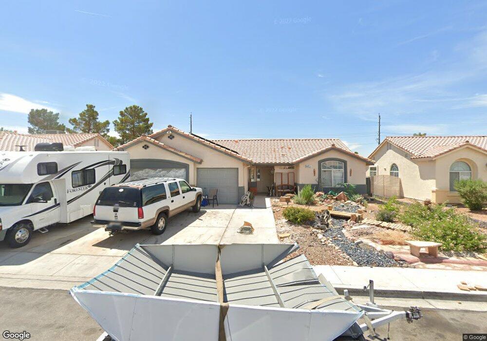
6153 Dundee Port Ave Las Vegas, NV 89110
Estimated Value: $400,881 - $459,000
3
Beds
2
Baths
1,565
Sq Ft
$273/Sq Ft
Est. Value
About This Home
This home is located at 6153 Dundee Port Ave, Las Vegas, NV 89110 and is currently estimated at $426,720, approximately $272 per square foot. 6153 Dundee Port Ave is a home located in Clark County with nearby schools including Eileen Brookman Elementary School, Dr. William H. Bailey Middle School, and Eldorado High School.
Ownership History
Date
Name
Owned For
Owner Type
Purchase Details
Closed on
Feb 18, 2020
Sold by
Smith James Leroy
Bought by
Smith James Leroy and The James Leroy Smith Trust
Current Estimated Value
Purchase Details
Closed on
Oct 28, 1994
Sold by
Lewis Homes Of Nevada
Bought by
Smith James L and Annie Smith M
Home Financials for this Owner
Home Financials are based on the most recent Mortgage that was taken out on this home.
Original Mortgage
$96,800
Interest Rate
8.7%
Create a Home Valuation Report for This Property
The Home Valuation Report is an in-depth analysis detailing your home's value as well as a comparison with similar homes in the area
Home Values in the Area
Average Home Value in this Area
Purchase History
| Date | Buyer | Sale Price | Title Company |
|---|---|---|---|
| Smith James Leroy | -- | None Available | |
| Smith James L | $121,000 | Nevada Title Company |
Source: Public Records
Mortgage History
| Date | Status | Borrower | Loan Amount |
|---|---|---|---|
| Closed | Smith James L | $96,800 |
Source: Public Records
Tax History Compared to Growth
Tax History
| Year | Tax Paid | Tax Assessment Tax Assessment Total Assessment is a certain percentage of the fair market value that is determined by local assessors to be the total taxable value of land and additions on the property. | Land | Improvement |
|---|---|---|---|---|
| 2025 | $2,165 | $89,146 | $31,150 | $57,996 |
| 2024 | $1,289 | $89,146 | $31,150 | $57,996 |
| 2023 | $1,289 | $87,513 | $32,200 | $55,313 |
| 2022 | $1,251 | $77,295 | $26,600 | $50,695 |
| 2021 | $1,215 | $71,451 | $23,100 | $48,351 |
| 2020 | $1,176 | $70,459 | $22,400 | $48,059 |
| 2019 | $1,142 | $66,749 | $19,250 | $47,499 |
| 2018 | $1,109 | $61,644 | $15,750 | $45,894 |
| 2017 | $1,778 | $60,628 | $14,000 | $46,628 |
| 2016 | $1,051 | $49,645 | $10,500 | $39,145 |
| 2015 | $1,048 | $41,402 | $8,750 | $32,652 |
| 2014 | $1,017 | $33,658 | $7,000 | $26,658 |
Source: Public Records
Map
Nearby Homes
- 796 Ringwood Ln
- 6235 Sapporo Cir
- 6218 Sapporo Cir
- 740 Santree Cir
- 6030 Halehaven Dr
- 910 N Sloan Ln Unit 201
- 5923 Halehaven Dr
- 6209 Exquisite Ave
- 563 Moon Chase St
- 1083 Devon Lake St
- 6449 Elizabethtown Ave
- 741 Round Table Dr
- 6538 Astorville Ct
- 6440 Spanish Garden Ct
- 6561 Alma White St
- 0 Linden Ave
- 6400 Stewart Ave
- 6165 Stanley Park Ave
- 1251 Los Meadows Dr
- 5802 Queenstown Way
- 6163 Dundee Port Ave
- 6143 Dundee Port Ave
- 6173 Dundee Port Ave
- 6133 Dundee Port Ave
- 6148 Dundee Port Ave
- 6158 Dundee Port Ave
- 6138 Dundee Port Ave
- 837 Ringwood Ln
- 6128 Dundee Port Ave
- 6123 Dundee Port Ave
- 797 Ringwood Ln
- 799 Milstead Ct
- 6145 Osaka Ct
- 6135 Osaka Ct
- 6195 Dundee Port Ave
- 780 Milstead Ct
- 6188 Dundee Port Ave
- 6125 Osaka Ct
- 6125 Osaka Ct Unit 89110