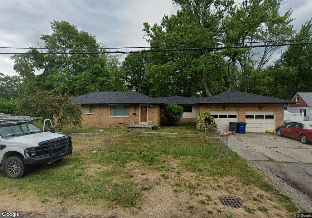
6154 Judge Dr Toledo, OH 43615
Reynolds Corners NeighborhoodEstimated Value: $167,884 - $204,000
3
Beds
2
Baths
1,622
Sq Ft
$113/Sq Ft
Est. Value
About This Home
This home is located at 6154 Judge Dr, Toledo, OH 43615 and is currently estimated at $182,971, approximately $112 per square foot. 6154 Judge Dr is a home located in Lucas County with nearby schools including McTigue Elementary School, Rogers High School, and Horizon Science Academy-Springfield.
Ownership History
Date
Name
Owned For
Owner Type
Purchase Details
Closed on
May 31, 2009
Sold by
Davison Sarenda L and Davison Kenneth L
Bought by
Davison Sarenda L and Davison Kenneth L
Current Estimated Value
Purchase Details
Closed on
Aug 28, 2006
Sold by
Borton Kelly A and Sheets Jodi A
Bought by
Davidson Kenneth L and Turner Sarenda L
Home Financials for this Owner
Home Financials are based on the most recent Mortgage that was taken out on this home.
Original Mortgage
$122,112
Outstanding Balance
$84,921
Interest Rate
9.8%
Mortgage Type
Purchase Money Mortgage
Estimated Equity
$98,050
Purchase Details
Closed on
Nov 1, 1991
Sold by
Ptaszynski Laura B
Create a Home Valuation Report for This Property
The Home Valuation Report is an in-depth analysis detailing your home's value as well as a comparison with similar homes in the area
Home Values in the Area
Average Home Value in this Area
Purchase History
| Date | Buyer | Sale Price | Title Company |
|---|---|---|---|
| Davison Sarenda L | -- | First Title & Escrow | |
| Davidson Kenneth L | $135,700 | Northern United Title Svcs | |
| -- | $57,500 | -- |
Source: Public Records
Mortgage History
| Date | Status | Borrower | Loan Amount |
|---|---|---|---|
| Open | Davidson Kenneth L | $122,112 |
Source: Public Records
Tax History Compared to Growth
Tax History
| Year | Tax Paid | Tax Assessment Tax Assessment Total Assessment is a certain percentage of the fair market value that is determined by local assessors to be the total taxable value of land and additions on the property. | Land | Improvement |
|---|---|---|---|---|
| 2024 | $1,335 | $37,625 | $7,700 | $29,925 |
| 2023 | $2,446 | $32,585 | $6,860 | $25,725 |
| 2022 | $2,406 | $32,585 | $6,860 | $25,725 |
| 2021 | $2,494 | $32,585 | $6,860 | $25,725 |
| 2020 | $2,711 | $30,975 | $4,480 | $26,495 |
| 2019 | $2,598 | $30,975 | $4,480 | $26,495 |
| 2018 | $2,659 | $30,975 | $4,480 | $26,495 |
| 2017 | $2,598 | $30,275 | $4,375 | $25,900 |
| 2016 | $2,648 | $86,500 | $12,500 | $74,000 |
| 2015 | $2,701 | $86,500 | $12,500 | $74,000 |
| 2014 | $1,905 | $30,280 | $4,380 | $25,900 |
| 2013 | $1,905 | $30,280 | $4,380 | $25,900 |
Source: Public Records
Map
Nearby Homes
- 1032 Saturn Dr
- 419 N Holland Sylvania Rd
- 312 Hayes Rd
- 5873 Nebraska Ave
- 6324 Bapst Ave
- 5805 Fryer Ave
- 1715 Brooklynn Park W
- 1709 Acorn Dr
- 428 Deline Dr
- 5845 Cook Dr
- 6106 Hill Ave
- 6339 Hill Ave
- 1911 N Holland Sylvania Rd
- 2004 Oakside Rd
- 4860 Airport Hwy
- 1966 Devinci Dr
- 2015 Oakside Rd
- 2010 Oakside Rd
- 127 N Dorcas Rd
- 6607 Hill Ave