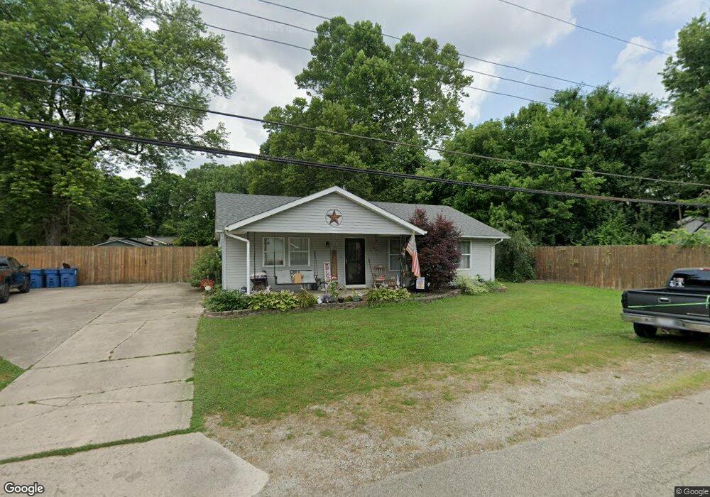
6155 Apache St Dayton, OH 45424
Estimated Value: $134,000 - $208,000
3
Beds
1
Bath
1,276
Sq Ft
$128/Sq Ft
Est. Value
About This Home
This home is located at 6155 Apache St, Dayton, OH 45424 and is currently estimated at $163,475, approximately $128 per square foot. 6155 Apache St is a home located in Montgomery County with nearby schools including Wayne High School.
Ownership History
Date
Name
Owned For
Owner Type
Purchase Details
Closed on
Feb 22, 2011
Sold by
Secretary Of Housing & Urban Development
Bought by
Mullins Jacob M
Current Estimated Value
Home Financials for this Owner
Home Financials are based on the most recent Mortgage that was taken out on this home.
Original Mortgage
$44,790
Outstanding Balance
$30,649
Interest Rate
4.78%
Mortgage Type
FHA
Estimated Equity
$132,826
Purchase Details
Closed on
Nov 10, 2010
Sold by
Midfirst Bank
Bought by
Secretary Of Housing & Urban Development
Purchase Details
Closed on
Sep 30, 2010
Sold by
Vanzant Stephen T
Bought by
Midfirst Bank
Purchase Details
Closed on
Nov 8, 1999
Sold by
Durham James R and Durham Dawnyel
Bought by
Vanzant Stephen T
Create a Home Valuation Report for This Property
The Home Valuation Report is an in-depth analysis detailing your home's value as well as a comparison with similar homes in the area
Home Values in the Area
Average Home Value in this Area
Purchase History
| Date | Buyer | Sale Price | Title Company |
|---|---|---|---|
| Mullins Jacob M | $45,000 | None Available | |
| Secretary Of Housing & Urban Development | -- | None Available | |
| Midfirst Bank | $72,335 | None Available | |
| Vanzant Stephen T | $79,900 | -- |
Source: Public Records
Mortgage History
| Date | Status | Borrower | Loan Amount |
|---|---|---|---|
| Open | Mullins Jacob M | $44,790 |
Source: Public Records
Tax History Compared to Growth
Tax History
| Year | Tax Paid | Tax Assessment Tax Assessment Total Assessment is a certain percentage of the fair market value that is determined by local assessors to be the total taxable value of land and additions on the property. | Land | Improvement |
|---|---|---|---|---|
| 2024 | $1,442 | $24,870 | $2,780 | $22,090 |
| 2023 | $1,442 | $24,870 | $2,780 | $22,090 |
| 2022 | $1,795 | $24,870 | $2,780 | $22,090 |
| 2021 | $1,800 | $24,870 | $2,780 | $22,090 |
| 2020 | $1,802 | $24,870 | $2,780 | $22,090 |
| 2019 | $1,796 | $21,930 | $2,500 | $19,430 |
| 2018 | $1,802 | $21,930 | $2,500 | $19,430 |
| 2017 | $1,791 | $21,930 | $2,500 | $19,430 |
| 2016 | $1,837 | $22,020 | $2,780 | $19,240 |
| 2015 | $1,794 | $22,020 | $2,780 | $19,240 |
| 2014 | $1,794 | $22,020 | $2,780 | $19,240 |
| 2012 | -- | $25,470 | $3,910 | $21,560 |
Source: Public Records
Map
Nearby Homes
- 6494 Shore Dr
- 6512 Shore Dr
- Milford Plan at Canal Heights
- Cortland Plan at Canal Heights
- Chatham Plan at Canal Heights
- Fairfax Plan at Canal Heights
- Johnstown Plan at Canal Heights
- Newcastle Plan at Canal Heights
- Holcombe Plan at Canal Heights
- Bellamy Plan at Canal Heights
- 2251 Kiel St
- 4572 Keeneland Ct
- 7075 Gulf Stream Place
- 679 Deerhurst Dr
- 827 Foxfire Trail
- 715 Deerhurst Dr
- 710 Deerhurst Dr
- Fairfax Plan at Foxfire - Maple Street Collection
- Yosemite Plan at Foxfire - Maple Street Collection
- Cumberland Plan at Foxfire - Maple Street Collection
- 6177 Apache St
- 6180 Pocahontas St
- 5955 Shore Dr
- 6187 Apache St
- 5920 Shore Dr
- 6190 Apache St
- 5821 Shore Dr
- 5975 Shore Dr
- 4086 Catawba Ave
- 6212 Apache St
- 5981 Shore Dr
- 6171 Pocahontas St
- 4066 Catawba Ave
- 6220 Apache St
- 6035 Shore Dr
- 6219 Apache St
- 4056 Catawba Ave
- 5820 Shore Dr
- 5819 Shore Dr
- 6030 Shore Dr