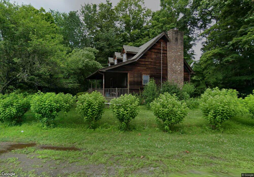
6157 Route 82 Stanfordville, NY 12581
Stanford NeighborhoodEstimated Value: $437,039 - $584,000
3
Beds
2
Baths
1,404
Sq Ft
$351/Sq Ft
Est. Value
About This Home
This home is located at 6157 Route 82, Stanfordville, NY 12581 and is currently estimated at $492,510, approximately $350 per square foot. 6157 Route 82 is a home located in Dutchess County with nearby schools including Stissing Mountain High School.
Ownership History
Date
Name
Owned For
Owner Type
Purchase Details
Closed on
Aug 4, 2014
Sold by
Heleotis Harry
Bought by
Kaye Debra
Current Estimated Value
Purchase Details
Closed on
Aug 19, 2002
Purchase Details
Closed on
Mar 20, 2001
Sold by
Clancey Ronald
Bought by
Hayes Victoria
Purchase Details
Closed on
Mar 1, 2001
Purchase Details
Closed on
Sep 11, 1997
Sold by
Feldman Daniel M
Bought by
J & R Assoc Lp
Create a Home Valuation Report for This Property
The Home Valuation Report is an in-depth analysis detailing your home's value as well as a comparison with similar homes in the area
Home Values in the Area
Average Home Value in this Area
Purchase History
| Date | Buyer | Sale Price | Title Company |
|---|---|---|---|
| Kaye Debra | $255,000 | Michele Leibson | |
| -- | $151,800 | -- | |
| Hayes Victoria | $190,000 | -- | |
| -- | -- | -- | |
| J & R Assoc Lp | -- | -- | |
| J & R Assoc Lp | -- | -- | |
| J & R Assoc Lp | -- | -- |
Source: Public Records
Tax History Compared to Growth
Tax History
| Year | Tax Paid | Tax Assessment Tax Assessment Total Assessment is a certain percentage of the fair market value that is determined by local assessors to be the total taxable value of land and additions on the property. | Land | Improvement |
|---|---|---|---|---|
| 2024 | $4,829 | $336,000 | $51,800 | $284,200 |
| 2023 | $4,740 | $323,100 | $51,800 | $271,300 |
| 2022 | $4,514 | $287,700 | $48,000 | $239,700 |
| 2021 | $4,299 | $235,900 | $44,400 | $191,500 |
| 2020 | $4,050 | $229,000 | $44,400 | $184,600 |
| 2019 | $4,071 | $229,000 | $44,400 | $184,600 |
| 2018 | $4,372 | $234,600 | $44,400 | $190,200 |
| 2017 | $4,384 | $234,600 | $44,400 | $190,200 |
| 2016 | $4,922 | $153,346 | $16,800 | $136,546 |
| 2015 | -- | $153,346 | $16,800 | $136,546 |
| 2014 | -- | $153,346 | $16,800 | $136,546 |
Source: Public Records
Map
Nearby Homes
- 22 Hunns Lake Rd
- 2 Hunns Lake Rd
- 6099 New York 82
- 5-15 Old Depot Way
- 287 Hunns Lake Rd
- 135 Sisters Hill Rd
- 62 Ernest Rd
- 966 S Anson Rd
- 0 New York 82
- 0 New York 82
- 151 Ernest Rd
- 5760 Route 82
- 900 S Anson Rd
- 5654 Route 82
- 36 Market Ln
- 5646 Route 82
- 129 W Meadow Ln
- 62 Hicks Ln
- 465 Shunpike
- 0 New York 82 Unit KEYM420064
- 27 Hunns Lake Rd
- 6172 Route 82
- 25 Hunns Lake Rd
- 45 Hunns Lake Rd
- 34 Hunns Lake Rd
- 44 Hunns Lake Rd
- 9 Carriage Way Unit 15
- 54 Hunns Lake Rd
- 6187 Route 82 Unit 61
- 19 Burdick Way Unit 27
- 19 Burdick Way Unit 1
- 62 Hunns Lake Rd
- 62-64 Hunns Lake Rd
- 6 Hunns Lake Rd
- 6198 Route 82
- 64 Hunns Lake Rd
- 72 Hunns Lake Rd
- 6109 Route 82
- 6112-6114 New York 82
- 6103 Route 82 Unit 61