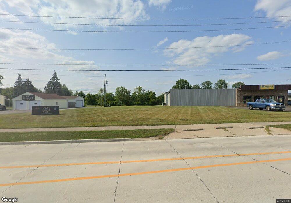
6159 E State Blvd Fort Wayne, IN 46815
Buckingham NeighborhoodEstimated Value: $301,000
3
Beds
1
Bath
12,588
Sq Ft
$24/Sq Ft
Est. Value
About This Home
This home is located at 6159 E State Blvd, Fort Wayne, IN 46815 and is currently priced at $301,000, approximately $23 per square foot. 6159 E State Blvd is a home located in Allen County with nearby schools including J Wilbur Haley Elementary School, Blackhawk Middle School, and R Nelson Snider High School.
Ownership History
Date
Name
Owned For
Owner Type
Purchase Details
Closed on
Jul 20, 2006
Sold by
Fox Robert H
Bought by
Michael Timothy J
Current Estimated Value
Home Financials for this Owner
Home Financials are based on the most recent Mortgage that was taken out on this home.
Original Mortgage
$200,000
Outstanding Balance
$119,846
Interest Rate
6.82%
Mortgage Type
Purchase Money Mortgage
Create a Home Valuation Report for This Property
The Home Valuation Report is an in-depth analysis detailing your home's value as well as a comparison with similar homes in the area
Home Values in the Area
Average Home Value in this Area
Purchase History
| Date | Buyer | Sale Price | Title Company |
|---|---|---|---|
| Michael Timothy J | -- | Lawyers Title Ins |
Source: Public Records
Mortgage History
| Date | Status | Borrower | Loan Amount |
|---|---|---|---|
| Open | Michael Timothy J | $200,000 |
Source: Public Records
Tax History Compared to Growth
Tax History
| Year | Tax Paid | Tax Assessment Tax Assessment Total Assessment is a certain percentage of the fair market value that is determined by local assessors to be the total taxable value of land and additions on the property. | Land | Improvement |
|---|---|---|---|---|
| 2024 | $13,514 | $507,200 | $101,900 | $405,300 |
| 2023 | $13,514 | $511,600 | $101,900 | $409,700 |
| 2022 | $13,838 | $508,900 | $101,900 | $407,000 |
| 2021 | $14,092 | $486,900 | $101,900 | $385,000 |
| 2020 | $14,440 | $486,900 | $101,900 | $385,000 |
| 2019 | $16,849 | $571,300 | $98,700 | $472,600 |
| 2018 | $17,136 | $571,300 | $98,700 | $472,600 |
| 2017 | $17,240 | $561,100 | $98,700 | $462,400 |
| 2016 | $17,725 | $582,000 | $98,700 | $483,300 |
| 2014 | $17,395 | $590,200 | $98,700 | $491,500 |
| 2013 | $13,798 | $473,900 | $98,700 | $375,200 |
Source: Public Records
Map
Nearby Homes
- 6334 Bennington Dr
- 6038 Monarch Dr
- 6105 Cordava Ct
- 2528 E Saint Thomas Point
- 5912 Monarch Dr
- 6601 Bennington Dr
- 6532 Monarch Dr
- 6102 Landover Place
- 5720 Bayside Dr
- 5723 Port Royal
- 5717 Bayside Dr
- 2924 Seafarer Cove
- 5914 Vance Ave
- 7007 Forestwood Dr
- 2227 Lakeland Ln
- 7286 Starks (Lot 11) Blvd
- 7342 Starks (Lot 8) Blvd
- 2806 Knightsbridge Place
- 1903 Coronet Dr
- 1816 Montgomery Ct
- 6205 E State Blvd
- 6131 E State Blvd
- 6008 Brandy Chase Cove
- 6008 Brandy Chase Cove Unit K
- 6008 Brandy Chase Cove Unit J
- 6008 Brandy Chase Cove Unit L
- 6008 Brandy Chase Cove Unit D
- 6222 E State Blvd
- 6222 E State Blvd
- 6109 E State Blvd
- 6083 E State Blvd
- 8417 Maysville Rd
- 2789 Maplecrest Rd Unit Suite A
- 6049 E State Blvd
- 2787 Maplecrest Rd
- 6035 E State Blvd
- 6015 E State Blvd
- 2606 Maplecrest Rd
- 6321 Bennington Dr
- 6122 Millhollow Ln
