
Seller's Agent in 2024
Robyn Brown
Heritage Realty Group, LLC
(318) 245-4433
168 Total Sales
Estimated Value: $28,903 - $161,000
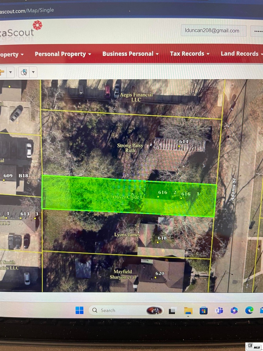
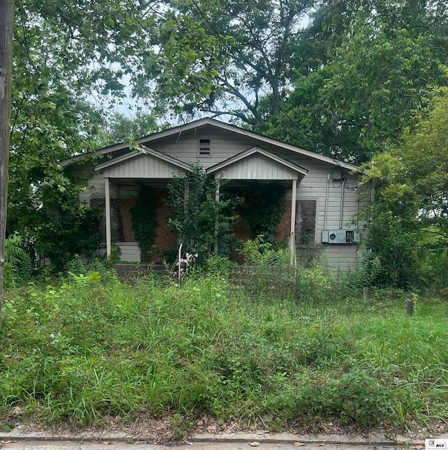
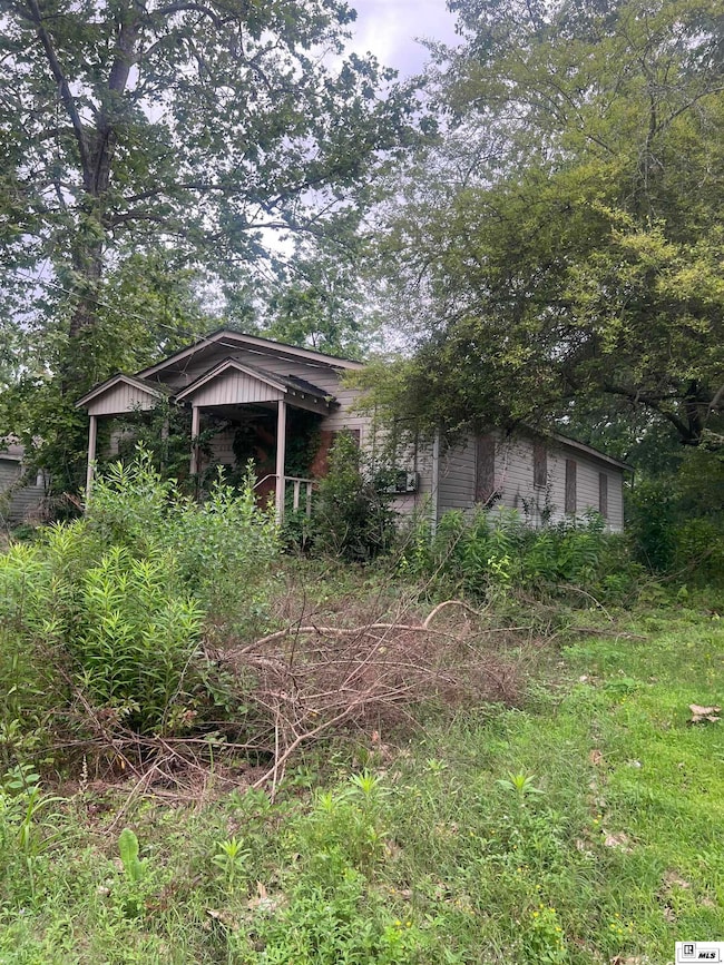
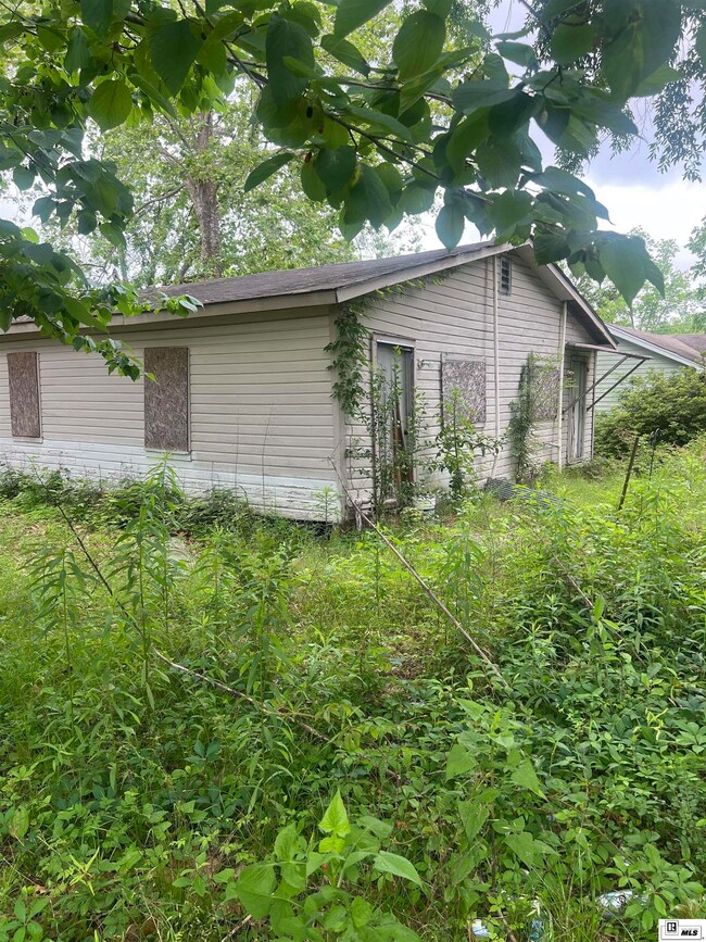
Core HIghway zoning. not in a flood zone. Property needs to be torn down. Estimate for tear down is $5400. House was not given value. One of the 2 units was rented until a few years ago.
Last Agent to Sell the Property
Heritage Realty Group, LLC License #0995683825 Listed on: 07/22/2024
| Date | Buyer | Sale Price | Title Company |
|---|---|---|---|
| H Family Llc | $63,280 | None Listed On Document |
| Date | Event | Price | List to Sale | Price per Sq Ft |
|---|---|---|---|---|
| 08/30/2024 08/30/24 | Sold | -- | -- | -- |
| 07/22/2024 07/22/24 | For Sale | $15,000 | -- | -- |
| Year | Tax Paid | Tax Assessment Tax Assessment Total Assessment is a certain percentage of the fair market value that is determined by local assessors to be the total taxable value of land and additions on the property. | Land | Improvement |
|---|---|---|---|---|
| 2024 | $233 | $2,728 | $390 | $2,338 |
| 2023 | $242 | $2,728 | $390 | $2,338 |
| 2022 | $244 | $2,728 | $390 | $2,338 |
| 2021 | $226 | $2,728 | $390 | $2,338 |
| 2020 | $211 | $2,535 | $446 | $2,089 |
| 2019 | $206 | $2,535 | $446 | $2,089 |
| 2018 | $200 | $2,535 | $446 | $2,089 |
| 2017 | $201 | $2,535 | $446 | $2,089 |
| 2016 | $200 | $0 | $0 | $0 |
| 2015 | $184 | $2,137 | $446 | $1,691 |
| 2013 | $186 | $2,137 | $446 | $1,691 |
Seller's Agent in 2024
Robyn Brown
Heritage Realty Group, LLC
(318) 245-4433
168 Total Sales
Buyer's Agent in 2024
Lisa Duncan
Heritage Realty Group, LLC
(318) 278-1920
54 Total Sales
Source: Northeast REALTORS® of Louisiana
MLS Number: 210975
APN: 4829
Disclaimer: Certain information contained herein is derived from information provided by parties other than Homes.com. All information provided is deemed reliable, but is not guaranteed to be accurate and should be independently verified.
![]() Copyright 2025 NELAR. All rights reserved. The sharing of MLS database, or any portion thereof, with any unauthorized third party is strictly prohibited.
Copyright 2025 NELAR. All rights reserved. The sharing of MLS database, or any portion thereof, with any unauthorized third party is strictly prohibited.
Information contained on this site is believed to be reliable, yet users of this web site are responsible for checking the accuracy, completeness, currency, or suitability of all information. Neither NELAR nor NELAR MLS makes any representation, guarantees, or information provided. They specifically disclaim any and all liability for all claims or damages that may result from providing information to be used on the web site or the information which it contains, including any web sites maintained by third parties, which may be linked to this web site.
The information being provided is for the consumer'
s personal, non-commercial use, end may not be used for any purpose other than to identify prospective properties, which consumers may be interested in purchasing. The user of this site is granted permission to copy a reasonable and limited number of copies to be used in satisfying the purposes identified in the preceding sentence.
By using this site, the consumer signifies their agreement with and acceptance of these terms and conditions. If you do not accept this policy; please do not use this site in any way. Your continued use of this site, and/or its affiliates'
sites, following the posting of changes to these terms will mean you accept those changes, regardless of whether you are provided with additional notices of such changes.