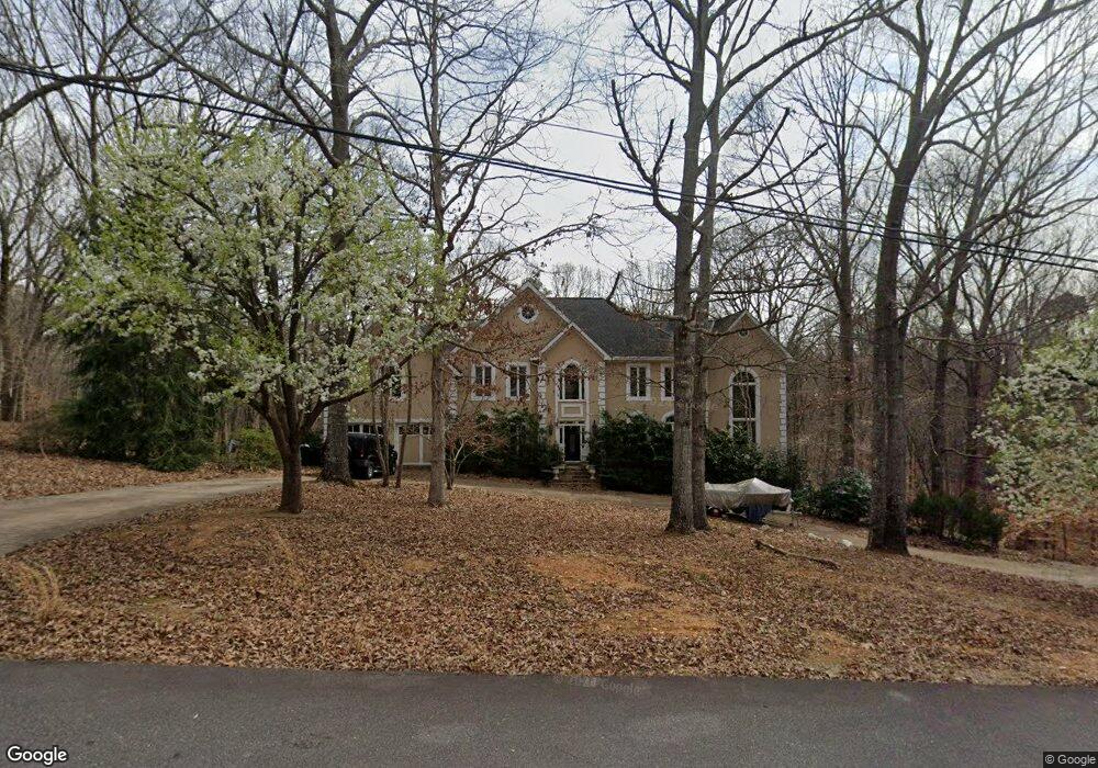
616 Apache Trail Woodstock, GA 30189
Sutallee NeighborhoodEstimated Value: $684,000 - $1,112,000
4
Beds
5
Baths
7,012
Sq Ft
$121/Sq Ft
Est. Value
About This Home
This home is located at 616 Apache Trail, Woodstock, GA 30189 and is currently estimated at $846,116, approximately $120 per square foot. 616 Apache Trail is a home located in Cherokee County with nearby schools including Boston Elementary School, E. T. Booth Middle School, and Etowah High School.
Ownership History
Date
Name
Owned For
Owner Type
Purchase Details
Closed on
Feb 22, 2001
Sold by
Brand Michael S
Bought by
Brand Michael S and Brand Daniel A
Current Estimated Value
Purchase Details
Closed on
May 21, 1999
Sold by
Brand Michael S
Bought by
Brand Michael S and Brand Daniela A
Purchase Details
Closed on
Aug 15, 1997
Sold by
Ivey James W
Bought by
Brand Michael S
Home Financials for this Owner
Home Financials are based on the most recent Mortgage that was taken out on this home.
Original Mortgage
$363,350
Interest Rate
7.5%
Mortgage Type
New Conventional
Purchase Details
Closed on
Aug 29, 1994
Sold by
Resolution Trust Corp Norma J
Bought by
Ivey James W
Home Financials for this Owner
Home Financials are based on the most recent Mortgage that was taken out on this home.
Original Mortgage
$173,600
Interest Rate
6%
Purchase Details
Closed on
Jul 12, 1993
Sold by
Jackson William A
Bought by
Rtc
Create a Home Valuation Report for This Property
The Home Valuation Report is an in-depth analysis detailing your home's value as well as a comparison with similar homes in the area
Home Values in the Area
Average Home Value in this Area
Purchase History
| Date | Buyer | Sale Price | Title Company |
|---|---|---|---|
| Brand Michael S | -- | -- | |
| Brand Michael S | -- | -- | |
| Brand Michael S | $382,500 | -- | |
| Ivey James W | -- | -- | |
| Rtc | $330,900 | -- |
Source: Public Records
Mortgage History
| Date | Status | Borrower | Loan Amount |
|---|---|---|---|
| Previous Owner | Brand Michael S | $363,350 | |
| Previous Owner | Ivey James W | $173,600 |
Source: Public Records
Tax History Compared to Growth
Tax History
| Year | Tax Paid | Tax Assessment Tax Assessment Total Assessment is a certain percentage of the fair market value that is determined by local assessors to be the total taxable value of land and additions on the property. | Land | Improvement |
|---|---|---|---|---|
| 2025 | $8,622 | $328,336 | $36,000 | $292,336 |
| 2024 | $8,655 | $333,056 | $36,000 | $297,056 |
| 2023 | $8,250 | $317,456 | $36,000 | $281,456 |
| 2022 | $6,581 | $250,376 | $36,000 | $214,376 |
| 2021 | $5,658 | $199,296 | $28,000 | $171,296 |
| 2020 | $4,996 | $175,816 | $24,200 | $151,616 |
| 2019 | $4,777 | $168,120 | $22,000 | $146,120 |
| 2018 | $4,708 | $164,680 | $22,000 | $142,680 |
| 2017 | $4,509 | $391,200 | $22,000 | $134,480 |
| 2016 | $4,125 | $354,200 | $22,000 | $119,680 |
| 2015 | $4,244 | $360,900 | $22,000 | $122,360 |
| 2014 | $4,304 | $365,300 | $22,000 | $124,120 |
Source: Public Records
Map
Nearby Homes
- 627 Apache Trail
- 1508 Towne Harbor Ln
- 1364 Towne Harbor Trail
- 1511 Harbor Watch Ct
- 373 N Victoria Rd
- 617 Driftwood Dr
- 315 Pinewood Dr
- 386 N Victoria Rd
- 442 Colonial Walk
- 130 Windsong Trail
- 313 Maltibe Dr
- 204 Wildwood Way
- 146 Sunset Ln
- 819 Victoria Place
- 7119 Big Woods Dr
- 507 Huntgate Rd
- 745 Cedar Creek Way Unit 1
- 522 Huntgate Rd Unit 4
- 1413 Reed Ln
- 331 Laurel Glen Crossing
- 614 Apache Trail
- 620 Apache Trail
- 615 Apache Trail
- 612 Apache Trail
- 613 Apache Trail
- 617 Apache Trail
- 611 Apache Trail
- 619 Apache Trail
- 610 Apache Trail
- 622 Apache Trail
- 1228 Harbor Cove
- 609 Apache Trail
- 621 Apache Trail
- 1230 Harbor Cove
- 624 Apache Trail
- 1232 Harbor Cove
- 607 Apache Trail
- 623 Apache Trail
- 1226 Harbor Cove
- 420 Shoni Ln