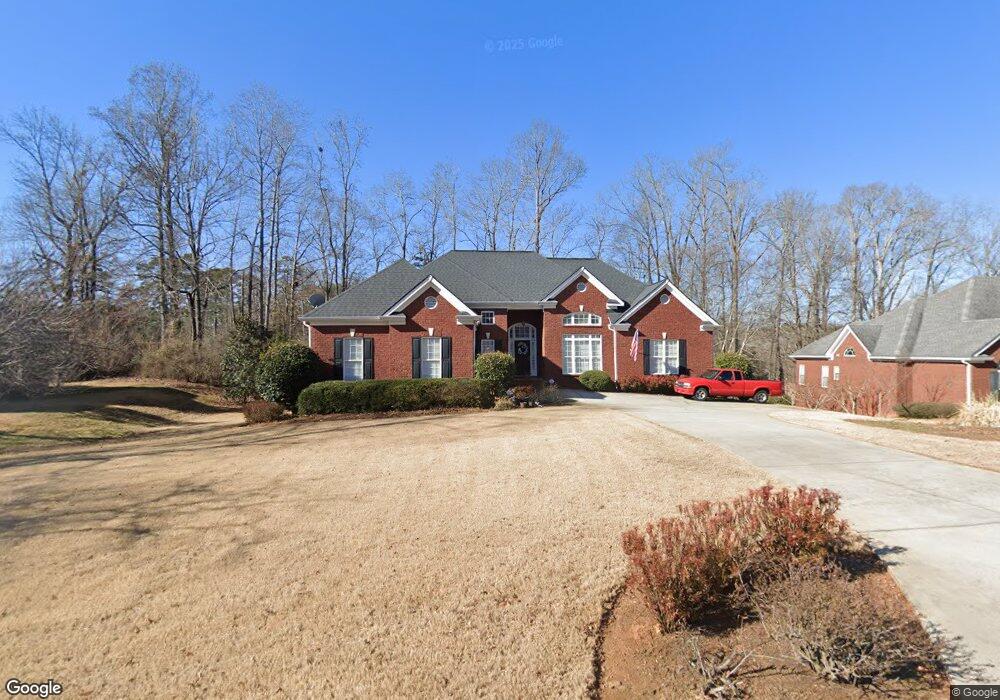
616 Chesterfield Rd Bogart, GA 30622
Estimated Value: $502,000 - $586,000
4
Beds
3
Baths
2,258
Sq Ft
$242/Sq Ft
Est. Value
About This Home
This home is located at 616 Chesterfield Rd, Bogart, GA 30622 and is currently estimated at $546,529, approximately $242 per square foot. 616 Chesterfield Rd is a home located in Clarke County with nearby schools including Cleveland Road Elementary School, Burney-Harris-Lyons Middle School, and Clarke Central High School.
Ownership History
Date
Name
Owned For
Owner Type
Purchase Details
Closed on
May 31, 2011
Sold by
Freeman Ronald C
Bought by
Benfield Myron J
Current Estimated Value
Purchase Details
Closed on
Mar 28, 2003
Sold by
H & B Homes Llc
Bought by
Freeman Ronald C and Freeman Betty W
Purchase Details
Closed on
Mar 1, 2000
Sold by
Willwork L L C
Bought by
H & B Homes Llc
Create a Home Valuation Report for This Property
The Home Valuation Report is an in-depth analysis detailing your home's value as well as a comparison with similar homes in the area
Home Values in the Area
Average Home Value in this Area
Purchase History
| Date | Buyer | Sale Price | Title Company |
|---|---|---|---|
| Benfield Myron J | $230,000 | -- | |
| Freeman Ronald C | $246,900 | -- | |
| H & B Homes Llc | $18,800 | -- |
Source: Public Records
Tax History Compared to Growth
Tax History
| Year | Tax Paid | Tax Assessment Tax Assessment Total Assessment is a certain percentage of the fair market value that is determined by local assessors to be the total taxable value of land and additions on the property. | Land | Improvement |
|---|---|---|---|---|
| 2025 | $4,844 | $223,947 | $18,000 | $205,947 |
| 2024 | $4,844 | $216,598 | $18,000 | $198,598 |
| 2023 | $4,883 | $204,898 | $18,000 | $186,898 |
| 2022 | $4,618 | $171,874 | $18,000 | $153,874 |
| 2021 | $3,676 | $142,836 | $16,000 | $126,836 |
| 2020 | $3,612 | $138,167 | $16,000 | $122,167 |
| 2019 | $3,482 | $126,516 | $16,000 | $110,516 |
| 2018 | $3,401 | $120,760 | $16,000 | $104,760 |
| 2017 | $3,259 | $110,539 | $16,000 | $94,539 |
| 2016 | $3,220 | $107,737 | $16,000 | $91,737 |
| 2015 | $3,170 | $104,195 | $16,000 | $88,195 |
| 2014 | $3,230 | $108,478 | $16,000 | $92,478 |
Source: Public Records
Map
Nearby Homes
- 682 Chesterfield Rd
- 190 W Huntington Rd
- 240 W Huntington Rd
- 100 Hanover Dr
- 241 Meeler Cir
- 212 Huntington Shoals Dr
- 141 Huntington Shoals Dr
- 637 Huntington Rd Unit B1
- 112 Deerhollow Rd
- 470 Huntington Rd Unit 5
- 150 Callaway Dr
- 532 Huntington Rd Unit 7
- 256 Cherokee Ridge
- 240 Deerfield Rd
- 178 Ben Burton Cir
- 575 Vaughn Rd
- 211 Littleton Way
- 240 Cleveland Rd Unit 105
- 612 Chesterfield Rd
- 622 Chesterfield Rd
- 602 Chesterfield Rd
- 632 Chesterfield Rd
- 621 Chesterfield Rd
- 611 Chesterfield Rd
- 631 Chesterfield Rd
- 600 Chesterfield Rd
- 698 Cleveland Rd
- 601 Chesterfield Rd
- 636 Chesterfield Rd
- 117 Brittany Rd
- 140 Chelsea Ct
- 641 Chesterfield Rd
- 582 Chesterfield Rd
- 127 Brittany Rd
- 642 Chesterfield Rd
- 581 Chesterfield Rd
- 160 Chelsea Ct
- 114 Brittany Rd