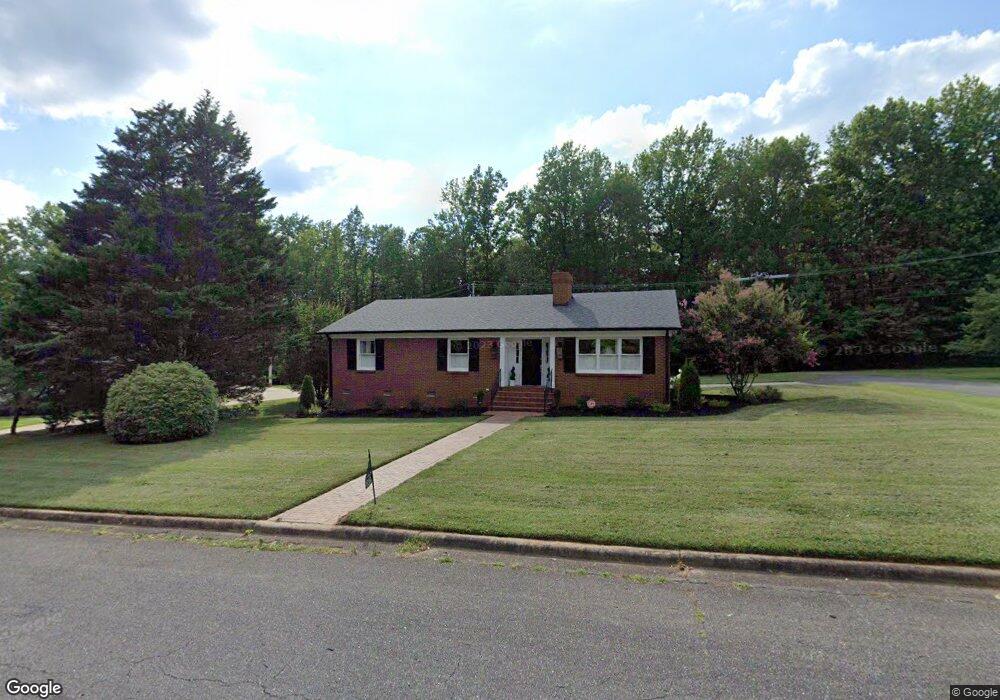
616 Hillside Dr Kings Mountain, NC 28086
Estimated Value: $337,000 - $358,000
--
Bed
--
Bath
1,662
Sq Ft
$206/Sq Ft
Est. Value
About This Home
This home is located at 616 Hillside Dr, Kings Mountain, NC 28086 and is currently estimated at $342,704, approximately $206 per square foot. 616 Hillside Dr is a home located in Cleveland County with nearby schools including West Elementary School, Kings Mountain Middle, and Kings Mountain Intermediate School.
Ownership History
Date
Name
Owned For
Owner Type
Purchase Details
Closed on
Nov 18, 2024
Sold by
Hubbard Iris Camille
Bought by
Robertson Janice E and Robertson Kenneth D
Current Estimated Value
Home Financials for this Owner
Home Financials are based on the most recent Mortgage that was taken out on this home.
Original Mortgage
$100,000
Outstanding Balance
$99,004
Interest Rate
6.12%
Mortgage Type
New Conventional
Estimated Equity
$243,700
Purchase Details
Closed on
Nov 16, 2016
Sold by
Maner B F
Bought by
Lawrence Sarah M
Create a Home Valuation Report for This Property
The Home Valuation Report is an in-depth analysis detailing your home's value as well as a comparison with similar homes in the area
Home Values in the Area
Average Home Value in this Area
Purchase History
| Date | Buyer | Sale Price | Title Company |
|---|---|---|---|
| Robertson Janice E | $350,000 | None Listed On Document | |
| Robertson Janice E | $350,000 | None Listed On Document | |
| Hubbard Iris Camille | -- | None Listed On Document | |
| Lawrence Sarah M | -- | Attorney |
Source: Public Records
Mortgage History
| Date | Status | Borrower | Loan Amount |
|---|---|---|---|
| Open | Robertson Janice E | $100,000 | |
| Closed | Robertson Janice E | $100,000 |
Source: Public Records
Tax History Compared to Growth
Tax History
| Year | Tax Paid | Tax Assessment Tax Assessment Total Assessment is a certain percentage of the fair market value that is determined by local assessors to be the total taxable value of land and additions on the property. | Land | Improvement |
|---|---|---|---|---|
| 2025 | $2,978 | $290,517 | $27,500 | $263,017 |
| 2024 | $2,452 | $207,902 | $24,750 | $183,152 |
| 2023 | $2,440 | $207,902 | $24,750 | $183,152 |
| 2022 | $2,337 | $207,902 | $24,750 | $183,152 |
| 2021 | $1,191 | $207,902 | $24,750 | $183,152 |
| 2020 | $898 | $154,197 | $20,900 | $133,297 |
| 2019 | $898 | $154,197 | $20,900 | $133,297 |
| 2018 | $1,794 | $154,197 | $20,900 | $133,297 |
| 2017 | $1,785 | $154,197 | $20,900 | $133,297 |
| 2016 | $1,792 | $154,197 | $20,900 | $133,297 |
| 2015 | $1,628 | $143,727 | $17,600 | $126,127 |
| 2014 | $1,628 | $143,727 | $17,600 | $126,127 |
Source: Public Records
Map
Nearby Homes
- 811 W Gold St Unit 26
- 417 Phifer Rd
- 442 Phifer Rd
- 400 S Cansler St
- 316 S Cansler St
- 430 Fulton Dr
- 112 Fulton Dr
- 411 S Battleground Ave
- 208 Victoria Cir
- 106 N Tracy St
- 1301 Shelby Rd
- 804 Lee St
- 300 N Watterson St
- 0 Southridge Dr Unit CAR4298120
- 117 Parker Claire Ln
- 111 Parker Claire Ln
- 213 Parker Claire Ln
- 200 E Gold St
- 310 Campbell Cir
- 245 Paige Rd
- 618 Hillside Dr
- 614 Hillside Dr
- 701 Hillside Dr
- 700 Hillside Dr
- 615 Hillside Dr
- 612 Hillside Dr
- 811 Meadowbrook Rd
- 704 Marion St
- 610 Hillside Dr
- 611 Hillside Dr
- 702 Marion St
- 809 Meadowbrook Rd
- 608 Hillside Dr
- 700 Marion St
- 705 Marion St
- 503 Hawthorne Rd
- 703 Marion St
- 602 Marion St
- 606 Hillside Dr
- 701 Marion St