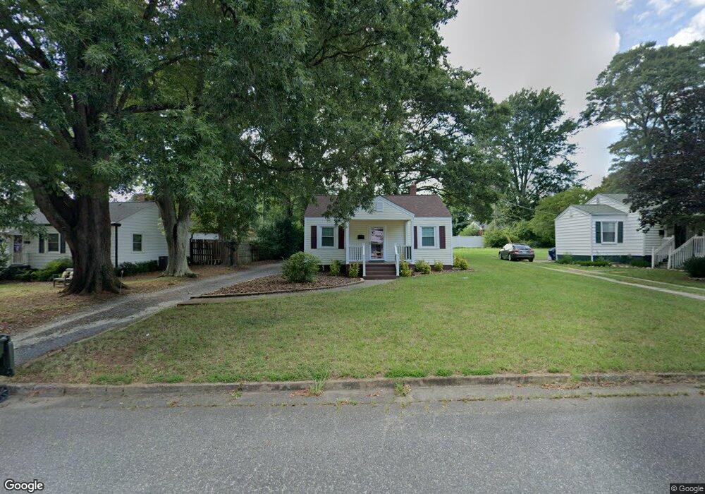
616 Meadowbrook Rd Kings Mountain, NC 28086
Estimated Value: $124,000 - $153,000
--
Bed
--
Bath
672
Sq Ft
$206/Sq Ft
Est. Value
About This Home
This home is located at 616 Meadowbrook Rd, Kings Mountain, NC 28086 and is currently estimated at $138,552, approximately $206 per square foot. 616 Meadowbrook Rd is a home located in Cleveland County with nearby schools including West Elementary School, Kings Mountain Middle, and Kings Mountain Intermediate School.
Ownership History
Date
Name
Owned For
Owner Type
Purchase Details
Closed on
Nov 27, 2019
Sold by
Gilbert Audrey Eatmon and Gilbert Paul D
Bought by
Dowda Bobby James
Current Estimated Value
Home Financials for this Owner
Home Financials are based on the most recent Mortgage that was taken out on this home.
Original Mortgage
$64,600
Outstanding Balance
$56,954
Interest Rate
3.6%
Mortgage Type
New Conventional
Estimated Equity
$81,598
Create a Home Valuation Report for This Property
The Home Valuation Report is an in-depth analysis detailing your home's value as well as a comparison with similar homes in the area
Home Values in the Area
Average Home Value in this Area
Purchase History
| Date | Buyer | Sale Price | Title Company |
|---|---|---|---|
| Dowda Bobby James | $68,000 | None Available |
Source: Public Records
Mortgage History
| Date | Status | Borrower | Loan Amount |
|---|---|---|---|
| Open | Dowda Bobby James | $64,600 |
Source: Public Records
Tax History Compared to Growth
Tax History
| Year | Tax Paid | Tax Assessment Tax Assessment Total Assessment is a certain percentage of the fair market value that is determined by local assessors to be the total taxable value of land and additions on the property. | Land | Improvement |
|---|---|---|---|---|
| 2025 | $1,125 | $109,780 | $17,767 | $92,013 |
| 2024 | $673 | $55,467 | $15,066 | $40,401 |
| 2023 | $669 | $55,467 | $15,066 | $40,401 |
| 2022 | $642 | $55,467 | $15,066 | $40,401 |
| 2021 | $645 | $55,467 | $15,066 | $40,401 |
| 2020 | $528 | $44,003 | $15,066 | $28,937 |
| 2019 | $528 | $44,003 | $15,066 | $28,937 |
| 2018 | $527 | $44,003 | $15,066 | $28,937 |
| 2017 | $524 | $44,003 | $15,066 | $28,937 |
| 2016 | $525 | $44,003 | $15,066 | $28,937 |
| 2015 | $488 | $41,909 | $12,437 | $29,472 |
| 2014 | $488 | $41,909 | $12,437 | $29,472 |
Source: Public Records
Map
Nearby Homes
- 400 S Cansler St
- 411 S Battleground Ave
- 316 S Cansler St
- 811 W Gold St Unit 26
- 200 E Gold St
- 106 N Tracy St
- 112 Fulton Dr
- 440 Phifer Rd
- 442 Phifer Rd
- 300 N Watterson St
- 310 Campbell Cir
- 430 Fulton Dr
- 110 N Gaston St
- 208 Victoria Cir
- 710 York Rd
- 804 Lee St
- 311 E King St Unit 2
- 207 Morris St
- 5066 Beargrass Dr
- 1301 Shelby Rd
- 618 Meadowbrook Rd
- 614 Meadowbrook Rd
- 620 Meadowbrook Rd
- 612 Meadowbrook Rd
- 609 Crescent Cir
- 607 Crescent Cir
- 611 Crescent Cir
- 622 Meadowbrook Rd
- 622 Meadowbrook Rd Unit 18
- 619 Meadowbrook Rd
- 610 Meadowbrook Rd
- 621 Meadowbrook Rd
- 617 Meadowbrook Rd
- 623 Meadowbrook Rd
- 615 Meadowbrook Rd
- 605 Crescent Cir
- 608 Meadowbrook Rd
- 625 Meadowbrook Rd
- 613 Meadowbrook Rd
- 700 Meadowbrook Rd