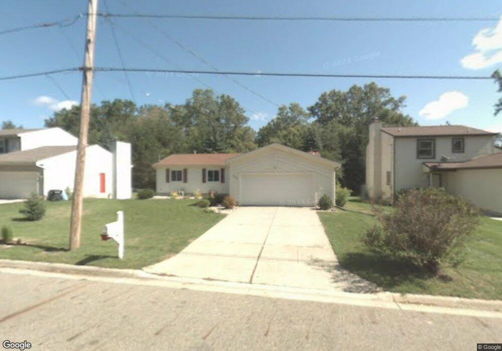
616 Moorland Dr East Lansing, MI 48823
Estimated Value: $274,000 - $343,356
3
Beds
3
Baths
2,664
Sq Ft
$114/Sq Ft
Est. Value
About This Home
This home is located at 616 Moorland Dr, East Lansing, MI 48823 and is currently estimated at $304,589, approximately $114 per square foot. 616 Moorland Dr is a home located in Ingham County with nearby schools including Marble Elementary School, MacDonald Middle School, and East Lansing High School.
Ownership History
Date
Name
Owned For
Owner Type
Purchase Details
Closed on
Sep 15, 2003
Sold by
Griffin Bradley S and Griffin Cynthia L
Bought by
Lampi Jeffrey W and Lampi Stephanie M
Current Estimated Value
Home Financials for this Owner
Home Financials are based on the most recent Mortgage that was taken out on this home.
Original Mortgage
$141,600
Interest Rate
5.5%
Mortgage Type
Purchase Money Mortgage
Purchase Details
Closed on
Mar 24, 1999
Sold by
Chewning Kirk M
Bought by
Griffin Bradley W and Griffin Cynthia L
Home Financials for this Owner
Home Financials are based on the most recent Mortgage that was taken out on this home.
Original Mortgage
$125,300
Interest Rate
6.94%
Mortgage Type
Purchase Money Mortgage
Purchase Details
Closed on
May 1, 1997
Purchase Details
Closed on
Jan 1, 1989
Purchase Details
Closed on
Jul 1, 1986
Purchase Details
Closed on
Mar 1, 1984
Create a Home Valuation Report for This Property
The Home Valuation Report is an in-depth analysis detailing your home's value as well as a comparison with similar homes in the area
Home Values in the Area
Average Home Value in this Area
Purchase History
| Date | Buyer | Sale Price | Title Company |
|---|---|---|---|
| Lampi Jeffrey W | $177,000 | Landamerica Transnation | |
| Griffin Bradley W | $131,900 | Midstate Title Company | |
| -- | $124,000 | -- | |
| -- | $91,000 | -- | |
| -- | $79,000 | -- | |
| -- | $67,500 | -- |
Source: Public Records
Mortgage History
| Date | Status | Borrower | Loan Amount |
|---|---|---|---|
| Previous Owner | Lampi Jeffrey W | $141,600 | |
| Previous Owner | Griffin Bradley W | $125,300 | |
| Closed | Lampi Jeffrey W | $17,650 |
Source: Public Records
Tax History Compared to Growth
Tax History
| Year | Tax Paid | Tax Assessment Tax Assessment Total Assessment is a certain percentage of the fair market value that is determined by local assessors to be the total taxable value of land and additions on the property. | Land | Improvement |
|---|---|---|---|---|
| 2025 | $4,571 | $173,100 | $22,100 | $151,000 |
| 2024 | -- | $155,300 | $22,100 | $133,200 |
| 2023 | $4,269 | $134,400 | $18,900 | $115,500 |
| 2022 | $4,091 | $119,000 | $16,400 | $102,600 |
| 2021 | $4,020 | $111,200 | $15,600 | $95,600 |
| 2020 | $3,976 | $103,900 | $15,600 | $88,300 |
| 2019 | $3,813 | $93,200 | $16,900 | $76,300 |
| 2018 | $4,170 | $96,000 | $12,300 | $83,700 |
| 2017 | $4,003 | $95,500 | $12,400 | $83,100 |
| 2016 | -- | $74,100 | $11,900 | $62,200 |
| 2015 | -- | $69,000 | $21,970 | $47,030 |
| 2014 | -- | $65,000 | $21,970 | $43,030 |
Source: Public Records
Map
Nearby Homes
- 692 Moorland Dr Unit 10
- 1653 Ann St
- 5435 Blue Haven Dr
- 1542 Ann St
- 586 Lexington Ave
- 5420 Park Lake Rd
- 562 Virginia Ave
- 5189 E Brookfield Dr
- 657 Spartan Ave
- 1105 Robb St
- 1608 Haslett Rd
- 2545 Koala Dr
- 5604 Deville Ct
- 5680 Deville Ct Unit 61
- 5120 Wardcliff Dr
- 509 Cornell Ave
- 1124 Burcham Dr
- 5403 Wild Oak Dr
- 5724 Lebaron Ct
- 919 Collingwood Dr
- 622 Moorland Dr
- 608 Moorland Dr
- 630 Moorland Dr
- 1737 Snyder Rd
- 1831 Snyder Rd
- 627 Moorland Dr
- 536 Moorland Dr
- 640 Moorland Dr
- 1727 Snyder Rd
- 1736 E Mt Vernon
- 1736 Mount Vernon Ave
- 530 Moorland Dr
- 1820 Snyder Rd
- 1736 Snyder Rd
- 1726 Mt Vernon
- 1826 Snyder Rd
- 1726 Mount Vernon Ave
- 1717 Snyder Rd
- 1726 E Mt Vernon
- 1832 Snyder Rd