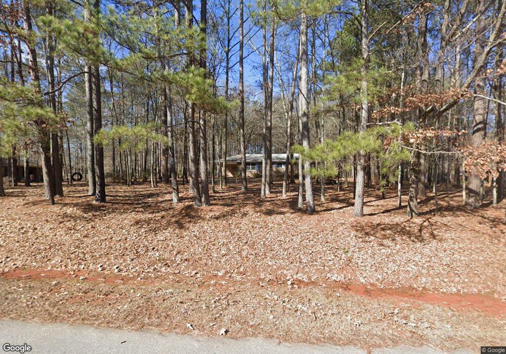
616 Phillips Dr Monroe, GA 30656
Estimated Value: $248,000 - $279,000
Studio
1
Bath
1,176
Sq Ft
$224/Sq Ft
Est. Value
About This Home
This home is located at 616 Phillips Dr, Monroe, GA 30656 and is currently estimated at $263,763, approximately $224 per square foot. 616 Phillips Dr is a home located in Walton County with nearby schools including Walker Park Elementary School, Carver Middle School, and Monroe Area High School.
Ownership History
Date
Name
Owned For
Owner Type
Purchase Details
Closed on
Dec 26, 2006
Sold by
Land Walton
Bought by
Allison Linda J
Current Estimated Value
Home Financials for this Owner
Home Financials are based on the most recent Mortgage that was taken out on this home.
Original Mortgage
$31,000
Interest Rate
6.07%
Mortgage Type
New Conventional
Purchase Details
Closed on
Oct 2, 2003
Sold by
Anchinges Keda B
Bought by
Walton Land
Home Financials for this Owner
Home Financials are based on the most recent Mortgage that was taken out on this home.
Original Mortgage
$18,000
Interest Rate
6%
Mortgage Type
New Conventional
Purchase Details
Closed on
Jun 15, 1994
Sold by
Enslen Betty
Bought by
Anchings Perry
Create a Home Valuation Report for This Property
The Home Valuation Report is an in-depth analysis detailing your home's value as well as a comparison with similar homes in the area
Home Values in the Area
Average Home Value in this Area
Purchase History
| Date | Buyer | Sale Price | Title Company |
|---|---|---|---|
| Allison Linda J | $109,900 | -- | |
| Walton Land | $1,000 | -- | |
| Anchings Perry | $67,500 | -- |
Source: Public Records
Mortgage History
| Date | Status | Borrower | Loan Amount |
|---|---|---|---|
| Closed | Allison Linda J | $31,000 | |
| Previous Owner | Walton Land | $18,000 | |
| Closed | Anchings Perry | -- |
Source: Public Records
Tax History
| Year | Tax Paid | Tax Assessment Tax Assessment Total Assessment is a certain percentage of the fair market value that is determined by local assessors to be the total taxable value of land and additions on the property. | Land | Improvement |
|---|---|---|---|---|
| 2025 | $530 | $85,680 | $19,600 | $66,080 |
| 2024 | $453 | $79,120 | $18,800 | $60,320 |
| 2023 | $256 | $77,840 | $18,800 | $59,040 |
| 2022 | $425 | $68,440 | $14,800 | $53,640 |
| 2021 | $425 | $51,160 | $10,000 | $41,160 |
| 2020 | $435 | $47,000 | $8,000 | $39,000 |
| 2019 | $443 | $39,320 | $8,000 | $31,320 |
| 2018 | $432 | $39,320 | $8,000 | $31,320 |
| 2017 | $1,253 | $36,360 | $8,000 | $28,360 |
| 2016 | $281 | $27,736 | $6,000 | $21,736 |
| 2015 | $228 | $23,256 | $6,000 | $17,256 |
| 2014 | $196 | $19,948 | $0 | $0 |
Source: Public Records
Map
Nearby Homes
- 536 Phillips Dr
- 0 Phillips Dr Unit 10697835
- 0 Phillips Dr Unit 7719282
- 480 John Deere Rd NW
- 809 Parker Ct NW
- 2069 Highway 11 NW
- 1976 Alton Green Dr NE
- 1602 Annas Way
- 284 Doster Ave NW
- 102 Meadow Wood Ln
- 2457 Bold Springs Rd
- 137 Meadow Wood Ln
- 1409 Hwy 11 N
- 60 Parkway Dr NW
- 0 Nicholsville Rd Unit 10722417
- 0 Nicholsville Rd Unit 7745095
- 2103 Sourwood Ct
- 3 Saratoga Dr Unit AYE/3/1.858/16
- 1 Saratoga Dr Unit AYE/1/1.247/15
- 2 Saratoga Dr Unit AYE/2/1.00/16
- 596 Phillips Dr
- 636 Phillips Dr
- 617 Phillips Dr
- 1869 Clifford Ct NW
- 656 Phillips Dr
- 1886 Clifford Ct NW
- 637 Phillips Dr Unit 122
- 637 Phillips Dr
- 597 Phillips Dr
- 1886 Phillips Ct NW
- 1906 Phillips Ct NW
- 1909 Clifford Ct NW
- 1909 Clifford Ct NW
- 577 Phillips Dr
- 657 Phillips Dr
- 676 Phillips Dr
- 557 Phillips Dr
- 1870 Clifford Ct NW
- 1926 Phillips Ct NW
- 1983 State Highway 11
Your Personal Tour Guide
Ask me questions while you tour the home.