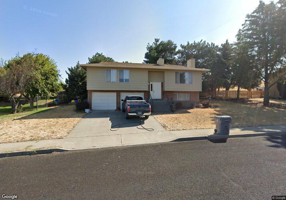
616 Summit Ridge Dr E the Dalles, OR 97058
Estimated Value: $466,204 - $483,000
3
Beds
3
Baths
1,274
Sq Ft
$373/Sq Ft
Est. Value
About This Home
This home is located at 616 Summit Ridge Dr E, the Dalles, OR 97058 and is currently estimated at $474,602, approximately $372 per square foot. 616 Summit Ridge Dr E is a home located in Wasco County with nearby schools including Dry Hollow Elementary School, The Dalles Middle School, and The Dalles High School.
Ownership History
Date
Name
Owned For
Owner Type
Purchase Details
Closed on
Oct 22, 2009
Sold by
Kumm Kevin and Kumm Heidi Arlene
Bought by
Kumm Kevin
Current Estimated Value
Home Financials for this Owner
Home Financials are based on the most recent Mortgage that was taken out on this home.
Original Mortgage
$124,700
Outstanding Balance
$81,094
Interest Rate
5%
Mortgage Type
Future Advance Clause Open End Mortgage
Estimated Equity
$393,508
Create a Home Valuation Report for This Property
The Home Valuation Report is an in-depth analysis detailing your home's value as well as a comparison with similar homes in the area
Home Values in the Area
Average Home Value in this Area
Purchase History
| Date | Buyer | Sale Price | Title Company |
|---|---|---|---|
| Kumm Kevin | -- | -- |
Source: Public Records
Mortgage History
| Date | Status | Borrower | Loan Amount |
|---|---|---|---|
| Open | Kumm Kevin | $124,700 |
Source: Public Records
Tax History Compared to Growth
Tax History
| Year | Tax Paid | Tax Assessment Tax Assessment Total Assessment is a certain percentage of the fair market value that is determined by local assessors to be the total taxable value of land and additions on the property. | Land | Improvement |
|---|---|---|---|---|
| 2024 | $4,472 | $248,428 | -- | -- |
| 2023 | $4,341 | $241,193 | $0 | $0 |
| 2022 | $4,245 | $103,838 | $0 | $0 |
| 2021 | $4,115 | $70,224 | $0 | $0 |
| 2020 | $4,013 | $68,179 | $0 | $0 |
| 2019 | $4,238 | $66,193 | $0 | $0 |
| 2018 | $4,120 | $208,055 | $0 | $0 |
| 2017 | $3,990 | $201,995 | $0 | $0 |
| 2016 | $3,818 | $196,112 | $0 | $0 |
| 2015 | $3,703 | $190,400 | $0 | $0 |
| 2014 | $3,503 | $184,854 | $0 | $0 |
Source: Public Records
Map
Nearby Homes
- 679 Brentwood Dr E
- 500 E Knoll Ct
- 512 E Knoll Ct
- 3103 Fremont St
- 936 Richmond St
- 1700 Lone Pine Blvd
- 1300 Lone Pine Blvd
- 0 Lone Pine Ln
- 1400 Lone Pine Blvd
- 192 Honeysuckle Ln
- 1500 Lone Pine Blvd
- 260 Lone Pine Ln Unit 2
- 240 Lone Pine Ln Unit 2
- 3564 E 2nd St Unit 33
- 155 Southshore Ave
- 112 Southshore Ave
- 2718 E 2nd St
- 2803 E 12th St
- 125 Southshore Ln
- 122 123 Southshore Ln
- 622 Summit Ridge Dr E
- 610 Summit Ridge Dr E
- 611 Summit Ridge Dr E
- 619 Summit Ridge Dr E
- 630 Summit Ridge Dr E
- 602 Summit Ridge Dr E
- 3540 Royal Crest Dr E
- 625 Summit Ridge Dr E
- 560 Summit Ridge Dr E
- 3532 Royal Crest Dr E
- 636 Summit Ridge Dr E
- 635 Summit Ridge Dr E
- 3541 Royal Crest Dr E
- 680 Brentwood Dr E
- 552 Summit Ridge Dr E
- 3526 Royal Crest Dr E
- 674 Brentwood Dr E
- 3533 Royal Crest Dr E
- 3522 Royal Crest Dr E
- 546 Summit Ridge Dr E