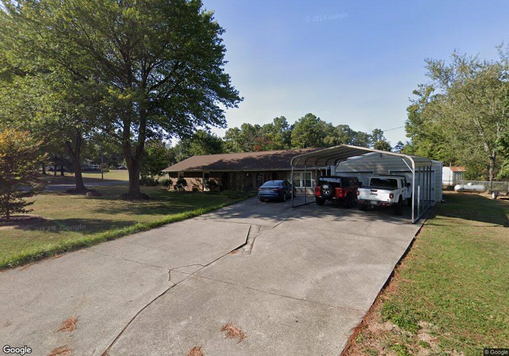
616 Whitepath Dr NW Dalton, GA 30721
Estimated Value: $222,000 - $287,000
--
Bed
2
Baths
1,605
Sq Ft
$157/Sq Ft
Est. Value
About This Home
This home is located at 616 Whitepath Dr NW, Dalton, GA 30721 and is currently estimated at $251,478, approximately $156 per square foot. 616 Whitepath Dr NW is a home located in Whitfield County with nearby schools including New Hope Elementary School, New Hope Middle School, and Northwest Whitfield County High School.
Ownership History
Date
Name
Owned For
Owner Type
Purchase Details
Closed on
Feb 5, 2016
Sold by
Vines Doyle Eugene
Bought by
Alexander Tommy Kay and Alexander Sandra Ensley
Current Estimated Value
Purchase Details
Closed on
Dec 16, 2005
Sold by
Vines Doyle Eugene
Bought by
Vines Doyle Eugene
Home Financials for this Owner
Home Financials are based on the most recent Mortgage that was taken out on this home.
Original Mortgage
$89,320
Interest Rate
6.28%
Mortgage Type
New Conventional
Purchase Details
Closed on
Oct 28, 2002
Sold by
Jones Vicky
Bought by
Dotson Vicky Lynn
Purchase Details
Closed on
Aug 28, 2002
Sold by
Dotson Richard D
Bought by
Dotson Vicky Lynn
Purchase Details
Closed on
Apr 1, 1994
Bought by
Jones Vicky
Create a Home Valuation Report for This Property
The Home Valuation Report is an in-depth analysis detailing your home's value as well as a comparison with similar homes in the area
Home Values in the Area
Average Home Value in this Area
Purchase History
| Date | Buyer | Sale Price | Title Company |
|---|---|---|---|
| Alexander Tommy Kay | $75,000 | -- | |
| Vines Doyle Eugene | -- | -- | |
| Vines Doyle Eugene | $120,000 | -- | |
| Dotson Vicky Lynn | -- | -- | |
| Dotson Vicky Lynn | -- | -- | |
| Jones Vicky | $25,000 | -- |
Source: Public Records
Mortgage History
| Date | Status | Borrower | Loan Amount |
|---|---|---|---|
| Previous Owner | Vines Doyle Eugene | $89,320 |
Source: Public Records
Tax History Compared to Growth
Tax History
| Year | Tax Paid | Tax Assessment Tax Assessment Total Assessment is a certain percentage of the fair market value that is determined by local assessors to be the total taxable value of land and additions on the property. | Land | Improvement |
|---|---|---|---|---|
| 2024 | $1,887 | $99,568 | $12,800 | $86,768 |
| 2023 | $1,887 | $69,950 | $11,600 | $58,350 |
| 2022 | $1,390 | $55,681 | $8,400 | $47,281 |
| 2021 | $1,390 | $55,660 | $8,400 | $47,260 |
| 2020 | $1,425 | $55,660 | $8,400 | $47,260 |
| 2019 | $1,443 | $55,660 | $8,400 | $47,260 |
| 2018 | $1,279 | $49,887 | $8,400 | $41,487 |
| 2017 | $653 | $49,887 | $8,400 | $41,487 |
| 2016 | $1,043 | $43,254 | $5,250 | $38,004 |
| 2014 | $965 | $43,254 | $5,250 | $38,004 |
| 2013 | -- | $43,254 | $5,250 | $38,004 |
Source: Public Records
Map
Nearby Homes
- 609 Cherokee Trail NW
- 1626 Lagenia Ct
- 1016 Prince Way
- 466 Scarlet Dr
- 1015 S Ridge Dr
- 1425 Wiggs Dr
- 0 West R W Ridge Dr
- 303 Cherokee Trail NW
- 287 Williams Rd NW
- 2256 Waring Rd NW
- 2215 Kerr Rd NW
- 2002 Broadacre Dr NW
- 3201 Maple Grove Dr NW
- 3025 Cleveland Hwy
- 0 Silhouette Way
- 3147 Cleveland Hwy
- 3450 Misty Meadows Dr NW
- 1247 Reed Rd
- 00 Waring Rd NW
- 3216 Cleveland Hwy
- 624 Cherokee Trail NW
- 614 Whitepath Dr NW
- 608 Cherokee Trail NW
- 619 Cherokee Trail NW
- 609 Whitepath Dr NW
- 591 Deer Trail NW
- 617 Cherokee Trail NW
- 612 Whitepath Dr NW
- 613 Cherokee Trail NW
- 623 Cherokee Trail NW
- 610 Whitepath Dr NW
- 2030 Deer Trail NW
- 2045 Deer Trail NW
- 700 Cherokee Trail NW
- 601 Deer Trail NW
- 606 Cherokee Trail NW
- 611 Cherokee Trail NW
- 603 Deer Trail NW
- 574 Deer Trail NW
- 607 Deer Trail NW