Estimated Value: $292,000 - $345,000
3
Beds
2
Baths
1,467
Sq Ft
$218/Sq Ft
Est. Value
About This Home
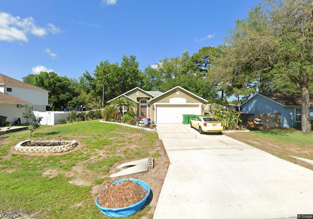
This home is located at 6160 Degan Rd, Cocoa, FL 32927 and is currently estimated at $319,762, approximately $217 per square foot. 6160 Degan Rd is a home located in Brevard County with nearby schools including Enterprise Elementary School, Space Coast Junior/Senior High School, and East Atlantic Prep of Brevard County.
Ownership History
Date
Name
Owned For
Owner Type
Purchase Details
Closed on
May 30, 2003
Sold by
Maronda Homes Inc Of Florida
Bought by
Latsbaugh Debra L
Current Estimated Value
Home Financials for this Owner
Home Financials are based on the most recent Mortgage that was taken out on this home.
Original Mortgage
$97,338
Outstanding Balance
$42,670
Interest Rate
5.79%
Estimated Equity
$277,092
Purchase Details
Closed on
Feb 20, 2002
Sold by
Chong Henry and Chong Lydia C
Bought by
Maronda Homes Inc
Create a Home Valuation Report for This Property
The Home Valuation Report is an in-depth analysis detailing your home's value as well as a comparison with similar homes in the area
Home Values in the Area
Average Home Value in this Area
Purchase History
| Date | Buyer | Sale Price | Title Company |
|---|---|---|---|
| Latsbaugh Debra L | $98,900 | Adnoram Title Company Inc | |
| Maronda Homes Inc | $10,900 | -- |
Source: Public Records
Mortgage History
| Date | Status | Borrower | Loan Amount |
|---|---|---|---|
| Open | Latsbaugh Debra L | $97,338 |
Source: Public Records
Tax History Compared to Growth
Tax History
| Year | Tax Paid | Tax Assessment Tax Assessment Total Assessment is a certain percentage of the fair market value that is determined by local assessors to be the total taxable value of land and additions on the property. | Land | Improvement |
|---|---|---|---|---|
| 2025 | $1,415 | $103,000 | -- | -- |
| 2024 | $1,377 | $100,100 | -- | -- |
| 2023 | $1,377 | $97,190 | $0 | $0 |
| 2022 | $1,283 | $94,360 | $0 | $0 |
| 2021 | $1,279 | $91,620 | $0 | $0 |
| 2020 | $1,216 | $90,360 | $0 | $0 |
| 2019 | $1,151 | $88,330 | $0 | $0 |
| 2018 | $1,143 | $86,690 | $0 | $0 |
| 2017 | $1,134 | $84,910 | $0 | $0 |
| 2016 | $1,133 | $83,170 | $18,000 | $65,170 |
| 2015 | $1,144 | $82,600 | $15,000 | $67,600 |
| 2014 | $1,144 | $81,950 | $11,000 | $70,950 |
Source: Public Records
Map
Nearby Homes
- 6200 Edison St
- 6155 Baltimore Ave
- 00000 Golfview Ave
- 0 Golfview Ave
- 6010 Fay Blvd
- 6180 Balboa St
- 5915 Akers St
- 6215 Balboa St
- 6510 Aspen Ln
- 5940 Fisherman Ln
- 23-35-21-JX-B-2 Aruin St
- 6365 Homestead Ave
- 6420 Homestead Ave
- 6551 Marlbrook Ln
- 6177 Brandt St
- 6545 Addie Ave
- 6115 Allmont St
- 5720 Flint Rd
- 6470 Aberdeen Ave
- 6105 Banyan St
- 6170 Degan Rd
- 6150 Degan Rd
- 6145 Baltimore Ave
- 6165 Baltimore Ave
- 6240 Edison St
- 6165 Degan Rd
- 6180 Degan Rd
- 6130 Degan Rd
- 6135 Baltimore Ave
- 6155 Degan Rd
- 6175 Degan Rd
- 6175 Baltimore Ave
- 6145 Degan Rd
- 6185 Degan Rd
- 6125 Baltimore Ave
- 6150 Baltimore Ave
- 6140 Baltimore Ave
- 6135 Degan Rd
- 6182 Dees Rd
- 6160 Baltimore Ave