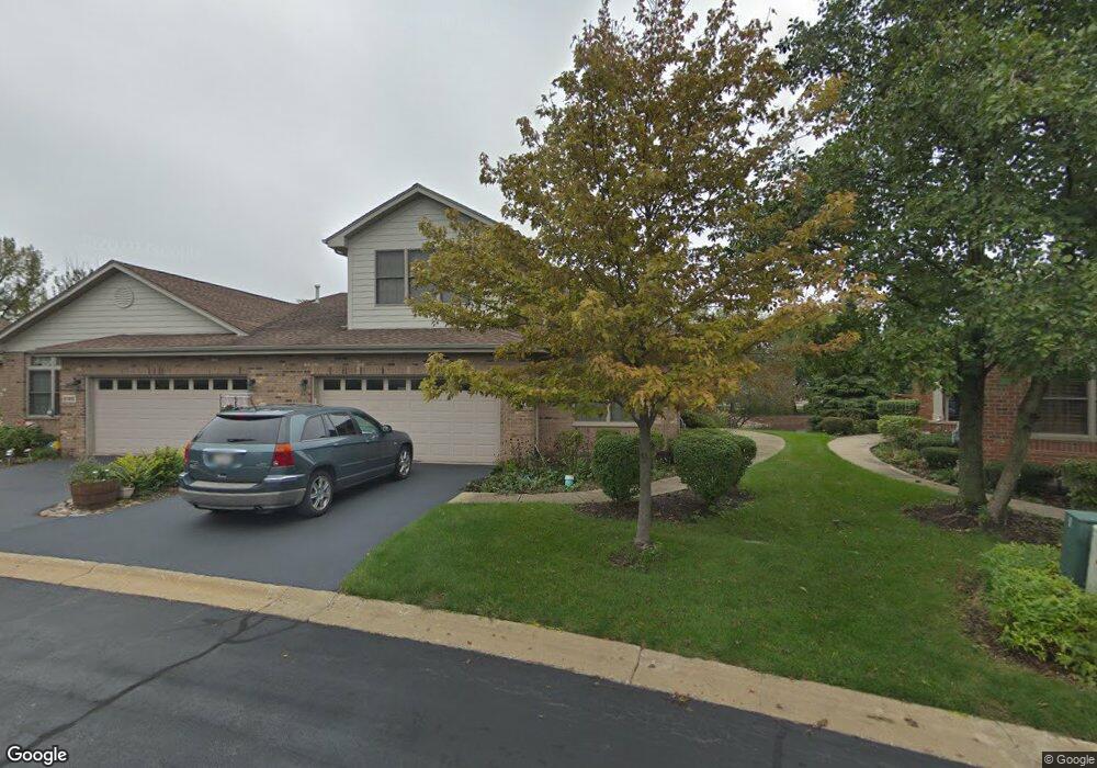
6160 Princeton Ln Palos Heights, IL 60463
Navajo Hills NeighborhoodEstimated Value: $377,000 - $442,000
3
Beds
3
Baths
2,471
Sq Ft
$167/Sq Ft
Est. Value
About This Home
This home is located at 6160 Princeton Ln, Palos Heights, IL 60463 and is currently estimated at $413,756, approximately $167 per square foot. 6160 Princeton Ln is a home located in Cook County with nearby schools including Chippewa Elementary School, Navajo Heights Elementary School, and Independence Jr High School.
Ownership History
Date
Name
Owned For
Owner Type
Purchase Details
Closed on
Aug 1, 2002
Sold by
Jdl Management Company
Bought by
Rock George W and Rock Judy
Current Estimated Value
Home Financials for this Owner
Home Financials are based on the most recent Mortgage that was taken out on this home.
Original Mortgage
$160,000
Outstanding Balance
$63,818
Interest Rate
5.75%
Estimated Equity
$349,938
Create a Home Valuation Report for This Property
The Home Valuation Report is an in-depth analysis detailing your home's value as well as a comparison with similar homes in the area
Home Values in the Area
Average Home Value in this Area
Purchase History
| Date | Buyer | Sale Price | Title Company |
|---|---|---|---|
| Rock George W | $322,500 | Ticor Title Insurance Compan |
Source: Public Records
Mortgage History
| Date | Status | Borrower | Loan Amount |
|---|---|---|---|
| Open | Rock George W | $160,000 |
Source: Public Records
Tax History Compared to Growth
Tax History
| Year | Tax Paid | Tax Assessment Tax Assessment Total Assessment is a certain percentage of the fair market value that is determined by local assessors to be the total taxable value of land and additions on the property. | Land | Improvement |
|---|---|---|---|---|
| 2024 | $9,696 | $37,998 | $2,380 | $35,618 |
| 2023 | $10,067 | $37,998 | $2,380 | $35,618 |
| 2022 | $10,067 | $34,035 | $2,040 | $31,995 |
| 2021 | $9,667 | $34,034 | $2,040 | $31,994 |
| 2020 | $9,623 | $34,034 | $2,040 | $31,994 |
| 2019 | $9,689 | $35,418 | $1,870 | $33,548 |
| 2018 | $9,169 | $35,418 | $1,870 | $33,548 |
| 2017 | $9,196 | $35,418 | $1,870 | $33,548 |
| 2016 | $9,660 | $33,680 | $1,530 | $32,150 |
| 2015 | $9,865 | $35,161 | $1,530 | $33,631 |
| 2014 | $9,607 | $35,161 | $1,530 | $33,631 |
| 2013 | $8,337 | $33,344 | $1,530 | $31,814 |
Source: Public Records
Map
Nearby Homes
- 6150 W 124th St
- 12857 S Austin Ave
- 12246 S Nagle Ave
- 5942 W 124th St
- 12513 S Mcvickers Ave
- 5844 W 124th St
- 12557 S Mason Ave
- 6519 W 126th Place
- 12611 Natoma Ave
- 6052 W 128th St
- 9208 S Monitor Ave
- 6711 W Shiawassie Dr
- 5821 W 127th St
- 12613 S Parkside Ave
- 6052 W 129th Place
- 12649 S Parkside Ave
- 5544 W Cal Sag Rd
- 12642 S Central Ave
- 12720 Carriage Ln Unit B2
- 11554 S Neenah Ave
- 6166 Princeton Ln
- 6154 Princeton Ln
- 6148 Princeton Ln Unit 6148
- 6172 Princeton Ln
- 6178 Princeton Ln
- 6161 Princeton Ln
- 6142 Princeton Ln
- 6165 Princeton Ln
- 6157 Princeton Ln
- 6136 Princeton Ln
- 6169 Princeton Ln
- 6136 Princeton Ln
- 6184 Princeton Ln
- 6153 Princeton Ln
- 6173 Princeton Ln
- 6149 Princeton Ln
- 6149 Princeton Ln Unit 6149
- 6177 Princeton Ln
- 6190 Princeton Ln
- 6130 Princeton Ln