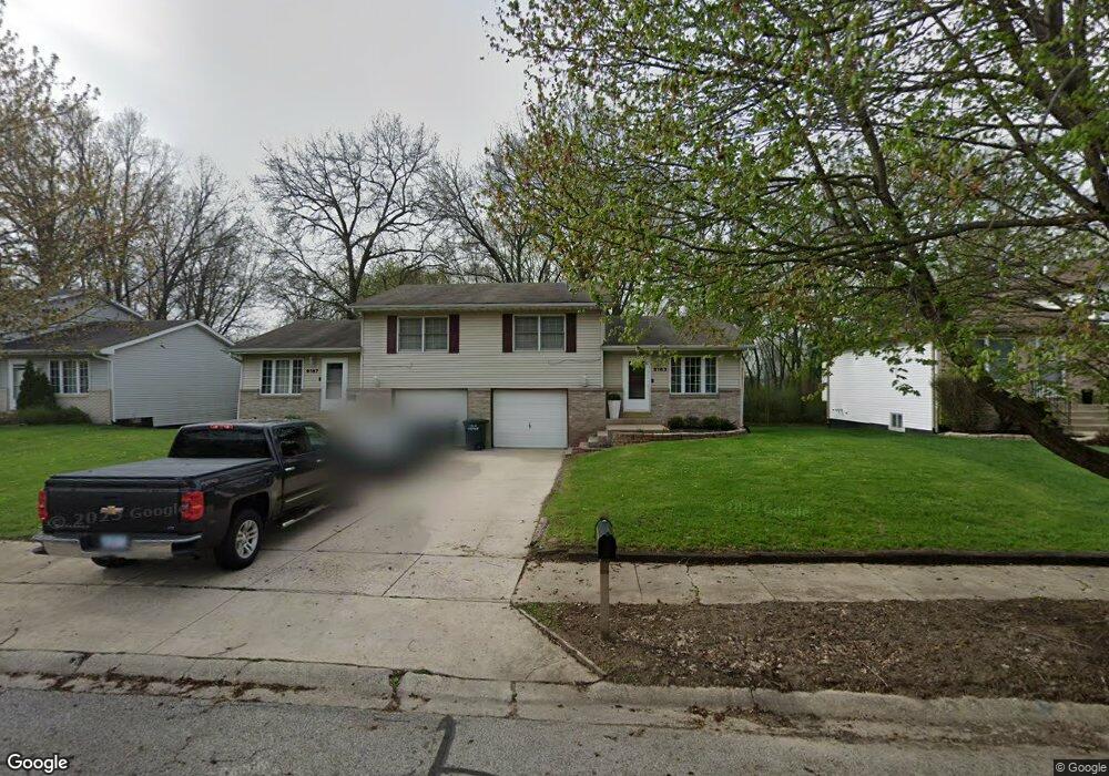
6163 Mccasland Ave Portage, IN 46368
Estimated Value: $224,000 - $337,000
4
Beds
4
Baths
2,172
Sq Ft
$124/Sq Ft
Est. Value
About This Home
This home is located at 6163 Mccasland Ave, Portage, IN 46368 and is currently estimated at $269,450, approximately $124 per square foot. 6163 Mccasland Ave is a home located in Porter County with nearby schools including Wallace Aylesworth Elementary, Willowcreek Middle School, and Portage High School.
Ownership History
Date
Name
Owned For
Owner Type
Purchase Details
Closed on
Apr 17, 2015
Sold by
Harmon Donald R and Harmon Barbara R
Bought by
Marshall Franklin L
Current Estimated Value
Home Financials for this Owner
Home Financials are based on the most recent Mortgage that was taken out on this home.
Original Mortgage
$173,794
Outstanding Balance
$136,784
Interest Rate
4.37%
Mortgage Type
FHA
Estimated Equity
$132,666
Create a Home Valuation Report for This Property
The Home Valuation Report is an in-depth analysis detailing your home's value as well as a comparison with similar homes in the area
Home Values in the Area
Average Home Value in this Area
Purchase History
| Date | Buyer | Sale Price | Title Company |
|---|---|---|---|
| Marshall Franklin L | -- | Fidelity National Title Co |
Source: Public Records
Mortgage History
| Date | Status | Borrower | Loan Amount |
|---|---|---|---|
| Open | Marshall Franklin L | $173,794 |
Source: Public Records
Tax History Compared to Growth
Tax History
| Year | Tax Paid | Tax Assessment Tax Assessment Total Assessment is a certain percentage of the fair market value that is determined by local assessors to be the total taxable value of land and additions on the property. | Land | Improvement |
|---|---|---|---|---|
| 2024 | $4,094 | $287,500 | $21,000 | $266,500 |
| 2023 | $3,570 | $278,400 | $20,000 | $258,400 |
| 2022 | $3,570 | $241,300 | $20,000 | $221,300 |
| 2021 | $3,296 | $221,100 | $20,000 | $201,100 |
| 2020 | $2,831 | $194,600 | $19,200 | $175,400 |
| 2019 | $2,924 | $199,200 | $19,200 | $180,000 |
| 2018 | $2,682 | $189,600 | $19,200 | $170,400 |
| 2017 | $3,161 | $185,600 | $19,200 | $166,400 |
| 2016 | $3,209 | $177,700 | $16,600 | $161,100 |
| 2014 | $1,890 | $144,300 | $16,700 | $127,600 |
| 2013 | -- | $144,600 | $16,700 | $127,900 |
Source: Public Records
Map
Nearby Homes
- 6170 Lakewood Ave
- 2373 Dunewood St
- 2359 Dunewood St
- 6184 Lakewood Ave
- 6195 Lakewood Ave
- 2408 Jupiter St
- 6192 Lakewood Ave
- S-1654-3 Blakely Plan at Dunewood Trails - Single Family Homes
- S-2820-3 Rowan Plan at Dunewood Trails - Single Family Homes
- 6227 Dunewood St
- Blakely Plan at Dunewood Trails - Single Family Homes
- Rowan Plan at Dunewood Trails - Single Family Homes
- 6208 Lakewood Ave
- 2349 Jupiter St
- Lot Evergreen Ave
- 6281 Venus Ave
- 0 Airport Us 6 Unit NRA829208
- 0 Central Ave Unit NRA826855
- 0 Melton Rd Unit NRA811705
- 0 Airport Us 6 Unit NRA806028
- 6155 Mccasland Ave
- 6167 Mccasland Ave
- 6151 Mccasland Ave
- 6171 Mccasland Ave Unit 6175
- 6150 Mccasland Ave Unit 54
- 6154 Mccasland Ave
- 6150-54 Mccasland Ave
- 6183 Mccasland Ave
- 6166 Mccasland Ave
- 6166-68 Mccasland Ave
- 6168 Mccasland Ave
- 6187 Mccasland Ave
- 6170 Mccasland Ave Unit 6174
- 6174 Mccasland Ave
- 2385 Dixie Dr
- 6182 Mccasland Ave Unit 2
- 6182 Mccasland Ave
- 6188 Mccasland Ave Unit 2
- 6188 Mccasland Ave
- 2375 Dixie Dr