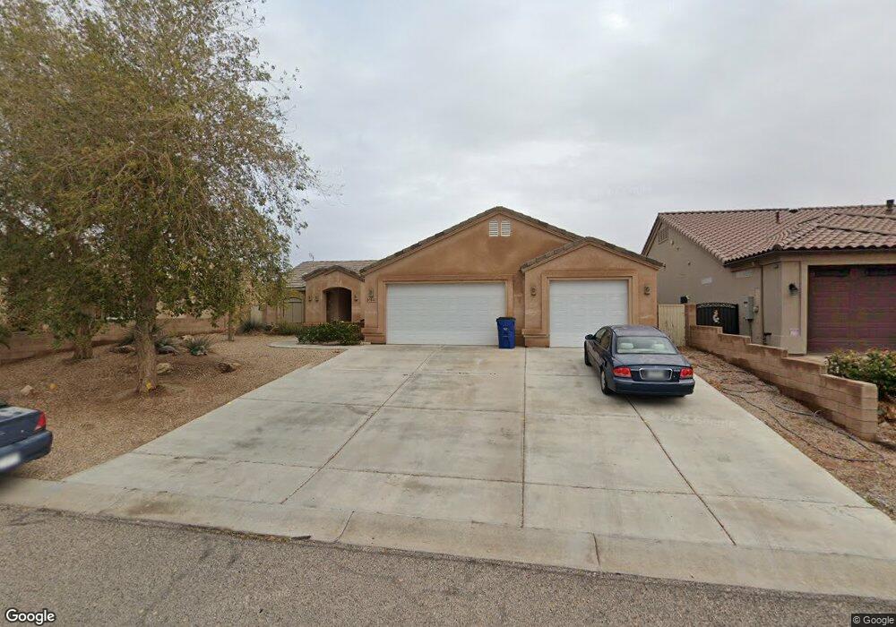
6164 S Kodiak E Fort Mohave, AR 86426
Estimated Value: $395,000 - $412,000
3
Beds
2
Baths
1,730
Sq Ft
$234/Sq Ft
Est. Value
About This Home
This home is located at 6164 S Kodiak E, Fort Mohave, AR 86426 and is currently estimated at $404,122, approximately $233 per square foot. 6164 S Kodiak E is a home located in Mohave County with nearby schools including Fort Mohave Elementary School, Mohave Valley Junior High School, and Camp Mohave Elementary School.
Ownership History
Date
Name
Owned For
Owner Type
Purchase Details
Closed on
Jun 7, 2019
Sold by
Pearman Mary M and The Pearman Family Trust
Bought by
Garrison Crystal Yvette
Current Estimated Value
Purchase Details
Closed on
Jan 20, 2006
Sold by
Pearman Robert L and Pearman Mary M
Bought by
Pearman Robert L and Pearman Mary M
Purchase Details
Closed on
May 5, 2005
Sold by
Iler Andy M and Iler Carol I
Bought by
Pearman Robert L and Pearman Mary M
Home Financials for this Owner
Home Financials are based on the most recent Mortgage that was taken out on this home.
Original Mortgage
$100,000
Interest Rate
5.84%
Mortgage Type
New Conventional
Purchase Details
Closed on
Oct 28, 2004
Sold by
Branson Elinor O
Bought by
Iler Andy M and Iler Carol I
Purchase Details
Closed on
Feb 27, 2004
Sold by
Hickey Lawrence W and Hickey Violeta C
Bought by
Branson Elinor O
Create a Home Valuation Report for This Property
The Home Valuation Report is an in-depth analysis detailing your home's value as well as a comparison with similar homes in the area
Home Values in the Area
Average Home Value in this Area
Purchase History
| Date | Buyer | Sale Price | Title Company |
|---|---|---|---|
| Garrison Crystal Yvette | $255,000 | Chicago Title Agency Inc | |
| Pearman Robert L | -- | None Available | |
| Pearman Robert L | $284,000 | Chicago Title Insurance Co | |
| Iler Andy M | $55,000 | Transnation Title Ins Co | |
| Branson Elinor O | $26,900 | Transnation Title Ins Co |
Source: Public Records
Mortgage History
| Date | Status | Borrower | Loan Amount |
|---|---|---|---|
| Previous Owner | Pearman Robert L | $100,000 |
Source: Public Records
Tax History Compared to Growth
Tax History
| Year | Tax Paid | Tax Assessment Tax Assessment Total Assessment is a certain percentage of the fair market value that is determined by local assessors to be the total taxable value of land and additions on the property. | Land | Improvement |
|---|---|---|---|---|
| 2026 | -- | -- | -- | -- |
| 2025 | $1,536 | $27,641 | $0 | $0 |
| 2024 | $1,536 | $32,221 | $0 | $0 |
| 2023 | $1,536 | $26,970 | $0 | $0 |
| 2022 | $1,507 | $21,854 | $0 | $0 |
| 2021 | $1,581 | $20,533 | $0 | $0 |
| 2019 | $1,708 | $17,306 | $0 | $0 |
| 2018 | $1,663 | $17,792 | $0 | $0 |
| 2017 | $1,646 | $17,348 | $0 | $0 |
| 2016 | $1,460 | $14,780 | $0 | $0 |
| 2015 | $1,458 | $13,098 | $0 | $0 |
Source: Public Records
Map
Nearby Homes
- 2315 E Pawnee Trail
- 2413 E Nez Perce Rd
- 2303 E Pawnee Trail
- 6062 Greenhorn Dr
- 6068 Greenhorn Dr
- 2365 E Calle Madrid
- 6083 S Greenhorn Dr
- 2424 E Calle Madrid
- 0 Off of S Vanderslice Rd
- Off of S Vanderslice Rd
- 000 Off of S Vanderslice Rd
- 6090 S Bella Vista Dr
- 2385 E Gibraltar Dr
- 0 S Vanderslice Rd
- 6066 S Bella Vista Dr
- 6052 S Bella Vista Dr
- 6101 S Bella Vista Dr
- 6136 S Bella Vista Dr
- 6316 S Via Fortuna
- 2550 E Nez Perce Rd
- 6164 S Kodiak E
- 6172 S Kodiak E
- 6156 S Kodiak E
- 6172 S Kodiak E
- 2376 E Nez Perce
- 2377 E Pawnee Trail
- 2383 E Pawnee Trail
- 2370 E Nez Perce Rd
- Unknown Kodiak E & Nez Perce
- 2370 E Nez Perce Rd
- 000 Nez Perce
- XXXX Kodiak
- Unknown Kodiak E & Pawnee Trail
- 2391 E Pawnee Trail
- 6180 S Kodiak E
- 2351 E Pawnee Trail
- 2378 E Nez Perce Rd
- 2378 E Pawnee Trail
- 2399 E Pawnee Trail
- 2378 E Pawnee Trail