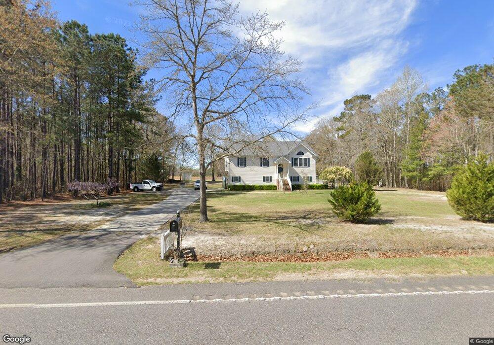
6165 Highway 19 Conway, SC 29526
Estimated Value: $350,000 - $468,000
3
Beds
3
Baths
2,160
Sq Ft
$194/Sq Ft
Est. Value
About This Home
This home is located at 6165 Highway 19, Conway, SC 29526 and is currently estimated at $419,469, approximately $194 per square foot. 6165 Highway 19 is a home located in Horry County with nearby schools including Loris Elementary School, Loris Middle School, and Loris High School.
Ownership History
Date
Name
Owned For
Owner Type
Purchase Details
Closed on
Aug 23, 2023
Sold by
Doyle Dallas L
Bought by
Gillis Rickey and Gillis Tasha Leeann
Current Estimated Value
Home Financials for this Owner
Home Financials are based on the most recent Mortgage that was taken out on this home.
Original Mortgage
$320,000
Outstanding Balance
$312,395
Interest Rate
6.81%
Mortgage Type
New Conventional
Estimated Equity
$107,074
Purchase Details
Closed on
Feb 12, 2010
Sold by
Keller Jennifer
Bought by
Doyle Dallas L
Purchase Details
Closed on
Dec 5, 2009
Sold by
Fucarino Beverly Jane
Bought by
Keller Jennifer
Purchase Details
Closed on
Apr 9, 2007
Sold by
Orten Philip A and Fucarino Beverly
Bought by
Fucarino Beverly J
Create a Home Valuation Report for This Property
The Home Valuation Report is an in-depth analysis detailing your home's value as well as a comparison with similar homes in the area
Home Values in the Area
Average Home Value in this Area
Purchase History
| Date | Buyer | Sale Price | Title Company |
|---|---|---|---|
| Gillis Rickey | $400,000 | -- | |
| Doyle Dallas L | $200,000 | -- | |
| Keller Jennifer | -- | -- | |
| Fucarino Beverly J | -- | None Available |
Source: Public Records
Mortgage History
| Date | Status | Borrower | Loan Amount |
|---|---|---|---|
| Open | Gillis Rickey | $320,000 |
Source: Public Records
Tax History Compared to Growth
Tax History
| Year | Tax Paid | Tax Assessment Tax Assessment Total Assessment is a certain percentage of the fair market value that is determined by local assessors to be the total taxable value of land and additions on the property. | Land | Improvement |
|---|---|---|---|---|
| 2024 | $1,623 | $16,097 | $3,504 | $12,593 |
| 2023 | $1,569 | $9,889 | $753 | $9,136 |
| 2021 | $1,025 | $29,670 | $2,002 | $27,668 |
| 2020 | $905 | $29,670 | $2,002 | $27,668 |
| 2019 | $905 | $29,670 | $2,002 | $27,668 |
| 2018 | $815 | $22,574 | $1,742 | $20,832 |
| 2017 | $800 | $21,496 | $664 | $20,832 |
| 2016 | -- | $21,496 | $664 | $20,832 |
| 2015 | $800 | $8,600 | $664 | $7,936 |
| 2014 | $738 | $8,600 | $664 | $7,936 |
Source: Public Records
Map
Nearby Homes
- TBD Cane Branch Rd
- TBD Bluebird Rd
- 1904 Blue Bird Rd
- 1715 Cane Branch Rd
- 2498 Rhonda Ct
- TBB44 Privetts Rd
- TBD22 Privetts Rd
- TBD 58 Privetts Rd
- 1-A Mack Rd
- 2846 New Home Cir
- 6220 Highway 65
- TBD 1 Winterberry Ct
- TBD 7 Winterberry Ct
- 1530 Tobacco Rd
- 160 Joey Ln
- 2520 Southern Dr
- 2506 Southern Dr
- TBD Dows Rd
- 8 Privetts Rd
- 300 Clio Rd
- 6160 E Highway 19
- Highway 19
- 5925 Westmoreland Rd
- 6180 E Highway 19
- 5926 Westmoreland Rd
- 5938 Westmoreland Rd
- 6228 E Highway 19
- 6228 E Highway 19 Unit Highway 19
- 5688 Westmoreland Rd
- 6062 E Highway 19
- 5854 Westmoreland Rd
- 6052 E Highway 19
- 4031 Long Farm Rd
- 5814 Westmoreland Rd
- 5797 Westmoreland Rd
- 4032 Long Farm Rd
- 5745 Westmoreland Rd
- 5940 E Highway 19
- 4058 Long Farm Rd
- TBD Lot 7 E Highway 19