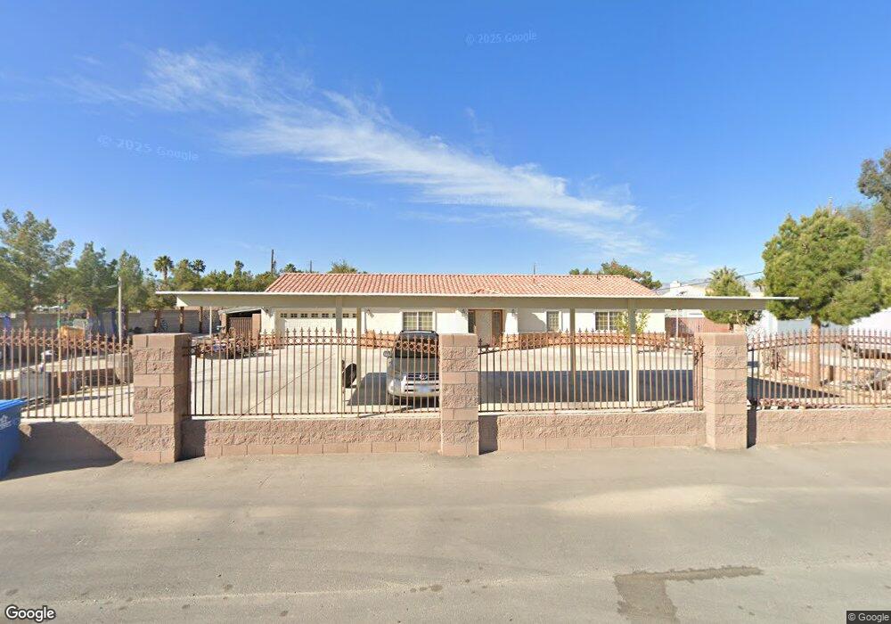
6165 Westwind Rd Las Vegas, NV 89118
Estimated Value: $691,207 - $793,000
4
Beds
3
Baths
2,207
Sq Ft
$341/Sq Ft
Est. Value
About This Home
This home is located at 6165 Westwind Rd, Las Vegas, NV 89118 and is currently estimated at $753,052, approximately $341 per square foot. 6165 Westwind Rd is a home located in Clark County with nearby schools including Helen Jydstrup Elementary School, Grant Sawyer Middle School, and Durango High School.
Ownership History
Date
Name
Owned For
Owner Type
Purchase Details
Closed on
Nov 26, 2003
Sold by
Banales Joe and Banales Yolanda
Bought by
Chen You Chun and Moa Magala
Current Estimated Value
Home Financials for this Owner
Home Financials are based on the most recent Mortgage that was taken out on this home.
Original Mortgage
$220,000
Outstanding Balance
$103,082
Interest Rate
6.04%
Mortgage Type
Unknown
Estimated Equity
$649,970
Purchase Details
Closed on
Aug 15, 2000
Sold by
Banales Yolanda
Bought by
Banales Joseph
Home Financials for this Owner
Home Financials are based on the most recent Mortgage that was taken out on this home.
Original Mortgage
$75,000
Interest Rate
8.16%
Create a Home Valuation Report for This Property
The Home Valuation Report is an in-depth analysis detailing your home's value as well as a comparison with similar homes in the area
Home Values in the Area
Average Home Value in this Area
Purchase History
| Date | Buyer | Sale Price | Title Company |
|---|---|---|---|
| Chen You Chun | $325,000 | Old Republic Title Co Of Ne | |
| Banales Joseph | -- | Nevada Title Company |
Source: Public Records
Mortgage History
| Date | Status | Borrower | Loan Amount |
|---|---|---|---|
| Open | Chen You Chun | $220,000 | |
| Previous Owner | Banales Joseph | $75,000 |
Source: Public Records
Tax History Compared to Growth
Tax History
| Year | Tax Paid | Tax Assessment Tax Assessment Total Assessment is a certain percentage of the fair market value that is determined by local assessors to be the total taxable value of land and additions on the property. | Land | Improvement |
|---|---|---|---|---|
| 2025 | $2,811 | $162,794 | $113,750 | $49,044 |
| 2024 | $2,730 | $162,794 | $113,750 | $49,044 |
| 2023 | $2,730 | $145,371 | $96,250 | $49,121 |
| 2022 | $2,651 | $122,987 | $77,000 | $45,987 |
| 2021 | $2,573 | $115,088 | $70,000 | $45,088 |
| 2020 | $2,495 | $115,790 | $70,000 | $45,790 |
| 2019 | $2,423 | $107,281 | $61,250 | $46,031 |
| 2018 | $2,352 | $101,456 | $56,000 | $45,456 |
| 2017 | $2,917 | $99,450 | $52,500 | $46,950 |
| 2016 | $2,228 | $88,585 | $40,250 | $48,335 |
| 2015 | $2,223 | $80,042 | $31,500 | $48,542 |
| 2014 | $2,154 | $72,493 | $24,500 | $47,993 |
Source: Public Records
Map
Nearby Homes
- 5829 W Patrick Ln
- 0 W Patrick Ln Unit 2675444
- 0 W Patrick Ln Unit 2718906
- 5880 W Post Rd
- 0 S Lindell Rd
- 6315 Bellisima St
- 5875 W Post Rd
- 0 Woodstock
- 5801 Exbury Gardens Ct
- 5332 Avory Peak Ct
- 5990 Viscaya Grove St
- 0 Unit 2701179
- 5910 W Post Rd
- 5790 Westwind Rd
- 0 Mohawk St Unit 2675414
- 6210 W Quail Ave
- 5354 Silver Branch Ave
- 5645 Warm Light St
- 5607 W Dewey Dr
- 6053 Conroe Ct
- 5815 W Patrick Ln
- 5760 Sobb Ave
- 6184 Westwind Rd
- 5843 W Patrick Ln
- 5801 W Patrick Ln
- 5595 Bisset Ave
- 5780 Sobb Ave
- 5685 Sobb Ave
- 6125 Spielburg St
- 6220 Westwind Rd
- 5575 Bisset Ave
- 5745 Sobb Ave
- 6235 Westwind Rd
- 5775 Sobb Ave
- 5570 Bisset Ave
- 5801 Sobb Ave
- 0 Sobb Ave
- 00 Sobb Ave
- 5540 Sobb Ave
- 5893 W Patrick Ln