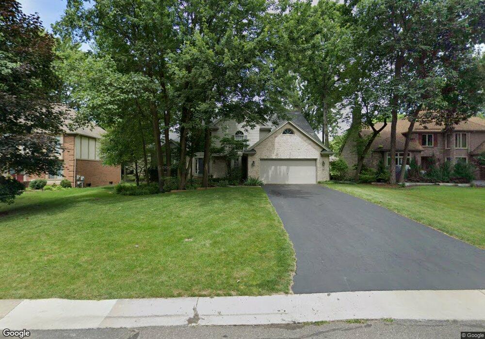
6166 Mission Dr Unit Bldg-Unit West Bloomfield, MI 48324
Estimated Value: $540,273 - $603,000
3
Beds
4
Baths
2,933
Sq Ft
$195/Sq Ft
Est. Value
About This Home
This home is located at 6166 Mission Dr Unit Bldg-Unit, West Bloomfield, MI 48324 and is currently estimated at $572,318, approximately $195 per square foot. 6166 Mission Dr Unit Bldg-Unit is a home located in Oakland County with nearby schools including Waterford Montessori Academy, Our Lady Of Refuge School, and Lakecrest Baptist School.
Ownership History
Date
Name
Owned For
Owner Type
Purchase Details
Closed on
Jun 17, 2024
Sold by
Turett Ronald and Turett Alice
Bought by
Feldman Parker J
Current Estimated Value
Home Financials for this Owner
Home Financials are based on the most recent Mortgage that was taken out on this home.
Original Mortgage
$505,400
Outstanding Balance
$498,950
Interest Rate
7.02%
Mortgage Type
New Conventional
Estimated Equity
$73,368
Purchase Details
Closed on
Feb 11, 2000
Sold by
Spray Michael A
Bought by
Turett Ronald
Home Financials for this Owner
Home Financials are based on the most recent Mortgage that was taken out on this home.
Original Mortgage
$231,650
Interest Rate
8.27%
Purchase Details
Closed on
Jun 23, 1997
Sold by
Grubb Eric L
Bought by
Spray Michael A
Create a Home Valuation Report for This Property
The Home Valuation Report is an in-depth analysis detailing your home's value as well as a comparison with similar homes in the area
Home Values in the Area
Average Home Value in this Area
Purchase History
| Date | Buyer | Sale Price | Title Company |
|---|---|---|---|
| Feldman Parker J | $532,000 | First American Title | |
| Feldman Parker J | $532,000 | First American Title | |
| Feldman Parker J | $532,000 | First American Title | |
| Turett Ronald | $351,000 | -- | |
| Spray Michael A | $277,500 | -- |
Source: Public Records
Mortgage History
| Date | Status | Borrower | Loan Amount |
|---|---|---|---|
| Open | Feldman Parker J | $505,400 | |
| Closed | Feldman Parker J | $505,400 | |
| Previous Owner | Turett Ronald | $231,650 |
Source: Public Records
Tax History Compared to Growth
Tax History
| Year | Tax Paid | Tax Assessment Tax Assessment Total Assessment is a certain percentage of the fair market value that is determined by local assessors to be the total taxable value of land and additions on the property. | Land | Improvement |
|---|---|---|---|---|
| 2024 | $3,732 | $235,630 | $0 | $0 |
| 2022 | $3,573 | $190,450 | $15,900 | $174,550 |
| 2021 | $5,458 | $176,810 | $0 | $0 |
| 2020 | $3,502 | $175,670 | $15,900 | $159,770 |
| 2018 | $4,869 | $164,900 | $15,900 | $149,000 |
| 2015 | -- | $140,850 | $0 | $0 |
| 2014 | -- | $126,060 | $0 | $0 |
| 2011 | -- | $109,590 | $0 | $0 |
Source: Public Records
Map
Nearby Homes
- 6034 Beachwood Dr
- 6057 Beachwood Dr
- 2112 Keylon Dr
- Lot 94 Hiller Rd
- 2140 Timberridge Ct
- 1992 Swaranne Dr
- 1985 Christopher Ct
- 6289 Lindsay Ct
- 5699 Applegrove Dr
- 6620 Red Cedar Ln Unit 37
- 2501 Doleman Dr
- 1811 Henbert Rd
- 6726 Red Cedar Ln
- 1837 Henbert Rd
- 2110 Peachtree Ct
- 1844 Poppleton Dr
- 1859 Poppleton Dr
- 2236 Locklin Ln
- 1753 Dawncrest Dr
- 5809 Hartwick Dr
- 6166 Mission Dr
- 6154 Mission Dr
- 6178 Mission Dr
- 6189 Kiev St
- 6171 Kiev St
- 6142 Mission Dr
- 6207 Kiev St
- 6167 Mission Dr
- 6155 Mission Dr
- 6143 Mission Dr
- 6179 Mission Dr
- 6130 Mission Dr
- 6191 Mission Dr
- 6135 Kiev St
- 6131 Mission Dr
- 6202 Mission Dr
- 6118 Mission Dr
- 6243 Kiev St
- 6203 Mission Dr
- 6194 Kiev St