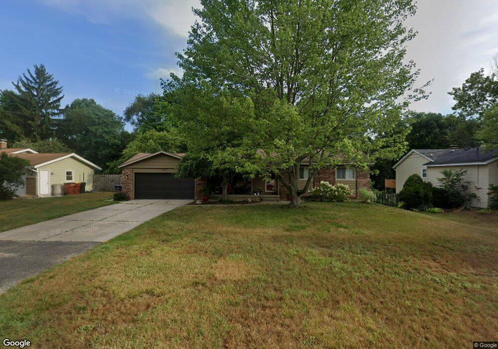
6167 Del Cano Dr SE Grand Rapids, MI 49546
Forest Hills NeighborhoodEstimated Value: $366,000 - $373,000
4
Beds
2
Baths
1
Sq Ft
$370,056/Sq Ft
Est. Value
About This Home
This home is located at 6167 Del Cano Dr SE, Grand Rapids, MI 49546 and is currently estimated at $370,056, approximately $370,056 per square foot. 6167 Del Cano Dr SE is a home located in Kent County with nearby schools including Thornapple Elementary School, Central Woodlands 5/6 School, and Central Middle School.
Ownership History
Date
Name
Owned For
Owner Type
Purchase Details
Closed on
Aug 17, 2020
Sold by
Spratke Brian L and Spratke Rebecca L
Bought by
Spratke Brain D and Spratke Rebecca L
Current Estimated Value
Home Financials for this Owner
Home Financials are based on the most recent Mortgage that was taken out on this home.
Original Mortgage
$71,000
Outstanding Balance
$50,302
Interest Rate
2.9%
Mortgage Type
New Conventional
Estimated Equity
$319,754
Purchase Details
Closed on
May 30, 2020
Sold by
Spratke Brian D and Spratke Rebecca L
Bought by
Spratke Brian D and Spratke Rebecca L
Purchase Details
Closed on
Mar 31, 2000
Sold by
Surman Jeffrey J
Bought by
Spratke Brian and Spratke Brian
Purchase Details
Closed on
Aug 30, 1993
Bought by
Surman Jeffrey J and Spratke Brian
Create a Home Valuation Report for This Property
The Home Valuation Report is an in-depth analysis detailing your home's value as well as a comparison with similar homes in the area
Home Values in the Area
Average Home Value in this Area
Purchase History
| Date | Buyer | Sale Price | Title Company |
|---|---|---|---|
| Spratke Brain D | -- | None Listed On Document | |
| Spratke Brian D | -- | None Available | |
| Spratke Brian D | -- | None Available | |
| Spratke Brian | $149,900 | -- | |
| Surman Jeffrey J | $121,300 | -- |
Source: Public Records
Mortgage History
| Date | Status | Borrower | Loan Amount |
|---|---|---|---|
| Open | Spratke Brian D | $71,000 |
Source: Public Records
Tax History Compared to Growth
Tax History
| Year | Tax Paid | Tax Assessment Tax Assessment Total Assessment is a certain percentage of the fair market value that is determined by local assessors to be the total taxable value of land and additions on the property. | Land | Improvement |
|---|---|---|---|---|
| 2025 | $1,981 | $165,000 | $0 | $0 |
| 2024 | $1,981 | $156,700 | $0 | $0 |
| 2023 | $2,788 | $141,700 | $0 | $0 |
| 2022 | $2,698 | $120,300 | $0 | $0 |
| 2021 | $2,633 | $116,300 | $0 | $0 |
| 2020 | $1,768 | $106,500 | $0 | $0 |
| 2019 | $2,616 | $99,200 | $0 | $0 |
| 2018 | $2,582 | $98,100 | $0 | $0 |
| 2017 | $2,571 | $88,100 | $0 | $0 |
| 2016 | $2,510 | $85,400 | $0 | $0 |
| 2015 | -- | $85,400 | $0 | $0 |
| 2013 | -- | $74,500 | $0 | $0 |
Source: Public Records
Map
Nearby Homes
- 2474 San Marie Dr SE
- 6236 Pinta Ct SE
- 2341 Cascade Pointe Ct SE
- 2570 Knightsbridge Rd SE Unit 63
- 6562 Glaston Ct SE Unit 11
- 2657 Chatham Woods Dr SE Unit 21
- 2630 Chatham Woods Dr SE Unit 1
- 6716 Cascade Rd SE Unit 43
- 2984 Chapshire Dr SE Unit 59
- 6657 Waybridge Dr SE
- 6663 Waybridge Dr SE Unit 37
- 1835 Linson Ct SE
- 6761 Burton St SE
- 6352 Greenway Dr SE Unit 61
- 6348 Greenway Dr SE Unit 62
- 3750 Charlevoix Dr SE
- 6569 Round Hill Ct SE
- 2968 Overlook Summit Dr
- 3140 Thornapple River Dr SE
- 1878 Watermark Dr SE
- 6177 Del Cano Dr SE
- 6159 Del Cano Dr SE
- 6151 Del Cano Dr SE
- 6146 Burton St SE
- 2449 San Marie Dr SE
- 6140 Burton St SE
- 2433 San Marie Dr SE
- 6170 Del Cano Dr SE
- 6154 Burton St SE
- 6160 Del Cano Dr SE
- 6178 Del Cano Dr SE
- 6126 Burton St SE
- 6143 Del Cano Dr SE
- 6154 Del Cano Dr SE
- 2415 San Marie Dr SE
- 6110 Burton St SE
- 6135 Del Cano Dr SE
- 6047 Del Cano Dr SE
- 6185 Capitan Dr SE
- 6195 Capitan Dr SE