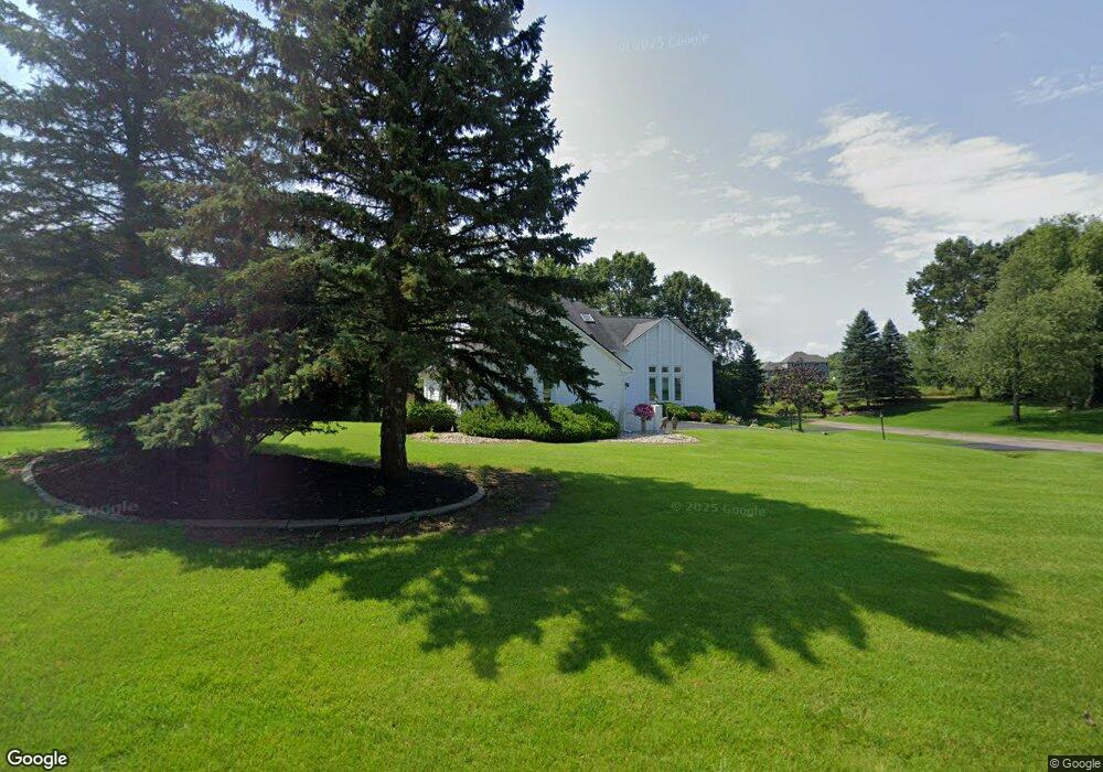
6168 Sprader Dr White Lake, MI 48383
Estimated Value: $551,000 - $670,000
3
Beds
4
Baths
2,453
Sq Ft
$243/Sq Ft
Est. Value
About This Home
This home is located at 6168 Sprader Dr, White Lake, MI 48383 and is currently estimated at $595,433, approximately $242 per square foot. 6168 Sprader Dr is a home located in Oakland County with nearby schools including St. Patrick School.
Ownership History
Date
Name
Owned For
Owner Type
Purchase Details
Closed on
Sep 27, 1995
Sold by
Sprader Robert C
Bought by
Sprader Building Co Inc
Current Estimated Value
Home Financials for this Owner
Home Financials are based on the most recent Mortgage that was taken out on this home.
Original Mortgage
$100,000
Outstanding Balance
$702
Interest Rate
7.61%
Estimated Equity
$594,731
Purchase Details
Closed on
Mar 10, 1995
Sold by
Innovative Land Dev Inc
Bought by
Sprader Robert C
Create a Home Valuation Report for This Property
The Home Valuation Report is an in-depth analysis detailing your home's value as well as a comparison with similar homes in the area
Home Values in the Area
Average Home Value in this Area
Purchase History
| Date | Buyer | Sale Price | Title Company |
|---|---|---|---|
| Sprader Building Co Inc | -- | -- | |
| Sprader Robert C | $40,900 | -- |
Source: Public Records
Mortgage History
| Date | Status | Borrower | Loan Amount |
|---|---|---|---|
| Open | Sprader Building Co Inc | $100,000 |
Source: Public Records
Tax History Compared to Growth
Tax History
| Year | Tax Paid | Tax Assessment Tax Assessment Total Assessment is a certain percentage of the fair market value that is determined by local assessors to be the total taxable value of land and additions on the property. | Land | Improvement |
|---|---|---|---|---|
| 2024 | $3,313 | $250,350 | $0 | $0 |
| 2023 | $3,160 | $218,670 | $0 | $0 |
| 2022 | $4,821 | $210,270 | $0 | $0 |
| 2021 | $4,507 | $195,360 | $0 | $0 |
| 2020 | $2,832 | $190,280 | $0 | $0 |
| 2019 | $4,298 | $187,290 | $0 | $0 |
| 2018 | $4,202 | $185,330 | $0 | $0 |
| 2017 | $4,051 | $185,330 | $0 | $0 |
| 2016 | $4,043 | $176,660 | $0 | $0 |
| 2015 | -- | $152,190 | $0 | $0 |
| 2014 | -- | $136,180 | $0 | $0 |
| 2011 | -- | $116,270 | $0 | $0 |
Source: Public Records
Map
Nearby Homes
- 6060 Rosewood Pkwy
- 6095 Whispering Meadows Dr Unit 66
- 969 Bogie Lake Rd
- 590 Bogie Lake Rd
- 880 Artdale Dr
- 6404 Pennington Dr Unit 6
- 5371 Tamarac Ln Unit 298
- 7135 Capri Dr
- 322 Laurent Ln Unit 219
- 1081 Pawgrove Ct
- 6157 High Valley Dr
- 6097 High Valley Dr
- 111 Highland Rd
- 2282 Sandlewood Dr Unit 26
- 000 Highland Rd
- 2403 Sandlewood Dr
- 685 Sunset
- 890 Beachway Dr
- 905 Nordic Dr
- 909 Nordic Dr
- 6180 Rosewood Pkwy
- 6160 Rosewood Pkwy
- 6190 Rosewood Pkwy
- 6173 Rosewood Pkwy
- 6183 Rosewood Pkwy Unit 130
- 6163 Rosewood Pkwy
- 6150 Rosewood Pkwy
- 6200 Rosewood Pkwy
- 6193 Rosewood Pkwy Unit 131
- 6153 Rosewood Pkwy
- 6143 Rosewood Pkwy
- 6203 Rosewood Pkwy
- 6130 Rosewood Pkwy Unit 44
- 6133 Rosewood Pkwy
- 1040 Weber Ct Unit 91
- 931 Kyle Ct
- 936 Kyle Ct
- 6120 Rosewood Pkwy
- 1030 Weber Ct
- 1039 Weber Ct