Estimated Value: $797,000 - $906,036
4
Beds
3
Baths
2,289
Sq Ft
$377/Sq Ft
Est. Value
About This Home
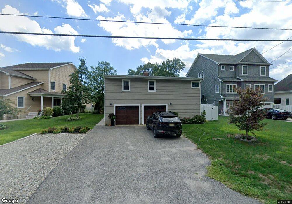
This home is located at 617 Carroll Fox Rd, Brick, NJ 08724 and is currently estimated at $864,009, approximately $377 per square foot. 617 Carroll Fox Rd is a home located in Ocean County with nearby schools including Midstreams Elementary School, Veterans Memorial Middle School, and Brick Township Memorial High School.
Ownership History
Date
Name
Owned For
Owner Type
Purchase Details
Closed on
Oct 18, 2000
Sold by
Davies Eric
Bought by
Donnelly Patrick and Donnelly Deanna
Current Estimated Value
Home Financials for this Owner
Home Financials are based on the most recent Mortgage that was taken out on this home.
Original Mortgage
$246,000
Outstanding Balance
$89,136
Interest Rate
7.83%
Estimated Equity
$774,873
Create a Home Valuation Report for This Property
The Home Valuation Report is an in-depth analysis detailing your home's value as well as a comparison with similar homes in the area
Home Values in the Area
Average Home Value in this Area
Purchase History
| Date | Buyer | Sale Price | Title Company |
|---|---|---|---|
| Donnelly Patrick | $289,900 | -- | |
| Donnelly Patrick | $289,900 | -- |
Source: Public Records
Mortgage History
| Date | Status | Borrower | Loan Amount |
|---|---|---|---|
| Open | Donnelly Patrick | $246,000 | |
| Closed | Donnelly Patrick | $246,000 |
Source: Public Records
Tax History Compared to Growth
Tax History
| Year | Tax Paid | Tax Assessment Tax Assessment Total Assessment is a certain percentage of the fair market value that is determined by local assessors to be the total taxable value of land and additions on the property. | Land | Improvement |
|---|---|---|---|---|
| 2025 | $12,066 | $462,300 | $266,200 | $196,100 |
| 2024 | $11,451 | $462,300 | $266,200 | $196,100 |
| 2023 | $11,285 | $462,300 | $266,200 | $196,100 |
| 2022 | $11,285 | $462,300 | $266,200 | $196,100 |
| 2021 | $11,049 | $462,300 | $266,200 | $196,100 |
| 2020 | $10,906 | $462,300 | $266,200 | $196,100 |
| 2019 | $10,711 | $462,300 | $266,200 | $196,100 |
| 2018 | $10,466 | $462,300 | $266,200 | $196,100 |
| 2017 | $10,184 | $462,300 | $266,200 | $196,100 |
| 2016 | $10,129 | $462,300 | $266,200 | $196,100 |
| 2015 | $9,865 | $462,300 | $266,200 | $196,100 |
| 2014 | $9,736 | $460,100 | $266,200 | $193,900 |
Source: Public Records
Map
Nearby Homes
- 665 Bancroft Rd
- 546 Princeton Ave
- 598 Robinhood Rd
- 680 Carroll Fox Rd
- 502 Princeton Ave
- 599 Point Ave
- 612 Harbor Rd
- 117 Joie Place
- 80 Jordan Rd
- 648 Point Ave
- 125 Northeast Dr
- 173 Cliff Rd
- 1615 Calamus Place
- 2510 Sylvan Dr
- 1608 Osprey Ct
- 205 Marlin Ct
- 701 Princeton Ave
- 1549 Littlehill Rd
- 1517 Dock Place
- 1538 Northstream Pkwy
- 619 Bancroft Rd
- 615 Carroll Fox Rd
- 621 Bancroft Rd
- 609 Carroll Fox Rd
- 623 Bancroft Rd
- 614 Carroll Fox Rd
- 618 Carroll Fox Rd
- 610 Carroll Fox Rd
- 607 Carroll Fox Rd
- 625 Bancroft Rd
- 624 Carroll Fox Rd
- 600 Carroll Fox Rd
- 605 Carroll Fox Rd
- 617 Thoroughfare Rd
- 615 Thoroughfare Rd
- 621 Thoroughfare Rd
- 611 Thoroughfare Rd
- 629 Bancroft Rd
- 625 Thoroughfare Rd
- 628 Carroll Fox Rd