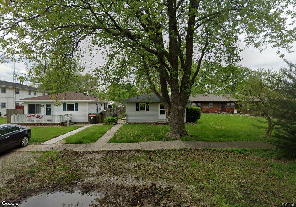
617 Denver St Lincoln, IL 62656
Estimated Value: $107,000 - $133,000
--
Bed
--
Bath
1,200
Sq Ft
$96/Sq Ft
Est. Value
About This Home
This home is located at 617 Denver St, Lincoln, IL 62656 and is currently estimated at $115,101, approximately $95 per square foot. 617 Denver St is a home located in Logan County with nearby schools including Washington-Monroe Elementary School, Adams Elementary School, and Lincoln Junior High School.
Ownership History
Date
Name
Owned For
Owner Type
Purchase Details
Closed on
Jun 27, 2014
Sold by
Gibbens Freda J
Bought by
Hernandez Timothy J
Current Estimated Value
Home Financials for this Owner
Home Financials are based on the most recent Mortgage that was taken out on this home.
Original Mortgage
$62,919
Outstanding Balance
$48,318
Interest Rate
4.38%
Mortgage Type
New Conventional
Estimated Equity
$66,783
Create a Home Valuation Report for This Property
The Home Valuation Report is an in-depth analysis detailing your home's value as well as a comparison with similar homes in the area
Home Values in the Area
Average Home Value in this Area
Purchase History
| Date | Buyer | Sale Price | Title Company |
|---|---|---|---|
| Hernandez Timothy J | $63,500 | -- |
Source: Public Records
Mortgage History
| Date | Status | Borrower | Loan Amount |
|---|---|---|---|
| Open | Hernandez Timothy J | $62,919 |
Source: Public Records
Tax History Compared to Growth
Tax History
| Year | Tax Paid | Tax Assessment Tax Assessment Total Assessment is a certain percentage of the fair market value that is determined by local assessors to be the total taxable value of land and additions on the property. | Land | Improvement |
|---|---|---|---|---|
| 2024 | $2,211 | $30,120 | $3,820 | $26,300 |
| 2023 | $2,070 | $27,890 | $3,540 | $24,350 |
| 2022 | $1,981 | $26,070 | $3,310 | $22,760 |
| 2021 | $1,884 | $25,030 | $3,180 | $21,850 |
| 2020 | $1,851 | $24,660 | $3,130 | $21,530 |
| 2019 | $1,801 | $24,180 | $3,070 | $21,110 |
| 2018 | $1,776 | $23,710 | $3,010 | $20,700 |
| 2017 | $1,765 | $23,710 | $3,010 | $20,700 |
| 2016 | $1,719 | $23,690 | $3,010 | $20,680 |
| 2015 | $1,682 | $23,410 | $2,910 | $20,500 |
| 2014 | $1,682 | $23,410 | $2,910 | $20,500 |
| 2013 | $1,682 | $22,220 | $2,760 | $19,460 |
| 2012 | $1,682 | $22,620 | $2,810 | $19,810 |
Source: Public Records
Map
Nearby Homes
- 1019 N Mclean St
- 1208 N Kankakee St
- 145 Half Moon St
- 180 Regent St
- 1503 N Kankakee St
- 311 Davenport St
- 1107 N Kankakee St
- 1204 N Ottawa St
- 1431 N Ottawa St
- 102 Crestwood Dr
- 103 Crestwood Dr
- 915 Peoria St
- 620 Tremont St
- 6 Meadow Ln
- 1624 Delavan St
- 1225 Delavan St
- 1227 Delavan St
- 330 Water St
- 1354 Airport Rd
- 113 N Kickapoo St
- 611 Denver St Unit A
- 617 Denver Ave
- 621 Denver St
- 621 Denver Ave
- 609 Denver St
- 609 Denver St Unit B
- 1317 N Hamilton St
- 604 Denver Ave
- 604 Denver St
- 614 Omaha Ave
- 618 Denver Ave
- 1309 N Hamilton St
- 1310 N Mclean St
- 618 Denver St
- 610 Omaha Ave
- 624 Omaha Ave
- 1402 N Mclean St
- 1406 N Mclean St
- 628 Omaha Ave
- 1314 N Hamilton St