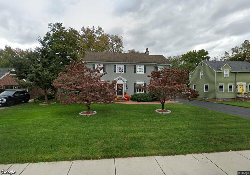
617 Grove St Haddonfield, NJ 08033
Estimated Value: $791,000 - $1,035,000
Studio
--
Bath
2,404
Sq Ft
$370/Sq Ft
Est. Value
About This Home
This home is located at 617 Grove St, Haddonfield, NJ 08033 and is currently estimated at $888,935, approximately $369 per square foot. 617 Grove St is a home located in Camden County with nearby schools including Haddonfield Memorial High School, Christ the King Regional School, and Haddonfield Friends School.
Ownership History
Date
Name
Owned For
Owner Type
Purchase Details
Closed on
Jan 16, 2001
Sold by
Household Finance Corp Iii
Bought by
Schmid Daniel J
Current Estimated Value
Home Financials for this Owner
Home Financials are based on the most recent Mortgage that was taken out on this home.
Original Mortgage
$135,000
Interest Rate
7.15%
Create a Home Valuation Report for This Property
The Home Valuation Report is an in-depth analysis detailing your home's value as well as a comparison with similar homes in the area
Home Values in the Area
Average Home Value in this Area
Purchase History
| Date | Buyer | Sale Price | Title Company |
|---|---|---|---|
| Schmid Daniel J | $220,000 | -- |
Source: Public Records
Mortgage History
| Date | Status | Borrower | Loan Amount |
|---|---|---|---|
| Previous Owner | Schmid Daniel J | $135,000 |
Source: Public Records
Tax History
| Year | Tax Paid | Tax Assessment Tax Assessment Total Assessment is a certain percentage of the fair market value that is determined by local assessors to be the total taxable value of land and additions on the property. | Land | Improvement |
|---|---|---|---|---|
| 2025 | $12,601 | $390,000 | $232,500 | $157,500 |
| 2024 | $12,433 | $390,000 | $232,500 | $157,500 |
| 2023 | $12,433 | $390,000 | $232,500 | $157,500 |
| 2022 | $12,336 | $390,000 | $232,500 | $157,500 |
| 2021 | $12,023 | $390,000 | $232,500 | $157,500 |
| 2020 | $12,188 | $390,000 | $232,500 | $157,500 |
| 2019 | $12,090 | $390,000 | $232,500 | $157,500 |
| 2018 | $11,946 | $390,000 | $232,500 | $157,500 |
| 2017 | $11,661 | $390,000 | $232,500 | $157,500 |
| 2016 | $11,400 | $390,000 | $232,500 | $157,500 |
| 2015 | $11,084 | $390,000 | $232,500 | $157,500 |
| 2014 | $10,838 | $390,000 | $232,500 | $157,500 |
Source: Public Records
Map
Nearby Homes
- 612 Grove St
- 633 S Edge Park Dr
- 318 Ardmore Ave
- 801 Cedar Ave
- 840 Cedar Ave
- 615 Pardee Ln
- 156 Ardmore Ave
- 139 Rhoads Ave
- 105 Denver Ave
- 1602 Park Blvd
- 102 A Cherry Parke
- 405 E Melrose Ave
- 123 Hawthorne Ave
- 286-288 Lake St
- 514 N Haddonfield Cmns Ave
- 209 Haddonfield Commons
- 237 Virginia Ave
- 128 E Cherry Parke
- 504 Park Place Dr
- 1405 Farrell Ave Unit 138
- 623 Grove St
- 611 Grove St
- 619 Maple Ave
- 601 Maple Ave
- 304 Beechwood Ave
- 629 Grove St
- 629 Grove St Unit A
- 629 Grove St Unit B
- 621 Maple Ave
- 308 Beechwood Ave
- 623 Maple Ave
- 606 Grove St
- 610 Grove St
- 604 Grove St
- 610 Maple Ave
- 635 Maple Ave
- 322 Beechwood Ave
- 600 Maple Ave
- 600 Grove St Unit 1
- 600 Grove St Unit 2
Your Personal Tour Guide
Ask me questions while you tour the home.