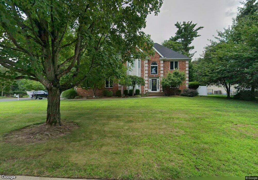
617 Haring Farm Ct Westwood, NJ 07675
Estimated Value: $1,283,000 - $1,558,000
--
Bed
--
Bath
3,617
Sq Ft
$393/Sq Ft
Est. Value
About This Home
This home is located at 617 Haring Farm Ct, Westwood, NJ 07675 and is currently estimated at $1,422,483, approximately $393 per square foot. 617 Haring Farm Ct is a home located in Bergen County with nearby schools including Pascack Valley High School.
Ownership History
Date
Name
Owned For
Owner Type
Purchase Details
Closed on
Jun 30, 2011
Sold by
Demoraes Sergio and Demoraes Anna Cruz
Bought by
Evans Craig B and Evans Jennifer
Current Estimated Value
Home Financials for this Owner
Home Financials are based on the most recent Mortgage that was taken out on this home.
Original Mortgage
$729,750
Outstanding Balance
$501,572
Interest Rate
4.49%
Mortgage Type
Unknown
Estimated Equity
$920,911
Create a Home Valuation Report for This Property
The Home Valuation Report is an in-depth analysis detailing your home's value as well as a comparison with similar homes in the area
Home Values in the Area
Average Home Value in this Area
Purchase History
| Date | Buyer | Sale Price | Title Company |
|---|---|---|---|
| Evans Craig B | $980,000 | -- |
Source: Public Records
Mortgage History
| Date | Status | Borrower | Loan Amount |
|---|---|---|---|
| Open | Evans Craig B | $729,750 |
Source: Public Records
Tax History Compared to Growth
Tax History
| Year | Tax Paid | Tax Assessment Tax Assessment Total Assessment is a certain percentage of the fair market value that is determined by local assessors to be the total taxable value of land and additions on the property. | Land | Improvement |
|---|---|---|---|---|
| 2025 | $27,485 | $1,006,400 | $437,800 | $568,600 |
| 2024 | $27,314 | $1,006,400 | $437,800 | $568,600 |
| 2023 | $26,619 | $1,006,400 | $437,800 | $568,600 |
| 2022 | $26,619 | $1,006,400 | $437,800 | $568,600 |
| 2021 | $25,995 | $1,006,400 | $437,800 | $568,600 |
| 2020 | $26,297 | $1,006,400 | $437,800 | $568,600 |
| 2019 | $25,693 | $1,006,400 | $437,800 | $568,600 |
| 2018 | $25,412 | $1,006,400 | $437,800 | $568,600 |
| 2017 | $25,039 | $1,006,400 | $437,800 | $568,600 |
| 2016 | $24,325 | $1,006,400 | $437,800 | $568,600 |
| 2015 | $23,630 | $1,006,400 | $437,800 | $568,600 |
| 2014 | $22,865 | $1,006,400 | $437,800 | $568,600 |
Source: Public Records
Map
Nearby Homes
- 562 Baylor Ave
- 25 Muirfield Ln
- 4 Royal Birkdale Ct
- Falkirk II Plan at The Fairways at Edgewood - Carriages Collection
- Falkirk Plan at The Fairways at Edgewood - Carriages Collection
- Balmore Plan at The Fairways at Edgewood - Carriages Collection
- 404 Old Tappan Rd
- 12 Leoson Pkwy
- 2 Royal Birkdale Ln
- 10 Royal Birkdale Ln
- 12 Royal Birkdale Ln
- 560 Barr Ct
- 23 Royal Birkdale Ln
- 23 Muirfield Ln
- 6 Augusta Way
- 8 Augusta Way
- 103 Woodmont Cir
- 99 Woodmont Cir
- 13 Royal Birkdale Ln
- 87 Woodmont Cir
- 609 Haring Farm Ct
- 618 Haring Farm Ct
- 570 Rivervale Rd
- 622 Haring Farm Ct
- 566 Gruman Ct
- 610 Haring Farm Ct
- 574 Gruman Ct
- 601 Haring Farm Ct
- 602 Haring Farm Ct
- 624 Haring Farm Ct
- 557 Gruman Ct
- 633 Haring Farm Ct
- 558 Gruman Ct
- 592 Rivervale Rd
- 562 Rivervale Rd
- 625 Poplar Rd
- 641 Haring Farm Ct
- 611 Poplar Rd
- 575 Rivervale Rd
- 607 Poplar Rd