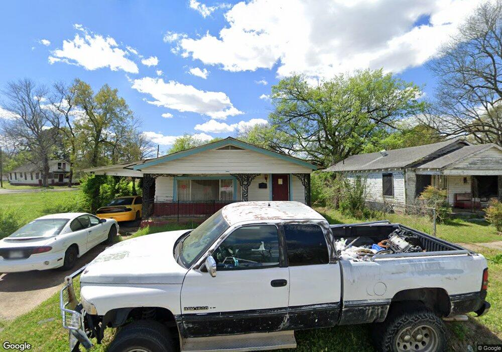
617 Main St Newport, AR 72112
Estimated Value: $49,510 - $109,000
--
Bed
2
Baths
2,268
Sq Ft
$34/Sq Ft
Est. Value
About This Home
This home is located at 617 Main St, Newport, AR 72112 and is currently estimated at $78,128, approximately $34 per square foot. 617 Main St is a home located in Jackson County with nearby schools including Newport Elementary School and Newport High School.
Ownership History
Date
Name
Owned For
Owner Type
Purchase Details
Closed on
Jan 21, 2022
Sold by
Thornsbe Gordon and Thornsbe Evelyn
Bought by
Nelson Tommy
Current Estimated Value
Purchase Details
Closed on
Nov 22, 2021
Sold by
Reyes Robin
Bought by
Thornsberry Evelyn S
Purchase Details
Closed on
Feb 18, 2015
Bought by
Reyes Robin
Purchase Details
Closed on
May 30, 2014
Sold by
Larry F
Bought by
Lewis Roy Lee
Purchase Details
Closed on
May 29, 2014
Sold by
Janice Janice and Anderson Janice T
Bought by
Lewis Roy Lee
Purchase Details
Closed on
Sep 24, 1999
Bought by
Tolerson Dora L and Tolerson Others
Create a Home Valuation Report for This Property
The Home Valuation Report is an in-depth analysis detailing your home's value as well as a comparison with similar homes in the area
Home Values in the Area
Average Home Value in this Area
Purchase History
| Date | Buyer | Sale Price | Title Company |
|---|---|---|---|
| Nelson Tommy | -- | None Listed On Document | |
| Thornsberry Evelyn S | $863 | None Available | |
| Reyes Robin | -- | -- | |
| Lewis Roy Lee | $45,000 | -- | |
| Lewis Roy Lee | -- | -- | |
| Tolerson Dora L | -- | -- |
Source: Public Records
Tax History Compared to Growth
Tax History
| Year | Tax Paid | Tax Assessment Tax Assessment Total Assessment is a certain percentage of the fair market value that is determined by local assessors to be the total taxable value of land and additions on the property. | Land | Improvement |
|---|---|---|---|---|
| 2024 | $89 | $1,720 | $200 | $1,520 |
| 2023 | $89 | $1,720 | $200 | $1,520 |
| 2022 | $97 | $1,720 | $200 | $1,520 |
| 2021 | $96 | $1,720 | $200 | $1,520 |
| 2020 | $96 | $1,720 | $200 | $1,520 |
| 2019 | $96 | $1,720 | $200 | $1,520 |
| 2018 | $88 | $1,720 | $200 | $1,520 |
| 2017 | $88 | $1,720 | $200 | $1,520 |
| 2015 | -- | $1,720 | $200 | $1,520 |
| 2014 | -- | $1,720 | $200 | $1,520 |
| 2013 | -- | $2,900 | $400 | $2,500 |
| 2012 | -- | $2,900 | $400 | $2,500 |
Source: Public Records
Map
Nearby Homes
- 418 Pine St
- 315 Pine St
- 304 Ash St
- 1016 Front St
- 318 Wilkerson Dr
- 000 Forrest Dr
- 208 Forrest Dr
- 623 Holden Ave
- 604 Mclain St
- 900 Dill St
- 910 & 914 Dill St
- 721 Mclain St
- 4 Virginia Rd
- 0 Holmes St Unit 25033630
- 0 Holmes St Unit 25-486
- 900 Josephine St
- 1105 Josephine St
- 1311 Dill St
- 1407 Dill St
- 203 Alice Ct