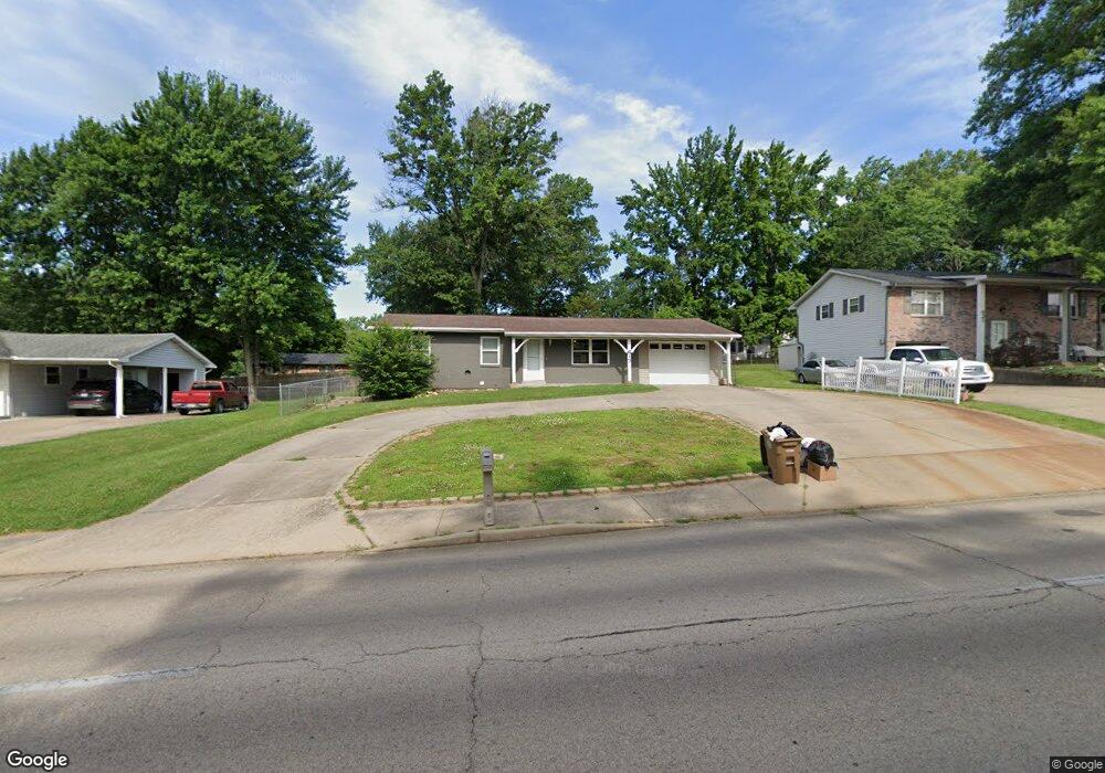
617 N Mount Auburn Rd Cape Girardeau, MO 63701
Estimated Value: $193,000 - $215,000
3
Beds
3
Baths
1,742
Sq Ft
$118/Sq Ft
Est. Value
About This Home
This home is located at 617 N Mount Auburn Rd, Cape Girardeau, MO 63701 and is currently estimated at $205,628, approximately $118 per square foot. 617 N Mount Auburn Rd is a home located in Cape Girardeau County with nearby schools including Clippard Elementary School, Central Junior High School, and Central Middle School.
Ownership History
Date
Name
Owned For
Owner Type
Purchase Details
Closed on
Sep 6, 2023
Sold by
Hollingsworth Chad and Hollingsworth Deborah
Bought by
Boswell Michael Ryan and Boswell Julie A
Current Estimated Value
Home Financials for this Owner
Home Financials are based on the most recent Mortgage that was taken out on this home.
Original Mortgage
$164,500
Outstanding Balance
$160,912
Interest Rate
6.81%
Mortgage Type
New Conventional
Estimated Equity
$44,716
Purchase Details
Closed on
Sep 9, 2021
Sold by
Bagot Mary A
Bought by
Hollingsworth Chad and Hollingsworth Deborah
Home Financials for this Owner
Home Financials are based on the most recent Mortgage that was taken out on this home.
Original Mortgage
$101,600
Interest Rate
2.8%
Mortgage Type
New Conventional
Purchase Details
Closed on
Oct 11, 2006
Sold by
Bagor Mary A
Bought by
Bagot James L
Create a Home Valuation Report for This Property
The Home Valuation Report is an in-depth analysis detailing your home's value as well as a comparison with similar homes in the area
Home Values in the Area
Average Home Value in this Area
Purchase History
| Date | Buyer | Sale Price | Title Company |
|---|---|---|---|
| Boswell Michael Ryan | -- | None Listed On Document | |
| Hollingsworth Chad | -- | None Available | |
| Bagot James L | -- | None Available |
Source: Public Records
Mortgage History
| Date | Status | Borrower | Loan Amount |
|---|---|---|---|
| Open | Boswell Michael Ryan | $164,500 | |
| Previous Owner | Hollingsworth Chad | $101,600 |
Source: Public Records
Tax History Compared to Growth
Tax History
| Year | Tax Paid | Tax Assessment Tax Assessment Total Assessment is a certain percentage of the fair market value that is determined by local assessors to be the total taxable value of land and additions on the property. | Land | Improvement |
|---|---|---|---|---|
| 2025 | $10 | $19,390 | $2,690 | $16,700 |
| 2024 | $10 | $18,470 | $2,560 | $15,910 |
| 2023 | $960 | $18,470 | $2,560 | $15,910 |
| 2022 | $885 | $17,020 | $2,360 | $14,660 |
| 2021 | $885 | $17,020 | $2,360 | $14,660 |
| 2020 | $888 | $17,020 | $2,360 | $14,660 |
| 2019 | $887 | $17,030 | $0 | $0 |
| 2018 | $885 | $17,030 | $0 | $0 |
| 2017 | $887 | $17,030 | $0 | $0 |
| 2016 | $884 | $17,030 | $0 | $0 |
| 2015 | $884 | $17,030 | $0 | $0 |
| 2014 | $889 | $17,030 | $0 | $0 |
Source: Public Records
Map
Nearby Homes
- 3027 Wisteria Dr
- 3022 Wisteria Dr
- 3106 Mimosa St
- 3269 Hopper Rd
- 3552 Mill View Crossing
- 901 Pheasant Cove Dr
- 1000 N Mount Auburn Rd
- 725 Old Mill Dr
- 3657 Engram St
- 769 Cedar Ln
- 807 Caribou Ct
- 3014 Keystone Dr
- 3466 Hopper Rd
- 835 Lochinvar Ln
- 3036 Keystone Dr
- 1070 Dorothy St
- 1107 Dorothy St
- 2 Schonoff Ln
- 2615 Maria Louise Ln
- 2811 Independence St
- 617 N My Auburn
- 621 N Mount Auburn Rd
- 613 Mt Auburn
- 618 Cordova St
- 625 N Mount Auburn Rd
- 614 Cordova St
- 609 N Mount Auburn Rd
- 622 Cordova St
- 622 N Mount Auburn Rd
- 610 Cordova St
- 618 N Mount Auburn Rd
- 626 N Mount Auburn Rd
- 626 Cordova St
- 614 N Mount Auburn Rd
- 629 N Mount Auburn Rd
- 614 Mt Auburn
- 605 Mt Auburn
- 605 N Mount Auburn Rd
- 628 N Mount Auburn Rd
- 606 Cordova St