Estimated Value: $83,508 - $147,000
Studio
1
Bath
1,248
Sq Ft
$101/Sq Ft
Est. Value
About This Home
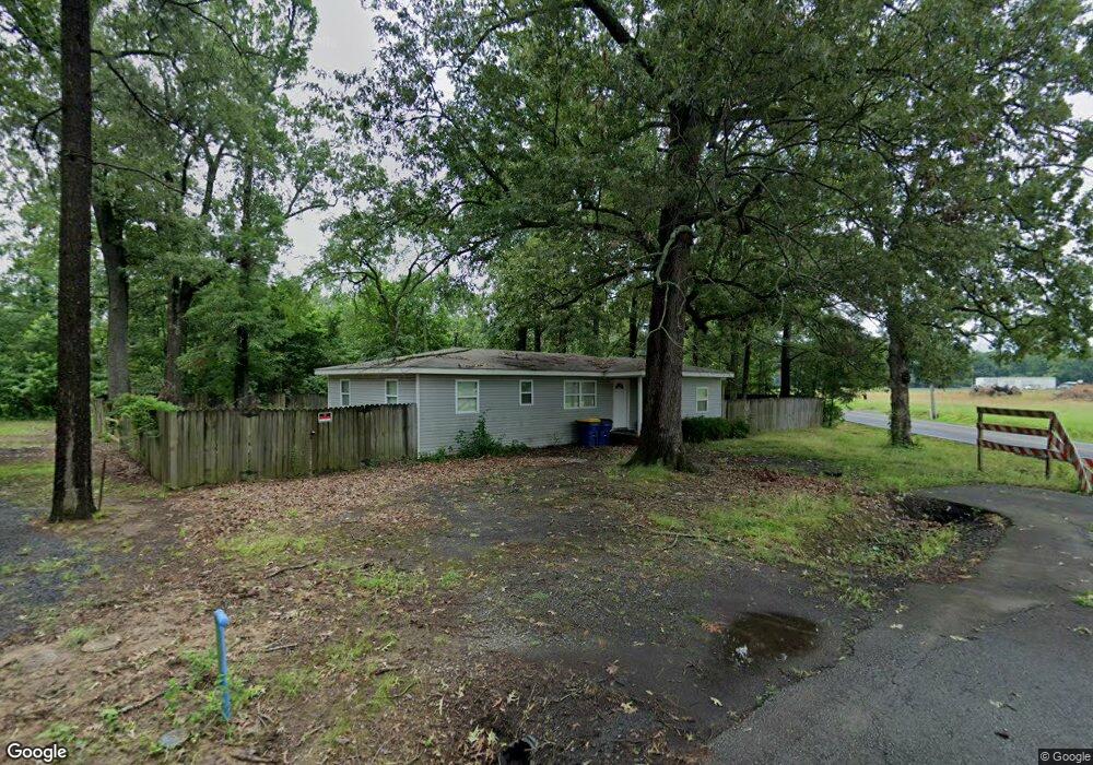
This home is located at 617 S Grant St, Cabot, AR 72023 and is currently estimated at $126,627, approximately $101 per square foot. 617 S Grant St is a home located in Lonoke County with nearby schools including Central Elementary School, Cabot Junior High South, and Cabot Middle School South.
Ownership History
Date
Name
Owned For
Owner Type
Purchase Details
Closed on
Feb 26, 2004
Bought by
Drennan
Current Estimated Value
Purchase Details
Closed on
May 28, 2003
Bought by
Heitman
Purchase Details
Closed on
Aug 15, 2002
Bought by
Denise Smith
Purchase Details
Closed on
Dec 27, 1996
Bought by
Gibbs
Purchase Details
Closed on
May 4, 1988
Bought by
David Hux and Wife Dallas
Purchase Details
Closed on
Jan 27, 1988
Bought by
Greens
Create a Home Valuation Report for This Property
The Home Valuation Report is an in-depth analysis detailing your home's value as well as a comparison with similar homes in the area
Purchase History
| Date | Buyer | Sale Price | Title Company |
|---|---|---|---|
| Drennan | $28,000 | -- | |
| Heitman | -- | -- | |
| Drennan | $28,000 | -- | |
| Heitman | -- | -- | |
| Heitman | -- | -- | |
| Denise Smith | -- | -- | |
| Gibbs | $36,000 | -- | |
| David Hux | $32,000 | -- | |
| Greens | $27,000 | -- |
Source: Public Records
Tax History
| Year | Tax Paid | Tax Assessment Tax Assessment Total Assessment is a certain percentage of the fair market value that is determined by local assessors to be the total taxable value of land and additions on the property. | Land | Improvement |
|---|---|---|---|---|
| 2025 | $496 | $9,740 | $1,350 | $8,390 |
| 2024 | $496 | $9,740 | $1,350 | $8,390 |
| 2023 | $496 | $9,740 | $1,350 | $8,390 |
| 2022 | $496 | $9,740 | $1,350 | $8,390 |
| 2021 | $496 | $9,740 | $1,350 | $8,390 |
| 2020 | $474 | $9,310 | $1,350 | $7,960 |
| 2019 | $474 | $9,310 | $1,350 | $7,960 |
| 2018 | $460 | $9,310 | $1,350 | $7,960 |
| 2017 | $427 | $9,310 | $1,350 | $7,960 |
| 2016 | $460 | $9,310 | $1,350 | $7,960 |
| 2015 | $488 | $9,880 | $1,350 | $8,530 |
| 2014 | $488 | $9,880 | $1,350 | $8,530 |
Source: Public Records
Map
Nearby Homes
- 00 Kerr Station Rd
- 49 Oak Meadows Dr
- 51 Meadowlark Dr
- 509 E Myrtle St
- 57 Meadowlark Dr
- 11 Meadowlark Dr
- 38 S 10th St
- 12 Bellaire Dr
- 37 Saint John St
- 22 Century Cir
- 113 Walnut St
- 23 Robinson St
- 110 N Monroe St
- 34 Bent Tree Dr
- 115 Rodney Guthrie Dr
- 20 Paige Ave
- 37 Pond St
- 19 Sycamore St
- 406 N 3rd St
- 28 Pheasant Run Dr
- 613 S Grant St
- 20 Oak Meadows Dr
- 611 S Grant St
- 18 Oak Meadows Dr
- 22 Oak Meadows Dr
- 607 S Grant St
- 608 S Jackson St
- 606 S Jackson St
- 608 S Grant St
- 24 Oak Meadows Dr
- 21 Oak Meadows Dr
- 603 S Grant St
- 602 S Grant St
- 16 Oak Meadows Dr
- 604 S Jackson St
- 600 S Jackson St
- 23 Oak Meadows Dr
- 601 S Grant St
- 601 S Jackson St
- 26 Oak Meadows Dr
Your Personal Tour Guide
Ask me questions while you tour the home.