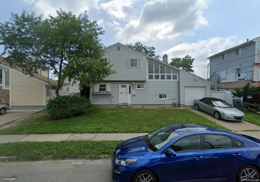
617 S Main St Freeport, NY 11520
Estimated Value: $497,000 - $634,924
3
Beds
2
Baths
1,280
Sq Ft
$442/Sq Ft
Est. Value
About This Home
This home is located at 617 S Main St, Freeport, NY 11520 and is currently estimated at $565,962, approximately $442 per square foot. 617 S Main St is a home located in Nassau County with nearby schools including Columbus Avenue School, Caroline G. Atkinson Intermediate School, and John W Dodd Middle School.
Ownership History
Date
Name
Owned For
Owner Type
Purchase Details
Closed on
May 10, 2016
Sold by
Gonzalez Vivienne G
Bought by
Carpio Dolores and Carpio Ernesto E
Current Estimated Value
Purchase Details
Closed on
Dec 4, 1995
Sold by
Schablin Michael and Coccia Gerilyn
Bought by
Gonzalez Vivienne
Home Financials for this Owner
Home Financials are based on the most recent Mortgage that was taken out on this home.
Original Mortgage
$146,700
Interest Rate
7.33%
Create a Home Valuation Report for This Property
The Home Valuation Report is an in-depth analysis detailing your home's value as well as a comparison with similar homes in the area
Home Values in the Area
Average Home Value in this Area
Purchase History
| Date | Buyer | Sale Price | Title Company |
|---|---|---|---|
| Carpio Dolores | $215,000 | Westcor Land Title Insurance | |
| Gonzalez Vivienne | $163,000 | -- |
Source: Public Records
Mortgage History
| Date | Status | Borrower | Loan Amount |
|---|---|---|---|
| Previous Owner | Gonzalez Vivienne | $146,700 |
Source: Public Records
Tax History Compared to Growth
Tax History
| Year | Tax Paid | Tax Assessment Tax Assessment Total Assessment is a certain percentage of the fair market value that is determined by local assessors to be the total taxable value of land and additions on the property. | Land | Improvement |
|---|---|---|---|---|
| 2025 | $8,027 | $389 | $159 | $230 |
| 2024 | $853 | $389 | $159 | $230 |
| 2023 | $8,092 | $389 | $159 | $230 |
| 2022 | $8,092 | $389 | $159 | $230 |
| 2021 | $11,807 | $372 | $152 | $220 |
| 2020 | $11,166 | $492 | $335 | $157 |
| 2019 | $7,123 | $492 | $335 | $157 |
| 2018 | $7,124 | $492 | $0 | $0 |
| 2017 | $5,921 | $492 | $335 | $157 |
| 2016 | $6,659 | $492 | $335 | $157 |
| 2015 | $711 | $492 | $335 | $157 |
| 2014 | $711 | $492 | $335 | $157 |
| 2013 | $672 | $492 | $335 | $157 |
Source: Public Records
Map
Nearby Homes
- 92 Ann Dr S
- 34 W 2nd St
- 30 E Bedell St
- 8 Ocean Watch Ct
- 7 Ocean Watch Ct
- 9 Ocean Watch Ct
- 10 Ocean Watch Ct
- 11 Ocean Watch Ct
- 12 Ocean Watch Ct
- 13 Ocean Watch Ct
- 69 E 1st St
- 16 Ocean Watch Ct Unit 16
- 17 Ocean Watch Ct Unit 17
- 18 Ocean Watch Ct Unit 18
- 54 Ocean Watch Ct Unit 54
- 43 Ocean Watch Ct
- 308 Bedell St
- 121a Garfield St
- 142 Gordon Place
- 335 Arthur St