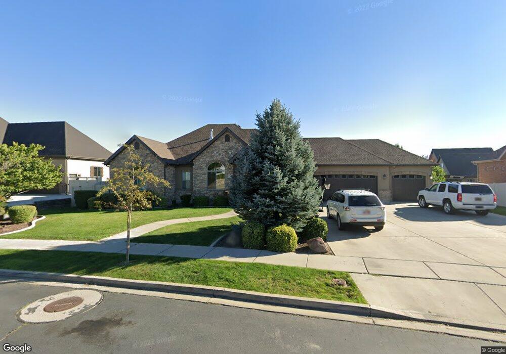
617 W 1040 N Unit 18 American Fork, UT 84003
Estimated Value: $892,000 - $1,137,000
3
Beds
4
Baths
2,222
Sq Ft
$451/Sq Ft
Est. Value
About This Home
This home is located at 617 W 1040 N Unit 18, American Fork, UT 84003 and is currently estimated at $1,002,268, approximately $451 per square foot. 617 W 1040 N Unit 18 is a home located in Utah County with nearby schools including Shelley Elementary School, American Fork Junior High School, and American Fork High School.
Ownership History
Date
Name
Owned For
Owner Type
Purchase Details
Closed on
Oct 23, 2006
Sold by
Brookwood Construction & Design Inc
Bought by
Anderson Dale and Anderson Bethany
Current Estimated Value
Purchase Details
Closed on
Apr 25, 2006
Sold by
First Choice Communities Llc
Bought by
Brookwood Construction & Design Inc
Home Financials for this Owner
Home Financials are based on the most recent Mortgage that was taken out on this home.
Original Mortgage
$500,960
Interest Rate
6.29%
Mortgage Type
Purchase Money Mortgage
Create a Home Valuation Report for This Property
The Home Valuation Report is an in-depth analysis detailing your home's value as well as a comparison with similar homes in the area
Home Values in the Area
Average Home Value in this Area
Purchase History
| Date | Buyer | Sale Price | Title Company |
|---|---|---|---|
| Anderson Dale | -- | First American Title Agency | |
| Brookwood Construction & Design Inc | -- | First American Title Agency | |
| First Choice Communities Llc | -- | First American Title Agency |
Source: Public Records
Mortgage History
| Date | Status | Borrower | Loan Amount |
|---|---|---|---|
| Previous Owner | Brookwood Construction & Design Inc | $500,960 |
Source: Public Records
Tax History Compared to Growth
Tax History
| Year | Tax Paid | Tax Assessment Tax Assessment Total Assessment is a certain percentage of the fair market value that is determined by local assessors to be the total taxable value of land and additions on the property. | Land | Improvement |
|---|---|---|---|---|
| 2025 | $4,093 | $527,010 | $308,500 | $649,700 |
| 2024 | $4,093 | $454,740 | $0 | $0 |
| 2023 | $3,803 | $447,975 | $0 | $0 |
| 2022 | $3,987 | $463,540 | $0 | $0 |
| 2021 | $3,499 | $635,400 | $216,100 | $419,300 |
| 2020 | $3,404 | $599,400 | $200,100 | $399,300 |
| 2019 | $3,038 | $553,400 | $200,100 | $353,300 |
| 2018 | $3,133 | $545,700 | $192,400 | $353,300 |
| 2017 | $2,991 | $281,105 | $0 | $0 |
| 2016 | $2,960 | $298,320 | $0 | $0 |
| 2015 | $3,198 | $265,045 | $0 | $0 |
| 2014 | $3,149 | $257,455 | $0 | $0 |
Source: Public Records
Map
Nearby Homes
- 3935 W 1000 N Unit 438
- 3983 W 1000 N Unit 442
- 4007 W 1000 N
- 3947 W 1000 N Unit 439
- 3959 W 1000 N
- 471 W 1040 N
- 602 W 860 N
- 987 N 410 W
- 425 W 1120 N
- 822 N 860 W Unit 317
- 822 W 800 St N Unit LOT319
- 344 W 1080 N
- 914 N 400 W Unit A
- 3889 W 950 Cir N Unit 366
- 9435 N Aspen Hollow Cir
- 901 N Lakota Rd
- 962 N 780 St W Unit 508
- 974 N 780 St W Unit 509
- 916 N 780 St W Unit 501
- 893 N 1580 E
- 617 W 1040 N
- 592 W 990 N
- 639 W 1040 N
- 639 W 1040 N Unit 19
- 603 W 1040 N
- 995 N 600 W Unit 10
- 995 N 600 W
- 1018 N 640 W
- 626 W 1040 N
- 1068 N 610 W
- 4003 W 1040 N Unit MM302
- 4003 W 1040 N Unit MM301
- 4003 W 1040 N Unit MM201
- 4003 W 1040 N Unit MM204
- 4003 W 1040 N Unit MM202
- 4003 W 1040 N Unit MM304
- 4003 W 1040 N Unit MM303
- 4003 W 1040 N Unit MM203
- 4003 W 1040 N Unit MM101
- 4003 W 1040 N Unit MM102