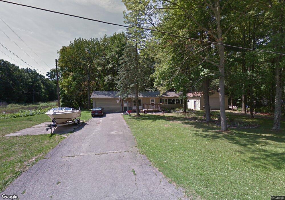
6170 Jade Ln Bridgeport, MI 48722
Estimated Value: $147,000 - $198,000
3
Beds
1
Bath
980
Sq Ft
$171/Sq Ft
Est. Value
About This Home
This home is located at 6170 Jade Ln, Bridgeport, MI 48722 and is currently estimated at $167,336, approximately $170 per square foot. 6170 Jade Ln is a home located in Saginaw County with nearby schools including Thomas White School, Martin G. Atkins Elementary School, and Bridgeport High School.
Ownership History
Date
Name
Owned For
Owner Type
Purchase Details
Closed on
Aug 24, 2018
Sold by
Garchow Brett M and Garchow Tabitha L
Bought by
Garchow Brett M and Garchow Tabitha L
Current Estimated Value
Purchase Details
Closed on
Apr 20, 1999
Sold by
Steffen Lois E and Rau Helen J
Bought by
Garchow Brett M
Home Financials for this Owner
Home Financials are based on the most recent Mortgage that was taken out on this home.
Original Mortgage
$48,510
Interest Rate
7.05%
Mortgage Type
Purchase Money Mortgage
Create a Home Valuation Report for This Property
The Home Valuation Report is an in-depth analysis detailing your home's value as well as a comparison with similar homes in the area
Home Values in the Area
Average Home Value in this Area
Purchase History
| Date | Buyer | Sale Price | Title Company |
|---|---|---|---|
| Garchow Brett M | -- | -- | |
| Garchow Brett M | $53,900 | Centennial Title & Abstract | |
| -- | $53,900 | -- |
Source: Public Records
Mortgage History
| Date | Status | Borrower | Loan Amount |
|---|---|---|---|
| Previous Owner | -- | $48,510 |
Source: Public Records
Tax History Compared to Growth
Tax History
| Year | Tax Paid | Tax Assessment Tax Assessment Total Assessment is a certain percentage of the fair market value that is determined by local assessors to be the total taxable value of land and additions on the property. | Land | Improvement |
|---|---|---|---|---|
| 2025 | $1,845 | $60,500 | $0 | $0 |
| 2024 | $452 | $59,900 | $0 | $0 |
| 2023 | $430 | $50,800 | $0 | $0 |
| 2022 | $1,552 | $46,500 | $0 | $0 |
| 2021 | $1,421 | $46,500 | $0 | $0 |
| 2020 | $1,381 | $42,400 | $0 | $0 |
| 2019 | $1,312 | $40,500 | $10,200 | $30,300 |
| 2018 | $375 | $39,200 | $0 | $0 |
| 2017 | $1,191 | $39,000 | $0 | $0 |
| 2016 | $1,283 | $34,300 | $0 | $0 |
| 2014 | -- | $33,900 | $0 | $24,600 |
| 2013 | -- | $33,600 | $0 | $0 |
Source: Public Records
Map
Nearby Homes
- 5885 McGrandy Rd
- 5205 Baker Rd
- 0 VL S Airport Rd
- V/L S Airport Rd
- 4719 Baker Rd
- 6605 Bridgeport Hwy
- 6267 Junction Rd
- Parcel E W Rolling Hills Dr
- Parcel B W Rolling Hills Dr
- Parcel D W Rolling Hills Dr
- Parcel F W Rolling Hills Dr
- Parcel C W Rolling Hills Dr
- 6412 Tin Lizzy Ln
- 4694 King Rd
- 3927 State St
- 3838 Sherman St
- 4333 Riverview Dr
- 4705 Weiss Rd
- 3977 Snowberry Rd
- 4224 Pineport Rd
- 6169 Jade Ln
- 6130 Jade Ln
- 6121 Jade Ln
- 6100 Jade Ln
- 4221 Emerald Dr
- 4239 Emerald Dr
- 4161 Emerald Dr
- 4259 Emerald Dr
- 4135 Emerald Dr
- 4281 Emerald Dr
- 6226 Jade Ln
- 4216 Emerald Dr
- 4200 Emerald Dr
- 4242 Emerald Dr
- 4105 Emerald Dr
- 4105 Emerald Rd
- 6065 Jade Ln
- 4256 Emerald Dr
- 4301 Emerald Dr
- 4142 Emerald Dr