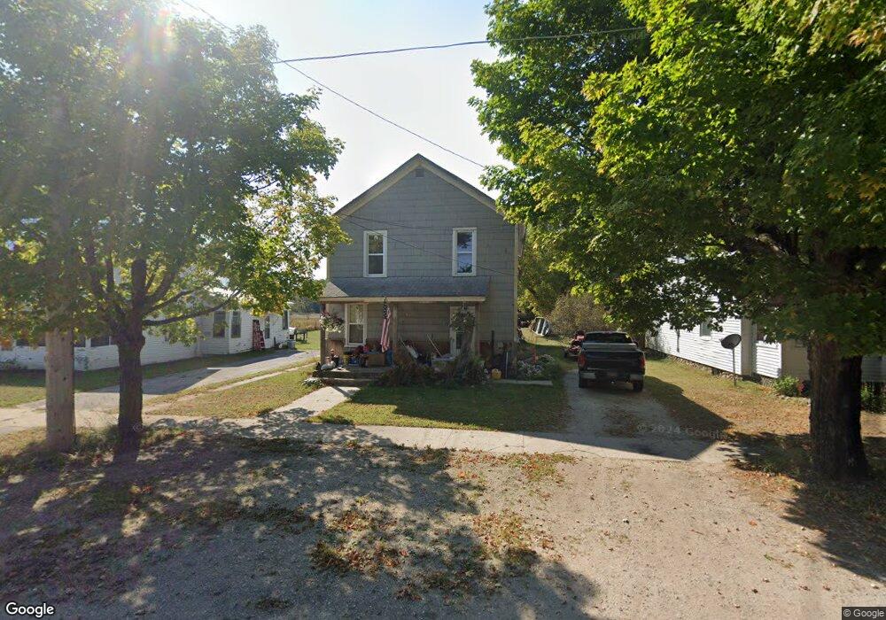
6170 W Main St Pellston, MI 49769
Estimated Value: $139,000 - $163,000
--
Bed
--
Bath
--
Sq Ft
7,710
Sq Ft Lot
About This Home
This home is located at 6170 W Main St, Pellston, MI 49769 and is currently estimated at $153,195. 6170 W Main St is a home located in Emmet County with nearby schools including Pellston Elementary School and Pellston Middle/High School.
Ownership History
Date
Name
Owned For
Owner Type
Purchase Details
Closed on
Oct 17, 2023
Sold by
Ross Melode M and Ross Y
Bought by
Ross Darrin Andrew and Ross Y
Current Estimated Value
Purchase Details
Closed on
Nov 21, 2014
Sold by
Robert S Robert S
Bought by
Ross Darrin and Ross Melodee
Purchase Details
Closed on
Sep 1, 2004
Sold by
Sorrick Thomas and Sorrick Donna
Bought by
Ross Darrin and Ross Melodee
Purchase Details
Closed on
Aug 1, 1982
Bought by
Sorrick
Create a Home Valuation Report for This Property
The Home Valuation Report is an in-depth analysis detailing your home's value as well as a comparison with similar homes in the area
Home Values in the Area
Average Home Value in this Area
Purchase History
| Date | Buyer | Sale Price | Title Company |
|---|---|---|---|
| Ross Darrin Andrew | -- | -- | |
| Ross Darrin | $55,000 | -- | |
| Ross Darrin | -- | -- | |
| Sorrick | $12,000 | -- |
Source: Public Records
Tax History Compared to Growth
Tax History
| Year | Tax Paid | Tax Assessment Tax Assessment Total Assessment is a certain percentage of the fair market value that is determined by local assessors to be the total taxable value of land and additions on the property. | Land | Improvement |
|---|---|---|---|---|
| 2025 | $1,273 | $66,100 | $66,100 | $0 |
| 2024 | $1,273 | $62,200 | $62,200 | $0 |
| 2023 | $1,187 | $57,400 | $57,400 | $0 |
| 2022 | $1,187 | $52,400 | $52,400 | $0 |
| 2021 | $1,232 | $48,500 | $48,500 | $0 |
| 2020 | $1,237 | $45,800 | $45,800 | $0 |
| 2019 | -- | $41,800 | $41,800 | $0 |
| 2018 | -- | $37,800 | $37,800 | $0 |
| 2017 | -- | $37,800 | $37,800 | $0 |
| 2016 | -- | $35,900 | $35,900 | $0 |
| 2015 | -- | $35,400 | $0 | $0 |
| 2014 | -- | $32,200 | $0 | $0 |
Source: Public Records
Map
Nearby Homes
- 000 Vacant U S 31
- 6457 State St
- 6421 Airport Crossing Rd Unit 1
- 6672 Industrial Dr
- 0 Reed Rd Unit 474270
- TBD Teal Rd
- 9160 Silver Strand Rd
- 4333 U S 31
- 9470 Silver Strand Rd
- 9670 Silver Strand Rd
- 9485 Ingleside Rd
- 3016 W Burt Lake Rd
- 10999 Koepke Rd
- 10222 W Munro Lake Dr
- 5383 N Conway Rd
- 1975 &1995 Club House Dr
- 1975 + 1995 Club House Dr
- 5100 N Bay Way
- 6430 Admirals Point Dr
- 6167 Lambert Dr