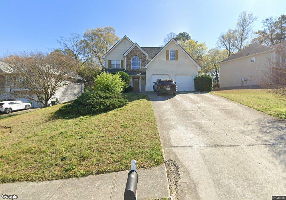
6171 Shadygrove Ridge Austell, GA 30168
Estimated Value: $361,000 - $432,000
4
Beds
3
Baths
2,590
Sq Ft
$149/Sq Ft
Est. Value
About This Home
This home is located at 6171 Shadygrove Ridge, Austell, GA 30168 and is currently estimated at $384,989, approximately $148 per square foot. 6171 Shadygrove Ridge is a home located in Cobb County with nearby schools including Deerwood Elementary School, Austell Elementary School, and Garrett Middle School.
Ownership History
Date
Name
Owned For
Owner Type
Purchase Details
Closed on
Mar 30, 2010
Sold by
Wells Fargo Bk Na
Bought by
Hill Frazier and Hill Malikah
Current Estimated Value
Home Financials for this Owner
Home Financials are based on the most recent Mortgage that was taken out on this home.
Original Mortgage
$128,627
Outstanding Balance
$87,436
Interest Rate
5.5%
Mortgage Type
FHA
Estimated Equity
$297,553
Purchase Details
Closed on
Dec 1, 2009
Sold by
Allen Renita
Bought by
Wells Fargo Bk Na
Purchase Details
Closed on
Oct 30, 2000
Sold by
Watson Homes Inc
Bought by
Sumner Garrett B and Sumner Cara G
Home Financials for this Owner
Home Financials are based on the most recent Mortgage that was taken out on this home.
Original Mortgage
$159,049
Interest Rate
7.93%
Mortgage Type
FHA
Create a Home Valuation Report for This Property
The Home Valuation Report is an in-depth analysis detailing your home's value as well as a comparison with similar homes in the area
Home Values in the Area
Average Home Value in this Area
Purchase History
| Date | Buyer | Sale Price | Title Company |
|---|---|---|---|
| Hill Frazier | $131,000 | -- | |
| Wells Fargo Bk Na | $117,450 | -- | |
| Wells Fargo Bk Na | $117,450 | -- | |
| Sumner Garrett B | $160,400 | -- |
Source: Public Records
Mortgage History
| Date | Status | Borrower | Loan Amount |
|---|---|---|---|
| Open | Hill Frazier | $128,627 | |
| Previous Owner | Sumner Garrett B | $159,049 |
Source: Public Records
Tax History Compared to Growth
Tax History
| Year | Tax Paid | Tax Assessment Tax Assessment Total Assessment is a certain percentage of the fair market value that is determined by local assessors to be the total taxable value of land and additions on the property. | Land | Improvement |
|---|---|---|---|---|
| 2025 | $3,788 | $125,728 | $24,000 | $101,728 |
| 2024 | $3,791 | $125,728 | $24,000 | $101,728 |
| 2023 | $3,791 | $125,728 | $24,000 | $101,728 |
| 2022 | $2,580 | $85,008 | $16,000 | $69,008 |
| 2021 | $2,580 | $85,008 | $16,000 | $69,008 |
| 2020 | $2,085 | $68,708 | $6,800 | $61,908 |
| 2019 | $2,085 | $68,708 | $6,800 | $61,908 |
| 2018 | $2,085 | $68,708 | $6,800 | $61,908 |
| 2017 | $1,975 | $68,708 | $6,800 | $61,908 |
| 2016 | $1,722 | $59,896 | $6,800 | $53,096 |
| 2015 | $1,360 | $46,172 | $6,000 | $40,172 |
| 2014 | $1,372 | $46,172 | $0 | $0 |
Source: Public Records
Map
Nearby Homes
- 6083 Oak Hill Dr
- 2023 Lee Dr
- 2072 Woodbine Cir
- 6084 S Gordon Rd
- 1972 Cox Dr Unit 5
- 1138 Pontiac Cir
- 1138 Pontiac Cir Unit 23
- 2414 Old Alabama Rd
- 1155 Elowen Dr
- 1055 Elowen Dr
- 1984 Brenda Dr
- 0 Maxham Rd Unit 10652291
- 6581 Coventry Point Unit 1
- 1794 Blossom Ln
- 1995 Matt Dr
- 110 Creekway Dr
- 1151 S Gordon Rd
- 3027 Creekside Overlook Way
- 2145 Venesa Cir
- 1995 Oak Ct
- 6167 Shadygrove Ridge Unit 2
- 6175 Shadygrove Ridge
- 6163 Shadygrove Ridge
- 6170 Shadygrove Ridge
- 2096 Old Alabama Rd
- 2096 Old Alabama Rd Unit 1
- 6179 Shadygrove Ridge
- 6159 Shadygrove Ridge
- 6183 Shadygrove Ridge Unit 2
- 6183 Shadygrove Ridge SW
- 6174 Shadygrove Ridge
- 6182 Shadygrove Ridge
- 2107 Shadygrove Walk
- 6178 Shadygrove Ridge Unit II
- 6155 Shadygrove Ridge
- 2090 Old Alabama Rd
- 2090 Old Alabama Rd Unit B
- 2104 Shadygrove Walk Unit 2
- 2111 Shadygrove Walk Unit 2111
- 2111 Shadygrove Walk