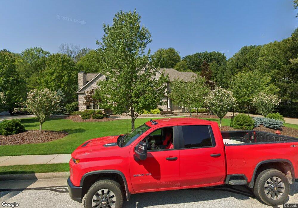
6172 Burr Oak Way Hudson, OH 44236
Estimated Value: $1,266,000 - $1,534,000
5
Beds
4
Baths
4,888
Sq Ft
$284/Sq Ft
Est. Value
About This Home
This home is located at 6172 Burr Oak Way, Hudson, OH 44236 and is currently estimated at $1,387,761, approximately $283 per square foot. 6172 Burr Oak Way is a home located in Summit County with nearby schools including Ellsworth Hill Elementary School, East Woods Intermediate School, and Hudson Middle School.
Ownership History
Date
Name
Owned For
Owner Type
Purchase Details
Closed on
Jun 25, 2004
Sold by
Bourn Perry E
Bought by
Kerscher Robert D and Kerscher Barbara F
Current Estimated Value
Home Financials for this Owner
Home Financials are based on the most recent Mortgage that was taken out on this home.
Original Mortgage
$896,000
Outstanding Balance
$488,813
Interest Rate
6.37%
Mortgage Type
Purchase Money Mortgage
Estimated Equity
$898,948
Create a Home Valuation Report for This Property
The Home Valuation Report is an in-depth analysis detailing your home's value as well as a comparison with similar homes in the area
Home Values in the Area
Average Home Value in this Area
Purchase History
| Date | Buyer | Sale Price | Title Company |
|---|---|---|---|
| Kerscher Robert D | $189,900 | Midland Commerce Group |
Source: Public Records
Mortgage History
| Date | Status | Borrower | Loan Amount |
|---|---|---|---|
| Open | Kerscher Robert D | $896,000 | |
| Closed | Kerscher Robert D | $60,000 |
Source: Public Records
Tax History Compared to Growth
Tax History
| Year | Tax Paid | Tax Assessment Tax Assessment Total Assessment is a certain percentage of the fair market value that is determined by local assessors to be the total taxable value of land and additions on the property. | Land | Improvement |
|---|---|---|---|---|
| 2025 | $19,734 | $380,503 | $53,375 | $327,128 |
| 2024 | $19,734 | $380,503 | $53,375 | $327,128 |
| 2023 | $19,734 | $380,503 | $53,375 | $327,128 |
| 2022 | $16,914 | $290,459 | $40,744 | $249,715 |
| 2021 | $16,942 | $290,459 | $40,744 | $249,715 |
| 2020 | $16,649 | $290,460 | $40,740 | $249,720 |
| 2019 | $23,723 | $383,720 | $47,260 | $336,460 |
| 2018 | $23,648 | $383,720 | $47,260 | $336,460 |
| 2017 | $21,583 | $383,720 | $47,260 | $336,460 |
| 2016 | $21,683 | $338,860 | $47,260 | $291,600 |
| 2015 | $21,583 | $338,860 | $47,260 | $291,600 |
| 2014 | $21,644 | $338,860 | $47,260 | $291,600 |
| 2013 | $22,271 | $340,600 | $47,260 | $293,340 |
Source: Public Records
Map
Nearby Homes
- 139 Mccracken Rd
- 174 Sapphire Ln
- 6629 Meadow Farm Dr
- 6751 Pheasants Ridge
- 389 Opal Ct
- 6869 Saint Regis Blvd
- 5937 Ogilby Dr
- 35 S Hayden Pkwy
- 9005 Sandpiper Dr
- 9085 Sandpiper Dr
- 8929 Falcon Dr
- 5974 Anna Lee Dr
- 5791 Sunset Dr
- 94 Fox Trace Ln
- 1705 Barlow Rd
- 148 Colony Dr
- 5431 Diana Lynn Dr
- 5473 Young Rd
- 2380 Victoria Pkwy
- 2749 Norton Rd
- 6178 Burr Oak Way
- 6170 Burr Oak Way
- 6177 Burr Oak Way
- 6168 Burr Oak Way
- 6173 Burr Oak Way
- 2472 Bramfield Way
- 6167 Burr Oak Way
- 6181 Burr Oak Way
- 2460 Bramfield Way
- 6187 Burr Oak Way
- 6164 Burr Oak Way
- 6161 Burr Oak Way
- 2475 Bramfield Way
- 6152 Burr Oak Way
- 6184 Wessington Dr
- 2463 Bramfield Way
- 6157 Burr Oak Way
- 6192 Wessington Dr
- 6180 Wessington Dr
- 6162 Paderborne Dr