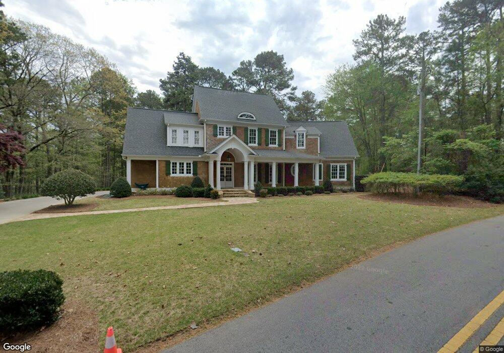
6172 Jim Crow Rd Flowery Branch, GA 30542
Estimated Value: $933,000 - $1,323,000
3
Beds
3
Baths
2,709
Sq Ft
$408/Sq Ft
Est. Value
About This Home
This home is located at 6172 Jim Crow Rd, Flowery Branch, GA 30542 and is currently estimated at $1,104,852, approximately $407 per square foot. 6172 Jim Crow Rd is a home located in Hall County with nearby schools including Flowery Branch Elementary School, West Hall Middle School, and West Hall High School.
Ownership History
Date
Name
Owned For
Owner Type
Purchase Details
Closed on
Aug 25, 2025
Sold by
Crow Darryl G
Bought by
Crow Charlotte Trust and Crow Darryl Trust
Current Estimated Value
Purchase Details
Closed on
Dec 9, 1994
Sold by
Crow Edith
Bought by
Crow Darryl
Home Financials for this Owner
Home Financials are based on the most recent Mortgage that was taken out on this home.
Original Mortgage
$48,150
Interest Rate
9.01%
Create a Home Valuation Report for This Property
The Home Valuation Report is an in-depth analysis detailing your home's value as well as a comparison with similar homes in the area
Home Values in the Area
Average Home Value in this Area
Purchase History
| Date | Buyer | Sale Price | Title Company |
|---|---|---|---|
| Crow Charlotte Trust | -- | -- | |
| Crow Darryl | $60,000 | -- |
Source: Public Records
Mortgage History
| Date | Status | Borrower | Loan Amount |
|---|---|---|---|
| Previous Owner | Crow Darryl | $48,150 |
Source: Public Records
Tax History Compared to Growth
Tax History
| Year | Tax Paid | Tax Assessment Tax Assessment Total Assessment is a certain percentage of the fair market value that is determined by local assessors to be the total taxable value of land and additions on the property. | Land | Improvement |
|---|---|---|---|---|
| 2024 | $9,959 | $402,560 | $133,360 | $269,200 |
| 2023 | $8,800 | $371,440 | $133,360 | $238,080 |
| 2022 | $7,594 | $294,240 | $91,080 | $203,160 |
| 2021 | $7,708 | $293,160 | $91,080 | $202,080 |
| 2020 | $7,728 | $285,520 | $91,080 | $194,440 |
| 2019 | $7,572 | $277,240 | $91,080 | $186,160 |
| 2018 | $7,386 | $261,720 | $83,560 | $178,160 |
| 2017 | $6,900 | $247,080 | $83,560 | $163,520 |
| 2016 | $6,733 | $247,080 | $83,560 | $163,520 |
| 2015 | $6,787 | $247,080 | $83,560 | $163,520 |
| 2014 | $6,787 | $247,080 | $83,560 | $163,520 |
Source: Public Records
Map
Nearby Homes
- 6026 Jim Crow Rd
- 6137 White Oak Dr
- 6135 White Oak Dr
- 6025 River Oaks Dr
- 6144 Scott Dr
- 6144 Scott Dr Unit 8
- 6185 Old Stringer Rd
- 5514 Mainsail Way
- 5610 Point Dr W
- 5359 Point Dr S
- 5580 Point West Dr
- 5540 Stone Trace
- 5411 Mayflower Ct
- 5704 Sallee Cir
- 5724 Sallee Cir
- 5431 Mayflower Ct
- 5626 Sallee Ave
- 5837 Meadow View Ln
- 6170 Jim Crow Rd
- 6157 Jim Crow Rd
- 6158 Jim Crow Rd
- 6147 Jim Crow Rd
- 6146 Jim Crow Rd
- 6141 Jim Crow Rd
- 6136 Jim Crow Rd
- 6133 Jim Crow Rd
- 6188 Lakeside Dr
- 6186 Lakeside Dr
- 6190 Lakeside Dr
- 6192 Lakeside Dr
- 6194 Lakeside Dr
- 6196 Lakeside Dr
- 6184 Lakeside Dr
- 6111 Oak Hill Dr
- 6115 Oak Hill Dr
- 6107 Oak Hill Dr
- 6164 White Oak Dr
- 61197 Lakeside Dr