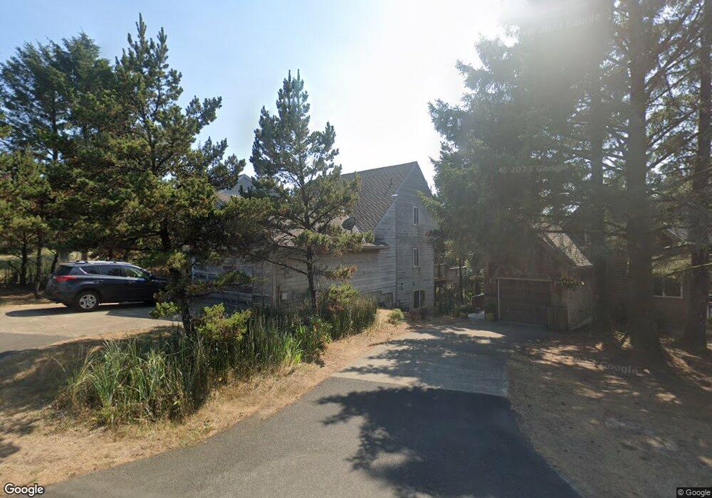
6175 Nestucca Ridge Rd Pacific City, OR 97135
Estimated Value: $778,181 - $885,000
4
Beds
3
Baths
2,558
Sq Ft
$324/Sq Ft
Est. Value
About This Home
This home is located at 6175 Nestucca Ridge Rd, Pacific City, OR 97135 and is currently estimated at $828,545, approximately $323 per square foot. 6175 Nestucca Ridge Rd is a home located in Tillamook County with nearby schools including Nestucca K-8 School and Nestucca High School.
Ownership History
Date
Name
Owned For
Owner Type
Purchase Details
Closed on
Sep 28, 2017
Sold by
Parsons Edmiston Rhonnda K and Parsons Jeffrey
Bought by
Edmison/Moore/Parsons Llc
Current Estimated Value
Purchase Details
Closed on
Apr 28, 2017
Sold by
Parsons Edmiston Rhonnda K
Bought by
Parsons Edmiston Rhonnda K and Parsons Jeffrey
Purchase Details
Closed on
Mar 16, 2011
Sold by
Welch Darron R and Welch Stephanie E Starostka
Bought by
Parsons Wachholz Roberta
Create a Home Valuation Report for This Property
The Home Valuation Report is an in-depth analysis detailing your home's value as well as a comparison with similar homes in the area
Home Values in the Area
Average Home Value in this Area
Purchase History
| Date | Buyer | Sale Price | Title Company |
|---|---|---|---|
| Edmison/Moore/Parsons Llc | -- | None Available | |
| Parsons Edmiston Rhonnda K | -- | None Available | |
| Parsons Wachholz Roberta | $350,000 | Ticor Title Company |
Source: Public Records
Tax History Compared to Growth
Tax History
| Year | Tax Paid | Tax Assessment Tax Assessment Total Assessment is a certain percentage of the fair market value that is determined by local assessors to be the total taxable value of land and additions on the property. | Land | Improvement |
|---|---|---|---|---|
| 2024 | $4,433 | $367,160 | $84,360 | $282,800 |
| 2023 | $4,402 | $356,470 | $81,900 | $274,570 |
| 2022 | $4,247 | $346,090 | $79,510 | $266,580 |
| 2021 | $4,146 | $336,010 | $77,190 | $258,820 |
| 2020 | $4,046 | $326,230 | $74,940 | $251,290 |
| 2019 | $4,023 | $316,730 | $72,760 | $243,970 |
| 2018 | $3,697 | $307,510 | $70,640 | $236,870 |
| 2017 | $3,384 | $298,560 | $68,580 | $229,980 |
| 2016 | $3,328 | $289,870 | $66,580 | $223,290 |
| 2015 | $3,254 | $281,430 | $64,640 | $216,790 |
| 2014 | $3,190 | $273,240 | $62,760 | $210,480 |
| 2013 | -- | $265,290 | $60,930 | $204,360 |
Source: Public Records
Map
Nearby Homes
- 34320 Cape Kiwanda Dr
- 5950 Neptune Dr
- 5706 Four Sisters Ln
- 34270 Sea Swallow Dr
- 34475 Brooten Rd
- 34905 Cape Kiwanda Dr
- 5904 Barefoot Ln
- 5930 Summerhouse Ln
- 34800 Ocean Dr
- TL 2714 Tent St
- 34700 Hill St
- 5685 Barefoot Ln
- 35100 Sunset Dr
- 33520 Cape Kiwanda Dr
- 34970 6th St
- 34970 Sixth St
- 0 Dory Pointe Loop Unit TL8100 229390931
- 33515 Madrona Dr
- 35165 Rueppell Ave
- 34200 Tidewater Ln
- 34200 Tidewater Ln
- 6155 Nestucca Ridge Rd
- 6155 Nestucca Ridge Rd
- TL 2800 Tide Water Ln
- 24 Tide Water Ln
- 0 Tide Water Ln Unit 99-90491
- Tax Lot Tide Water Ln
- 0 Tide Water Ln Unit 24 11132505
- 0 Tide Water Ln Unit 31
- 6105 Nestucca Ridge Rd
- 34300 Tide Water Ln
- 6255 Nestucca Ridge Rd
- 6055 Nestucca Ridge Rd
- 6100 Nestucca Ridge Rd
- 34400 Tidewater Ln
- 34305 Tide Water Ln
- 34305 Tidewater Ln
- 6200 Nestucca Ridge Rd
- 34155 Venture Blvd