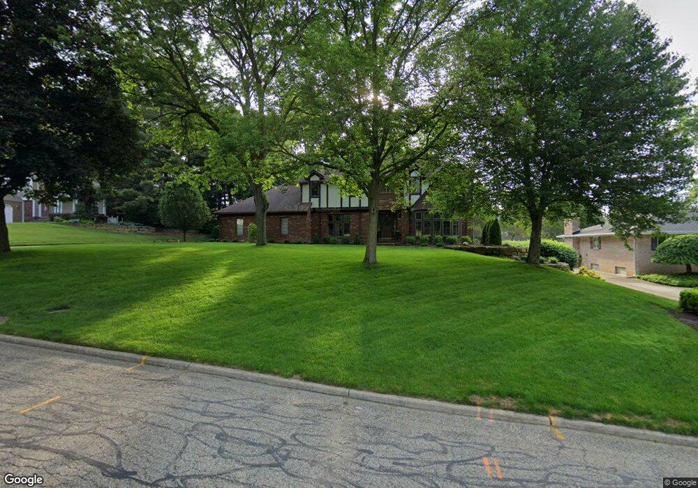
6175 Saint Andrews Dr Canfield, OH 44406
Estimated Value: $344,000 - $422,000
4
Beds
4
Baths
2,768
Sq Ft
$142/Sq Ft
Est. Value
About This Home
This home is located at 6175 Saint Andrews Dr, Canfield, OH 44406 and is currently estimated at $394,411, approximately $142 per square foot. 6175 Saint Andrews Dr is a home located in Mahoning County with nearby schools including Canfield Village Middle School, Canfield High School, and Youngstown Christian School.
Ownership History
Date
Name
Owned For
Owner Type
Purchase Details
Closed on
Jun 3, 1983
Bought by
Pfahler Wm C and Pfahler Lorene A
Current Estimated Value
Create a Home Valuation Report for This Property
The Home Valuation Report is an in-depth analysis detailing your home's value as well as a comparison with similar homes in the area
Home Values in the Area
Average Home Value in this Area
Purchase History
| Date | Buyer | Sale Price | Title Company |
|---|---|---|---|
| Pfahler Wm C | -- | -- |
Source: Public Records
Tax History Compared to Growth
Tax History
| Year | Tax Paid | Tax Assessment Tax Assessment Total Assessment is a certain percentage of the fair market value that is determined by local assessors to be the total taxable value of land and additions on the property. | Land | Improvement |
|---|---|---|---|---|
| 2024 | $4,316 | $105,730 | $12,290 | $93,440 |
| 2023 | $4,244 | $105,730 | $12,290 | $93,440 |
| 2022 | $4,601 | $91,620 | $12,290 | $79,330 |
| 2021 | $4,456 | $91,620 | $12,290 | $79,330 |
| 2020 | $4,476 | $91,620 | $12,290 | $79,330 |
| 2019 | $4,283 | $78,960 | $12,290 | $66,670 |
| 2018 | $4,152 | $78,960 | $12,290 | $66,670 |
| 2017 | $4,149 | $78,960 | $12,290 | $66,670 |
| 2016 | $3,752 | $67,990 | $12,290 | $55,700 |
| 2015 | $3,669 | $67,990 | $12,290 | $55,700 |
| 2014 | $3,684 | $67,990 | $12,290 | $55,700 |
| 2013 | $3,549 | $67,990 | $12,290 | $55,700 |
Source: Public Records
Map
Nearby Homes
- 3770 Fairway Dr
- 4032 Saint Andrews Ct Unit 1
- 3649 Indian Run Dr Unit 2
- 6931 Lockwood Blvd
- 6729 Tippecanoe Rd Unit 6
- 5391 Muirfield Dr
- 6743 Lockwood Blvd
- 6747 Lockwood Blvd
- 6670 Summit Dr
- 6723 Lockwood Blvd Unit 4
- 1422 Turnberry Dr
- 6873 Tippecanoe Rd
- 6850 Abbey Rd N
- 6911 Tippecanoe Rd
- 6845 Abbey Rd
- 6843 Abbey Rd
- 6839 Abbey Rd S
- 6837 Abbey Rd S
- 1133 Red Tail Hawk Ct Unit 6
- 3885 Shields Rd
- 6185 Saint Andrews Dr
- 6151 Saint Andrews Dr
- 6114 Jamison Place
- 6197 Saint Andrews Dr
- 6173 Saint Andrews Dr
- 6186 Saint Andrews Dr
- 6145 Saint Andrews Dr
- 6140 Jamison Place
- 3 Pebble Beach Dr
- 6156 Saint Andrews Dr
- 6209 Saint Andrews Dr
- 6156 Jamison Place
- 6100 Jamison Place
- 6131 Saint Andrews Dr
- 4011 Pebble Beach Dr
- 6185 Southern Hills Ct
- 6169 Southern Hills Ct
- 3920 Tyler Dr
- 6135 Jamison Place
- 6128 Saint Andrews Dr