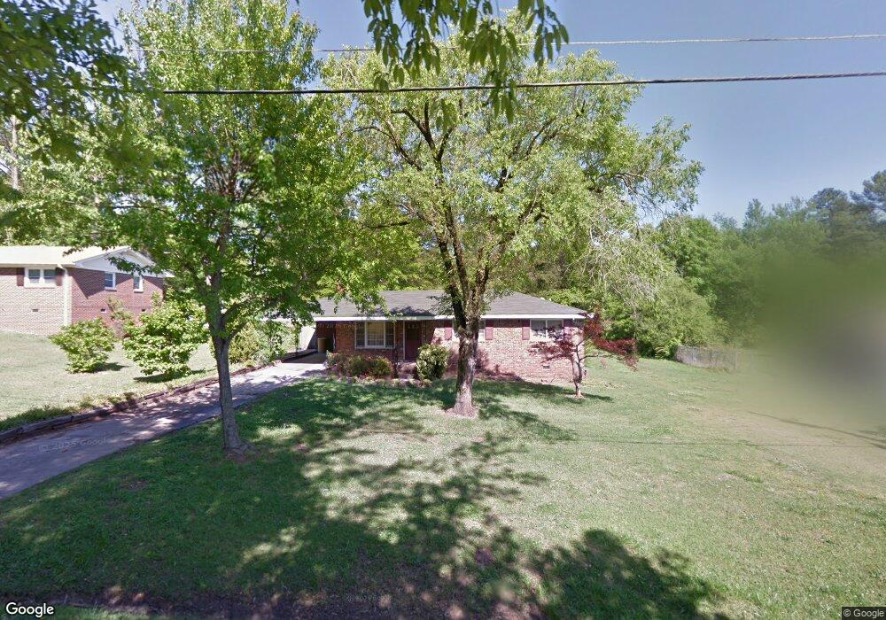
6179 Britt Rd SW Mableton, GA 30126
Estimated Value: $253,000 - $278,154
3
Beds
2
Baths
1,397
Sq Ft
$193/Sq Ft
Est. Value
About This Home
This home is located at 6179 Britt Rd SW, Mableton, GA 30126 and is currently estimated at $269,289, approximately $192 per square foot. 6179 Britt Rd SW is a home located in Cobb County with nearby schools including Clay-Harmony Leland Elementary School, Lindley Middle School, and Pebblebrook High School.
Ownership History
Date
Name
Owned For
Owner Type
Purchase Details
Closed on
Jul 16, 2024
Sold by
Paye George M
Bought by
Paye George M and Paye Bbridget C
Current Estimated Value
Purchase Details
Closed on
Apr 30, 2001
Sold by
Cooper Clarence L and Cooper Dianne
Bought by
Paye George M
Home Financials for this Owner
Home Financials are based on the most recent Mortgage that was taken out on this home.
Original Mortgage
$108,300
Interest Rate
7.11%
Mortgage Type
FHA
Create a Home Valuation Report for This Property
The Home Valuation Report is an in-depth analysis detailing your home's value as well as a comparison with similar homes in the area
Home Values in the Area
Average Home Value in this Area
Purchase History
| Date | Buyer | Sale Price | Title Company |
|---|---|---|---|
| Paye George M | -- | None Listed On Document | |
| Paye George M | $110,000 | -- |
Source: Public Records
Mortgage History
| Date | Status | Borrower | Loan Amount |
|---|---|---|---|
| Previous Owner | Paye George M | $108,300 |
Source: Public Records
Tax History Compared to Growth
Tax History
| Year | Tax Paid | Tax Assessment Tax Assessment Total Assessment is a certain percentage of the fair market value that is determined by local assessors to be the total taxable value of land and additions on the property. | Land | Improvement |
|---|---|---|---|---|
| 2025 | $2,358 | $102,360 | $18,000 | $84,360 |
| 2024 | $2,360 | $102,360 | $18,000 | $84,360 |
| 2023 | $1,817 | $102,360 | $18,000 | $84,360 |
| 2022 | $2,187 | $93,608 | $12,000 | $81,608 |
| 2021 | $1,653 | $69,236 | $12,000 | $57,236 |
| 2020 | $1,653 | $69,236 | $12,000 | $57,236 |
| 2019 | $1,327 | $54,336 | $10,000 | $44,336 |
| 2018 | $899 | $38,644 | $6,000 | $32,644 |
| 2017 | $854 | $38,644 | $6,000 | $32,644 |
| 2016 | $855 | $38,644 | $6,000 | $32,644 |
| 2015 | $437 | $23,664 | $6,000 | $17,664 |
| 2014 | $413 | $22,740 | $0 | $0 |
Source: Public Records
Map
Nearby Homes
- 6266 Britt Rd SW
- 6281 Denny Ln SW
- 846 Orris Ln SW
- 767 Kenneth Ln SW
- Harbor Plan at Mableton Station
- Robie Plan at Mableton Station
- Aisle Plan at Mableton Station
- Elston Plan at Mableton Station
- 5981 Pisgah Rd SW
- 6302 Mount Pisgah Ln
- 6243 Honeybell Aly
- 537 Elizabeth Ln SW
- KNOLLWOOD Plan at Mableton Station - Townhomes
- 496 Elizabeth Ln SW
- 1144 Angelia Dr SW
- 1076 Stoney Creek Ln
- 377 Waterbluff Dr SW
- 373 Waterbluff Dr SW
- 368 Waterbluff Dr SW
- 369 Waterbluff Dr SW
- 6175 Britt Rd SW
- 6185 Britt Rd SW
- 6207 Britt Rd SW
- 6190 Denny Ln SW
- 6180 Britt Rd SW
- 6204 Britt Rd SW
- 6163 Britt Rd SW
- 6178 Denny Ln SW
- 6118 Denny Ln SW
- 6200 Denny Ln SW
- 6192 Britt Rd SW
- 6208 Britt Rd SW
- 795 Boggs Rd SW
- 6215 Britt Rd SW
- 821 Boggs Rd SW
- 6214 Denny Ln SW
- 783 Boggs Rd SW
- 6264 Britt Rd SW
- 0000 Britt Rd SW
- 0 Britt Rd SW