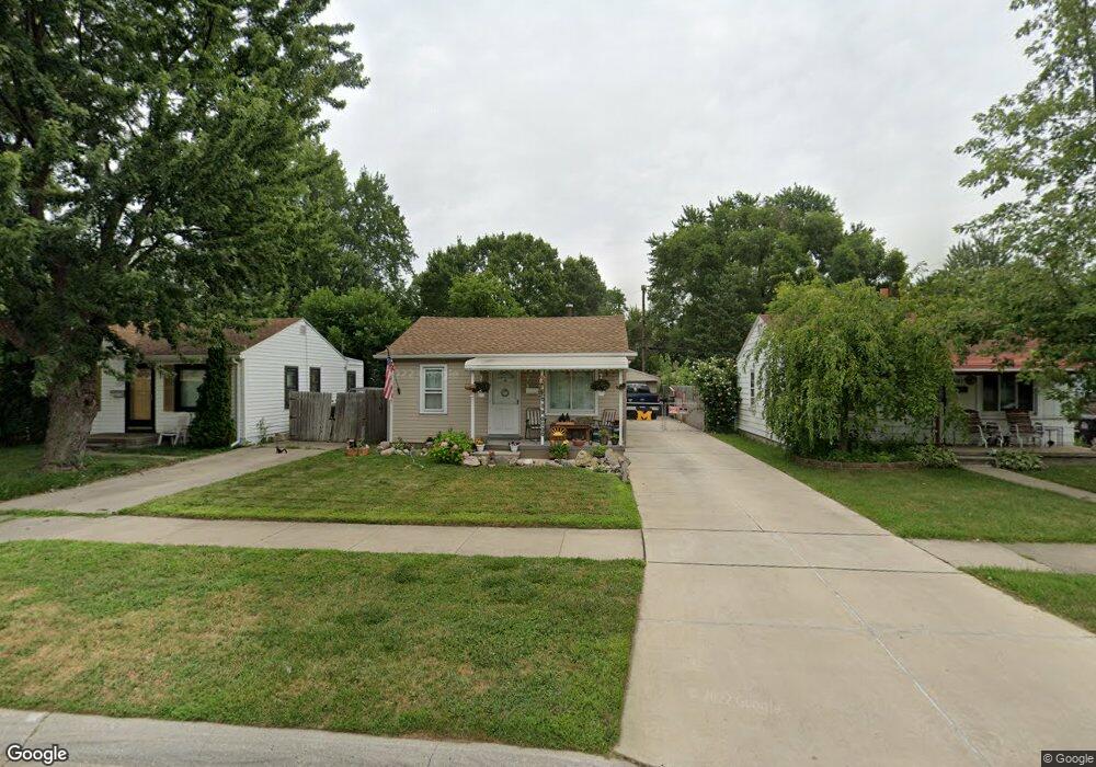
6179 Harold St Taylor, MI 48180
Estimated Value: $129,776 - $156,000
3
Beds
1
Bath
924
Sq Ft
$158/Sq Ft
Est. Value
About This Home
This home is located at 6179 Harold St, Taylor, MI 48180 and is currently estimated at $146,194, approximately $158 per square foot. 6179 Harold St is a home located in Wayne County with nearby schools including Clarence Randall Elementary School, Hoover Middle School, and Taylor High School.
Ownership History
Date
Name
Owned For
Owner Type
Purchase Details
Closed on
Nov 6, 2008
Sold by
Preston Steven C and Secretary Of Housing & Urban D
Bought by
Mosher Patrick W
Current Estimated Value
Purchase Details
Closed on
May 22, 2007
Sold by
Lasalle Bank Midwest
Bought by
Hud
Purchase Details
Closed on
Nov 15, 2006
Sold by
Hoover Gary and Hoover Gary E
Bought by
Lasalle Bank Midwest and Standard Federal Bank
Purchase Details
Closed on
Nov 17, 1994
Sold by
Marjorie E Smith Pr Shrf
Bought by
Mary Hutchings
Create a Home Valuation Report for This Property
The Home Valuation Report is an in-depth analysis detailing your home's value as well as a comparison with similar homes in the area
Home Values in the Area
Average Home Value in this Area
Purchase History
| Date | Buyer | Sale Price | Title Company |
|---|---|---|---|
| Mosher Patrick W | $12,050 | None Available | |
| Hud | -- | None Available | |
| Lasalle Bank Midwest | $81,164 | None Available | |
| Mary Hutchings | $17,210 | -- |
Source: Public Records
Tax History
| Year | Tax Paid | Tax Assessment Tax Assessment Total Assessment is a certain percentage of the fair market value that is determined by local assessors to be the total taxable value of land and additions on the property. | Land | Improvement |
|---|---|---|---|---|
| 2025 | $1,478 | $58,700 | $0 | $0 |
| 2024 | $1,435 | $53,500 | $0 | $0 |
| 2023 | $2,240 | $45,500 | $0 | $0 |
| 2022 | $1,350 | $42,300 | $0 | $0 |
| 2021 | $1,450 | $35,800 | $0 | $0 |
| 2020 | $1,434 | $30,600 | $0 | $0 |
| 2019 | $142,285 | $26,600 | $0 | $0 |
| 2018 | $1,185 | $21,200 | $0 | $0 |
| 2017 | $463 | $20,800 | $0 | $0 |
| 2016 | $1,398 | $20,200 | $0 | $0 |
| 2015 | $1,880 | $18,800 | $0 | $0 |
| 2013 | $2,090 | $21,700 | $0 | $0 |
| 2012 | $920 | $21,400 | $7,600 | $13,800 |
Source: Public Records
Map
Nearby Homes
- 6310 Duncan St
- 6041 Fellrath St
- 26215 Beverly Rd
- 6363 Mcguire St
- 26424 Beverly Rd
- 6330 Hampden St
- 6334 Hampden St
- 5970 John Daly St
- 26131 Amherst St
- 5845 Beech Daly Rd
- 6155 Princess St
- 5904 Janet St
- 6198 Princess St
- 6144 Princess St
- 5842 Janet St
- 6713 Mcguire St
- 25965 Currier St
- 000 Currier St
- 27032 Joan St
- 27029 Michelle Ct
- 6169 Harold St
- 6187 Harold St
- 6197 Harold St
- 6151 Harold St
- 6178 Fellrath St
- 6186 Fellrath St
- 6168 Fellrath St
- 6160 Fellrath St
- 6196 Fellrath St
- 6150 Fellrath St
- 6168 Harold St
- 6186 Harold St
- 6305 Harold St
- 6139 Harold St
- 6196 Harold St
- 6158 Harold St
- 6142 Fellrath St
- 6148 Harold St
- 6304 Fellrath St
- 6136 Fellrath St
Your Personal Tour Guide
Ask me questions while you tour the home.