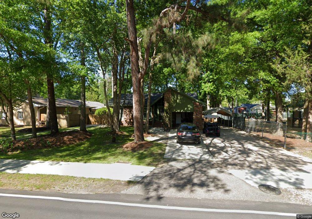
618 10th Ave S Unit SB Surfside Beach, SC 29575
Estimated Value: $419,000 - $495,000
3
Beds
2
Baths
1,413
Sq Ft
$324/Sq Ft
Est. Value
About This Home
This home is located at 618 10th Ave S Unit SB, Surfside Beach, SC 29575 and is currently estimated at $457,845, approximately $324 per square foot. 618 10th Ave S Unit SB is a home located in Horry County with nearby schools including Seaside Elementary, St. James Intermediate, and St. James Middle School.
Ownership History
Date
Name
Owned For
Owner Type
Purchase Details
Closed on
Mar 10, 2005
Sold by
Fillers Carl O and Fillers Virginia M
Bought by
Fillers Carl O and Fillers Virginia M
Current Estimated Value
Purchase Details
Closed on
Jun 28, 2002
Sold by
Mcinvaill Mcinvaill Dwight E H Dwight E H and Mcinvaill Lendenmann Eve
Bought by
Fillers Carl O and Fillers Virginia M
Home Financials for this Owner
Home Financials are based on the most recent Mortgage that was taken out on this home.
Original Mortgage
$110,600
Outstanding Balance
$47,019
Interest Rate
6.75%
Mortgage Type
Purchase Money Mortgage
Estimated Equity
$410,826
Purchase Details
Closed on
Dec 12, 2001
Sold by
Mcinvaill Dwight E H and Estate Of Talulah L Mcinvaill
Bought by
Mcinvaill Mcinvaill Dwight E H Dwight E H and Mcinvaill Lendenmann Eve
Create a Home Valuation Report for This Property
The Home Valuation Report is an in-depth analysis detailing your home's value as well as a comparison with similar homes in the area
Home Values in the Area
Average Home Value in this Area
Purchase History
| Date | Buyer | Sale Price | Title Company |
|---|---|---|---|
| Fillers Carl O | -- | -- | |
| Fillers Carl O | $122,900 | -- | |
| Mcinvaill Mcinvaill Dwight E H Dwight E H | -- | -- |
Source: Public Records
Mortgage History
| Date | Status | Borrower | Loan Amount |
|---|---|---|---|
| Open | Fillers Carl O | $110,600 |
Source: Public Records
Tax History Compared to Growth
Tax History
| Year | Tax Paid | Tax Assessment Tax Assessment Total Assessment is a certain percentage of the fair market value that is determined by local assessors to be the total taxable value of land and additions on the property. | Land | Improvement |
|---|---|---|---|---|
| 2024 | $1,129 | $16,105 | $11,220 | $4,885 |
| 2023 | $1,129 | $8,664 | $5,144 | $3,520 |
| 2021 | $1,002 | $10,055 | $6,535 | $3,520 |
| 2020 | $980 | $10,055 | $6,535 | $3,520 |
| 2019 | $980 | $10,055 | $6,535 | $3,520 |
| 2018 | $818 | $7,534 | $3,122 | $4,412 |
| 2017 | $818 | $7,534 | $3,122 | $4,412 |
| 2016 | $0 | $7,534 | $3,122 | $4,412 |
| 2015 | -- | $7,534 | $3,122 | $4,412 |
| 2014 | -- | $7,534 | $3,122 | $4,412 |
Source: Public Records
Map
Nearby Homes
- 723 10th Ave S Unit Lot 8
- 1014 Bay Dr
- 633 Sparrow Dr Unit B
- 811 10th Ave S
- 1013 Sabal Palm Way
- TBD Poplar Dr S
- 617 13th Ave S Unit 116
- 610 14th Ave S Unit 181
- 614 14th Ave S Unit 132
- TBD Maple Dr
- 613 14th Ave S Unit 34
- 614 15th Ave S Unit 41
- 618 Cypress Dr Unit SB
- 1511 S Hollywood Dr Unit SB
- 323 14th Ave S Unit B
- 312 13th Ave S
- 710 Lakeside Dr
- 910 U S 17 Business
- 412 Cypress Dr
- 318 15th Ave S
- 913 Cedar Dr S
- 619 9th Ave S
- 911 Cedar Dr S Unit SB
- 617 9th Ave S
- 912 Cedar Dr S
- 1011A Cedar Dr S
- 711 10th Ave S
- 615 9th Ave S
- 910 Cedar Dr S
- 712 10th Ave S
- 1023 Cedar Dr S
- 615 10th Ave S
- 1012 Cedar Dr S
- 713 9th Ave S
- 1013 Cedar Dr S
- 1013 Cedar Dr S
- 910 S Hollywood Dr
- 1011 Moss Dr
- 611S 10th Ave S Unit SB
- 1015 Cedar Dr S