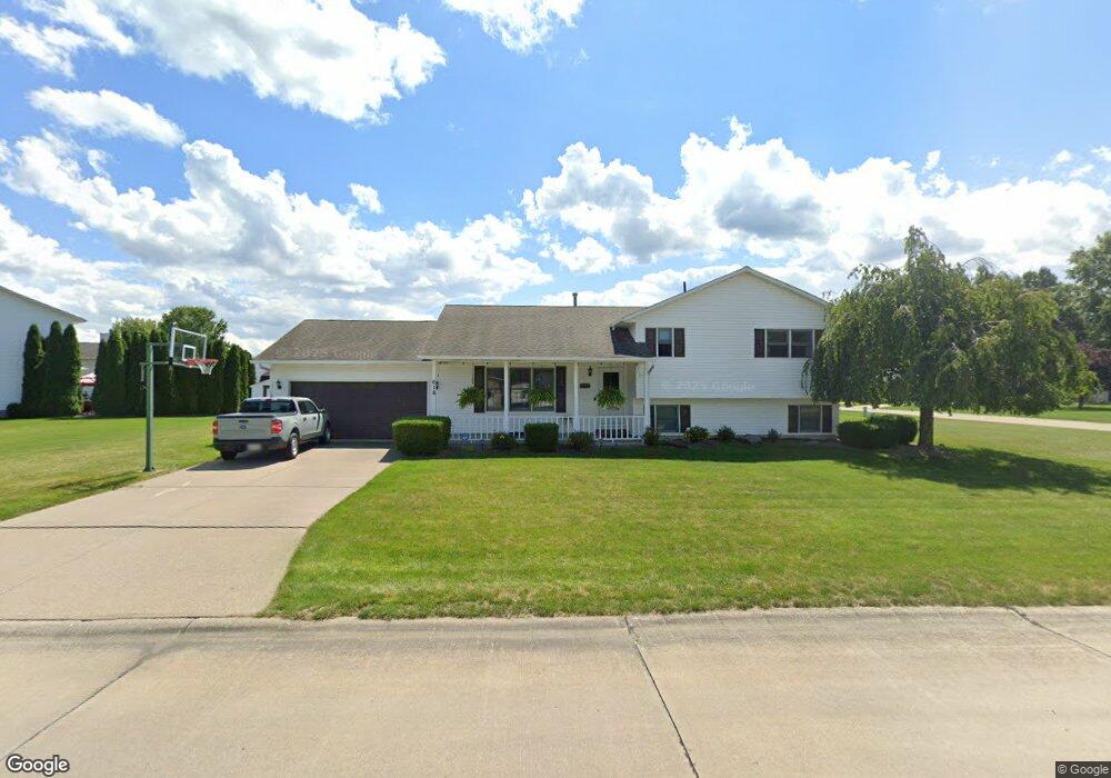
618 Bartish Dr Amherst, OH 44001
Estimated Value: $315,000 - $324,817
4
Beds
2
Baths
1,940
Sq Ft
$165/Sq Ft
Est. Value
About This Home
This home is located at 618 Bartish Dr, Amherst, OH 44001 and is currently estimated at $319,704, approximately $164 per square foot. 618 Bartish Dr is a home located in Lorain County with nearby schools including Powers Elementary School, Walter G. Nord Middle School, and Amherst Junior High School.
Ownership History
Date
Name
Owned For
Owner Type
Purchase Details
Closed on
Sep 22, 2025
Sold by
Collier Michael S and Collier Angie M
Bought by
Ellison Mary Ann M
Current Estimated Value
Purchase Details
Closed on
Apr 10, 2003
Sold by
Gargasz Edward J and Gargasz Wanda Lee
Bought by
Collier Michael S and Collier Angie M
Home Financials for this Owner
Home Financials are based on the most recent Mortgage that was taken out on this home.
Original Mortgage
$156,100
Interest Rate
5.87%
Create a Home Valuation Report for This Property
The Home Valuation Report is an in-depth analysis detailing your home's value as well as a comparison with similar homes in the area
Home Values in the Area
Average Home Value in this Area
Purchase History
| Date | Buyer | Sale Price | Title Company |
|---|---|---|---|
| Ellison Mary Ann M | $313,500 | None Listed On Document | |
| Collier Michael S | $172,900 | Lorain County Title Co Inc |
Source: Public Records
Mortgage History
| Date | Status | Borrower | Loan Amount |
|---|---|---|---|
| Previous Owner | Collier Michael S | $156,100 |
Source: Public Records
Tax History
| Year | Tax Paid | Tax Assessment Tax Assessment Total Assessment is a certain percentage of the fair market value that is determined by local assessors to be the total taxable value of land and additions on the property. | Land | Improvement |
|---|---|---|---|---|
| 2024 | $4,010 | $95,795 | $17,171 | $78,624 |
| 2023 | $3,177 | $62,570 | $12,376 | $50,194 |
| 2022 | $3,007 | $62,570 | $12,376 | $50,194 |
| 2021 | $3,013 | $62,570 | $12,380 | $50,190 |
| 2020 | $2,947 | $54,270 | $10,740 | $43,530 |
| 2019 | $2,890 | $54,270 | $10,740 | $43,530 |
| 2018 | $2,902 | $54,270 | $10,740 | $43,530 |
| 2017 | $2,995 | $53,420 | $10,840 | $42,580 |
| 2016 | $3,017 | $53,420 | $10,840 | $42,580 |
| 2015 | $3,008 | $53,420 | $10,840 | $42,580 |
| 2014 | $2,890 | $51,360 | $10,420 | $40,940 |
| 2013 | $2,898 | $51,360 | $10,420 | $40,940 |
Source: Public Records
Map
Nearby Homes
- 7475 S Dewey Rd
- 7007 Hidden Valley Dr
- 539 Fieldstone Dr
- 6501 Fox Tail Ln
- 135 Ridgeland Dr
- 411 Oaknoll Dr
- 0 Middle Ridge Rd Unit 5180506
- 0 Middle Ridge Rd Unit 5102632
- 376 Taylor St
- 129 Hidden Tree Ln
- 653 Brennan Dr
- 812 Bearing Ct
- 774 Tenney Ave
- 116 Rockridge Dr
- 60 Flamingo Ave
- 117 Caesars Cir
- 140 Luxor Ln
- 953 Longitude Ln
- 661 Tenney Ave
- 3300 Sandmill Run
- 523 Stone Valley Dr
- 612 Bartish Dr
- 525 Stone Valley Dr
- 517 Stone Valley Dr
- 617 Bartish Dr
- 608 Bartish Dr
- 522 Stone Valley Dr
- 520 Stone Valley Dr
- 524 Stone Valley Dr
- 615 Bartish Dr
- 518 Stone Valley Dr
- 606 Bartish Dr
- 527 Stone Valley Dr
- 526 Stone Valley Dr
- 613 Bartish Dr
- 516 Stone Valley Dr
- 200 Cotton Tail Ct
- 611 Bartish Dr
- 202 Cotton Tail Ct
- 604 Bartish Dr
Your Personal Tour Guide
Ask me questions while you tour the home.