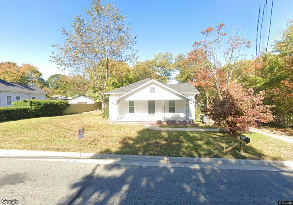
618 Leonard Ave Kannapolis, NC 28081
Estimated Value: $106,000 - $260,000
2
Beds
1
Bath
966
Sq Ft
$190/Sq Ft
Est. Value
About This Home
This home is located at 618 Leonard Ave, Kannapolis, NC 28081 and is currently estimated at $183,959, approximately $190 per square foot. 618 Leonard Ave is a home located in Cabarrus County with nearby schools including Fred L. Wilson Elementary School, Kannapolis Middle, and A.L. Brown High School.
Ownership History
Date
Name
Owned For
Owner Type
Purchase Details
Closed on
Oct 9, 2024
Sold by
Dna Construction Nc Llc
Bought by
Robinson Andrew W and Robinson Francis A
Current Estimated Value
Home Financials for this Owner
Home Financials are based on the most recent Mortgage that was taken out on this home.
Original Mortgage
$195,000
Outstanding Balance
$192,950
Interest Rate
6.35%
Mortgage Type
New Conventional
Estimated Equity
-$8,991
Purchase Details
Closed on
Apr 4, 2024
Sold by
Dalton Joan C
Bought by
Dna Construction Nc Llc
Create a Home Valuation Report for This Property
The Home Valuation Report is an in-depth analysis detailing your home's value as well as a comparison with similar homes in the area
Home Values in the Area
Average Home Value in this Area
Purchase History
| Date | Buyer | Sale Price | Title Company |
|---|---|---|---|
| Robinson Andrew W | -- | None Listed On Document | |
| Dna Construction Nc Llc | $100,000 | Tryon Title |
Source: Public Records
Mortgage History
| Date | Status | Borrower | Loan Amount |
|---|---|---|---|
| Open | Robinson Andrew W | $195,000 |
Source: Public Records
Tax History Compared to Growth
Tax History
| Year | Tax Paid | Tax Assessment Tax Assessment Total Assessment is a certain percentage of the fair market value that is determined by local assessors to be the total taxable value of land and additions on the property. | Land | Improvement |
|---|---|---|---|---|
| 2025 | $1,756 | $154,670 | $65,630 | $89,040 |
| 2024 | $1,756 | $154,670 | $65,630 | $89,040 |
| 2023 | $1,276 | $93,110 | $47,250 | $45,860 |
| 2022 | $1,276 | $93,110 | $47,250 | $45,860 |
| 2021 | $1,276 | $93,110 | $47,250 | $45,860 |
| 2020 | $1,276 | $93,110 | $47,250 | $45,860 |
| 2019 | $1,079 | $78,740 | $36,750 | $41,990 |
| 2018 | $1,063 | $78,740 | $36,750 | $41,990 |
| 2017 | $1,047 | $78,740 | $36,750 | $41,990 |
| 2016 | $1,047 | $78,840 | $36,750 | $42,090 |
| 2015 | $993 | $78,840 | $36,750 | $42,090 |
| 2014 | $993 | $78,840 | $36,750 | $42,090 |
Source: Public Records
Map
Nearby Homes
- 304 Bell St
- 606 Bethpage Rd
- 00 Centergrove Rd
- 5941 Mantle Way
- 828 Richard Ave
- 5880 Mantle Way
- 807 Klondale Ave
- 3131 Baines Ct
- 3161 Baines Ct
- 846 Murphy St
- 707 Oakshade Ave
- 417 York Ave
- 5860 Pittmon Ln
- 335 Vance St
- 5850 Pittmon Ln
- 5840 Pittmon Ln
- 0000 Bethpage Rd
- 427 Pleasant Ave
- 5820 Pittmon Ln
- 825 Margate Ave
- 616 Leonard Ave
- 616 Leonard Ave Unit 14pt 13blk d bergger
- 620 Leonard Ave
- 402 Broad St
- 404 Broad St
- 614 Leonard Ave
- 611 J Ave
- 615 Leonard Ave
- 406 Broad St
- 619 Leonard Ave
- 612 Leonard Ave
- 609 J Ave
- 401 Broad St
- 613 Leonard Ave
- 621 Leonard Ave
- 408 Broad St
- 405 Broad St
- 403 Broad St Unit 21
- 312 Bell St
- 607 J Ave