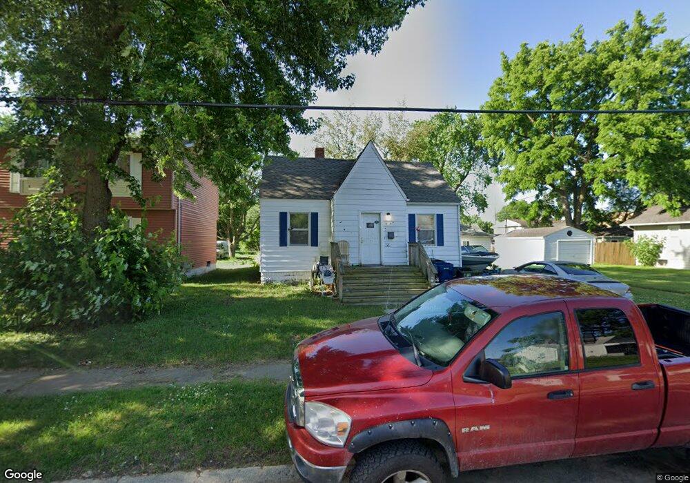
618 Macdonald Ave Flint, MI 48507
Circle Drive NeighborhoodEstimated Value: $65,000 - $73,988
2
Beds
2
Baths
724
Sq Ft
$95/Sq Ft
Est. Value
About This Home
This home is located at 618 Macdonald Ave, Flint, MI 48507 and is currently estimated at $68,497, approximately $94 per square foot. 618 Macdonald Ave is a home located in Genesee County with nearby schools including Freeman Elementary School, Flint Southwestern Classical Academy, and International Academy of Flint (K-12).
Ownership History
Date
Name
Owned For
Owner Type
Purchase Details
Closed on
Apr 11, 2003
Sold by
Lahoud Wilson and Lahoud Gloria
Bought by
Shinabarger Leroy and Shinabarger Deidie
Current Estimated Value
Home Financials for this Owner
Home Financials are based on the most recent Mortgage that was taken out on this home.
Original Mortgage
$39,920
Interest Rate
5.75%
Mortgage Type
Purchase Money Mortgage
Purchase Details
Closed on
Jul 3, 2002
Sold by
Mortgage Electronic Registration Systems
Bought by
Lahoud Wilson
Purchase Details
Closed on
Feb 28, 2001
Sold by
Arnold Clarence J and Arnold Virgilene J
Bought by
Mortgage Electronic Registration Systems
Create a Home Valuation Report for This Property
The Home Valuation Report is an in-depth analysis detailing your home's value as well as a comparison with similar homes in the area
Home Values in the Area
Average Home Value in this Area
Purchase History
| Date | Buyer | Sale Price | Title Company |
|---|---|---|---|
| Shinabarger Leroy | $49,900 | First American Title | |
| Lahoud Wilson | $29,000 | First American Title | |
| Mortgage Electronic Registration Systems | $15,236 | -- |
Source: Public Records
Mortgage History
| Date | Status | Borrower | Loan Amount |
|---|---|---|---|
| Previous Owner | Shinabarger Leroy | $39,920 |
Source: Public Records
Tax History Compared to Growth
Tax History
| Year | Tax Paid | Tax Assessment Tax Assessment Total Assessment is a certain percentage of the fair market value that is determined by local assessors to be the total taxable value of land and additions on the property. | Land | Improvement |
|---|---|---|---|---|
| 2025 | $1,160 | $36,000 | $0 | $0 |
| 2024 | $1,074 | $31,800 | $0 | $0 |
| 2023 | $1,050 | $29,300 | $0 | $0 |
| 2022 | $0 | $24,000 | $0 | $0 |
| 2021 | $1,064 | $18,500 | $0 | $0 |
| 2020 | $979 | $14,800 | $0 | $0 |
| 2019 | $956 | $11,500 | $0 | $0 |
| 2018 | $758 | $10,400 | $0 | $0 |
| 2017 | $758 | $0 | $0 | $0 |
| 2016 | $753 | $0 | $0 | $0 |
| 2015 | -- | $0 | $0 | $0 |
| 2014 | -- | $0 | $0 | $0 |
| 2012 | -- | $14,200 | $0 | $0 |
Source: Public Records
Map
Nearby Homes
- 802 McKeighan Ave
- 913 Macdonald Ave
- 621 Lochhead Ave
- 4424 Cheyenne Ave
- 621 Burroughs Ave
- 4127 Custer Ave
- 630 Buckingham Ave
- 4205 Red Arrow Rd
- 326 Burroughs Ave
- 3512 Barcey Ct
- 3614 Comanche Ave
- 3505 Comanche Ave
- 2207 E Boatfield Ave
- 0000 E Bristol Rd
- 2231 E Bergin Ave
- 1465 Norton St
- 2077 E Boatfield Ave
- 2061 E Boatfield Ave
- 1453 Carman St
- 1450 Carman St
- 622 Macdonald Ave
- 614 Macdonald Ave
- 626 Macdonald Ave
- 610 Macdonald Ave
- 657 E Hemphill Rd
- 641 E Hemphill Rd
- 606 Macdonald Ave
- 633 E Hemphill Rd
- 4608 Ogema Ave
- 4602 Ogema Ave
- 617 Macdonald Ave
- 4614 Ogema Ave
- 613 Macdonald Ave
- 625 Macdonald Ave
- 625 E Hemphill Rd
- 609 Macdonald Ave
- 665 E Hemphill Rd
- 4522 Ogema Ave Unit Bldg-Unit
- 4522 Ogema Ave
- 605 Macdonald Ave